Mexico City to Bahias Dehuatulco is 313 miles (504 km), a flight of about 1 hour 15 minutes.
Right-side seats win overall because the takeoff experience over Mexico City's volcanic landscape is more visually dramatic and geographically significant than the landing approach. The Sierra de Chichinautzin and Lake Xochimilco provide more distinctive visual landmarks during the initial climb than the landing sequence offers.
Flight Path
The flight path crosses the Oaxacan highlands, passing over the volcanic plateau that transitions southward into the Sierra Madre del Sur. The terrain becomes progressively more mountainous and forested. At cruise altitude (around 25,000 feet), the curvature of the coastal mountains becomes visible, with the Pacific appearing as a distinct horizon line to the south. The Isthmus of Tehuantepec region lies to the east of the direct route. No major cities are directly on the flight path, but the landscape shows the dramatic topographic transition from the high interior plateau to the coastal ranges.
Great circle distance and headings ›_(cropped).jpg?width=600)

Phase by phase
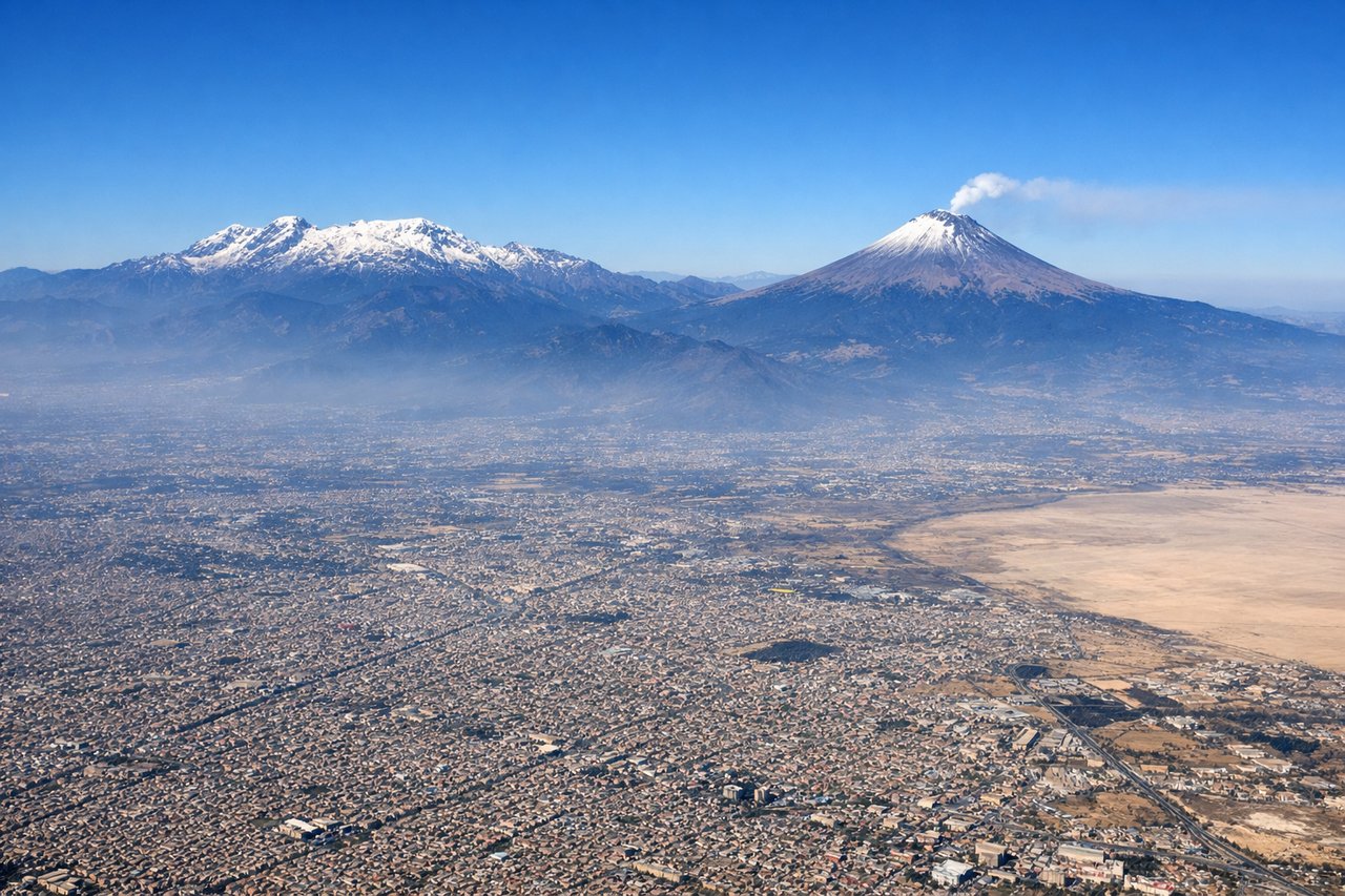
Takeoff from MEX
RIGHTRight-side seats capture the initial climb-out over Mexico City's southern suburbs and the Sierra de Chichinautzin volcanic range. MEX typically departs southbound (runways 05L/05R or 23L/23R), and right-side views show the dramatic volcanic peaks that form the southern rim of the Valley of Mexico.
Landing at HUX
LEFTLeft-side seats provide the best views during approach to HUX. The descent path brings aircraft over the Pacific coastal mountains and the Oaxacan highlands. Left-side views show the dramatic transition from interior mountains to the coastal plain and Bahía de Huatulco itself.
Landmarks on this routeAll landmarks →
Will your flight be in sunlight?
Pick a date and time in the Sun Map to watch the sun move across your whole flight.
About This Route
Which side of the plane should I sit on flying from Licenciado Benito Juarez International (MEX) to Bahias De Huatulco International (HUX)?
Sit on the Right side of the plane for the best views on flights from Mexico City to Bahias Dehuatulco. Right-side seats win overall because the takeoff experience over Mexico City's volcanic landscape is more visually dramatic and geographically significant than the landing approach. The Sierra de Chichinautzin and Lake Xochimilco provide more distinctive visual landmarks during the initial climb than the landing sequence offers.
What can I see during takeoff from Licenciado Benito Juarez International in Mexico City?
During takeoff from Licenciado Benito Juarez International (MEX), sit on the Right side for the best views. Right-side seats capture the initial climb-out over Mexico City's southern suburbs and the Sierra de Chichinautzin volcanic range. MEX typically departs southbound (runways 05L/05R or 23L/23R), and right-side views show the dramatic volcanic peaks that form the southern rim of the Valley of Mexico. Notable sights include: Sierra de Chichinautzin volcanic range, Lake Xochimilco (visible as a patchwork of canals and agricultural plots), Mexico City urban sprawl extending northward, Popocatépetl volcano (distant, on clear days).
What can I see when landing at Bahias De Huatulco International in Bahias Dehuatulco?
When landing at Bahias De Huatulco International (HUX), sit on the Left side for the best views. Left-side seats provide the best views during approach to HUX. The descent path brings aircraft over the Pacific coastal mountains and the Oaxacan highlands. Left-side views show the dramatic transition from interior mountains to the coastal plain and Bahía de Huatulco itself. Notable sights include: Sierra Madre del Sur mountain range (steep, forested ridges), Bahía de Huatulco with its distinctive rocky headlands and coves, Pacific Ocean, Río Copalita valley (visible as a green corridor through the mountains).
How long is the flight from Mexico City to Bahias Dehuatulco?
The flight from Licenciado Benito Juarez International (MEX) to Bahias De Huatulco International (HUX) takes about 1 hour 15 minutes. The shortest flight path between them is 313 miles (504 km); winds and air traffic control usually add a few percent.
What does the Mexico City to Bahias Dehuatulco flight path pass over?
The flight path crosses the Oaxacan highlands, passing over the volcanic plateau that transitions southward into the Sierra Madre del Sur. The terrain becomes progressively more mountainous and forested. At cruise altitude (around 25,000 feet), the curvature of the coastal mountains becomes visible, with the Pacific appearing as a distinct horizon line to the south. The Isthmus of Tehuantepec region lies to the east of the direct route. No major cities are directly on the flight path, but the landscape shows the dramatic topographic transition from the high interior plateau to the coastal ranges.