Mexico City to Los Mochis is 771 miles (1,240 km), a flight of about 2 hours 15 minutes.
Right seats capture the most dramatic geography: the volcanic terrain around Mexico City during departure and the Sierra Madre Occidental plus Fuerte River delta during approach. The northwestbound departure and southeastbound arrival create complementary views favoring the right side overall.
Flight Path
The flight path crosses the Mexican Plateau, passing east of the Sierra Madre Occidental. Notable features include the Durango highlands (visible to the east around cruise altitude), the transition from high plateau to lower Sinaloa coastal plains, and the gradual descent toward the Pacific coastal lowlands. The terrain shifts from volcanic and mountainous terrain near Mexico City to the more arid plateau, then to the greener agricultural valleys of Sinaloa as the aircraft approaches LMM.
Great circle distance and headings ›Phase by phase
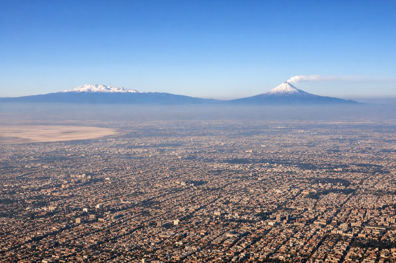
Takeoff from MEX
LEFTMEX typically departs northwestbound (Runways 05L/05R or 23L/23R). Left seats face the Sierra de Guadalupe and the northern Mexico City basin during climb-out, offering views of the city's sprawl and surrounding volcanic terrain.
Landing at LMM
RIGHTLMM approaches from the south or southeast (Runways 01 or 19). Right seats during descent offer views of the Fuerte River delta, coastal plains, and the Sierra Madre Occidental foothills to the east, providing geographic context for arrival in Sinaloa.
Landmarks on this routeAll landmarks →
Will your flight be in sunlight?
Pick a date and time in the Sun Map to watch the sun move across your whole flight.
About This Route
Which side of the plane should I sit on flying from Licenciado Benito Juarez International (MEX) to Valle Del Fuerte International (LMM)?
Sit on the Right side of the plane for the best views on flights from Mexico City to Los Mochis. Right seats capture the most dramatic geography: the volcanic terrain around Mexico City during departure and the Sierra Madre Occidental plus Fuerte River delta during approach. The northwestbound departure and southeastbound arrival create complementary views favoring the right side overall.
What can I see during takeoff from Licenciado Benito Juarez International in Mexico City?
During takeoff from Licenciado Benito Juarez International (MEX), sit on the Left side for the best views. MEX typically departs northwestbound (Runways 05L/05R or 23L/23R). Left seats face the Sierra de Guadalupe and the northern Mexico City basin during climb-out, offering views of the city's sprawl and surrounding volcanic terrain. Notable sights include: Sierra de Guadalupe (north), Lake Texcoco remnants (east), Mexico City urban grid (south and west), Popocatépetl volcano (distant southeast on clear days).
What can I see when landing at Valle Del Fuerte International in Los Mochis?
When landing at Valle Del Fuerte International (LMM), sit on the Right side for the best views. LMM approaches from the south or southeast (Runways 01 or 19). Right seats during descent offer views of the Fuerte River delta, coastal plains, and the Sierra Madre Occidental foothills to the east, providing geographic context for arrival in Sinaloa. Notable sights include: Fuerte River delta and estuary (west), Sierra Madre Occidental foothills (east), Sinaloa coastal plains (south), Los Mochis urban area (immediate approach).
How long is the flight from Mexico City to Los Mochis?
The flight from Licenciado Benito Juarez International (MEX) to Valle Del Fuerte International (LMM) takes about 2 hours 15 minutes. The shortest flight path between them is 771 miles (1,240 km); winds and air traffic control usually add a few percent.
What does the Mexico City to Los Mochis flight path pass over?
The flight path crosses the Mexican Plateau, passing east of the Sierra Madre Occidental. Notable features include the Durango highlands (visible to the east around cruise altitude), the transition from high plateau to lower Sinaloa coastal plains, and the gradual descent toward the Pacific coastal lowlands. The terrain shifts from volcanic and mountainous terrain near Mexico City to the more arid plateau, then to the greener agricultural valleys of Sinaloa as the aircraft approaches LMM.