While the left side offers strong takeoff scenery (Mexico City basin and volcanoes), the right side delivers superior landing views with the Panama Canal, Gatun Lake, and tropical forest—geographically unique and visually distinctive features. The landing approach outweighs the takeoff advantage, and the cruise segment over Central America (mountains, coastlines, and forest transitions) favors the right side's cumulative scenic value.
Flown MEX to PAC? Did we get it right?
Flight Path
Mexico City to Panama City is 1,491 miles (2,400 km), a flight of about 3 hours 30 minutes.
Sierra Madre del Sur (southern Mexico), Isthmus of Tehuantepec lowlands, Guatemala highlands and volcanic chain (Tajumulco, Acatenango visible on clear days), Yucatan Peninsula's northern edge, Belize barrier reef and cayes, Honduras Bay Islands, Central American Caribbean coast, Mosquitia rainforest region
Great circle distance and headings ›


Phase by phase
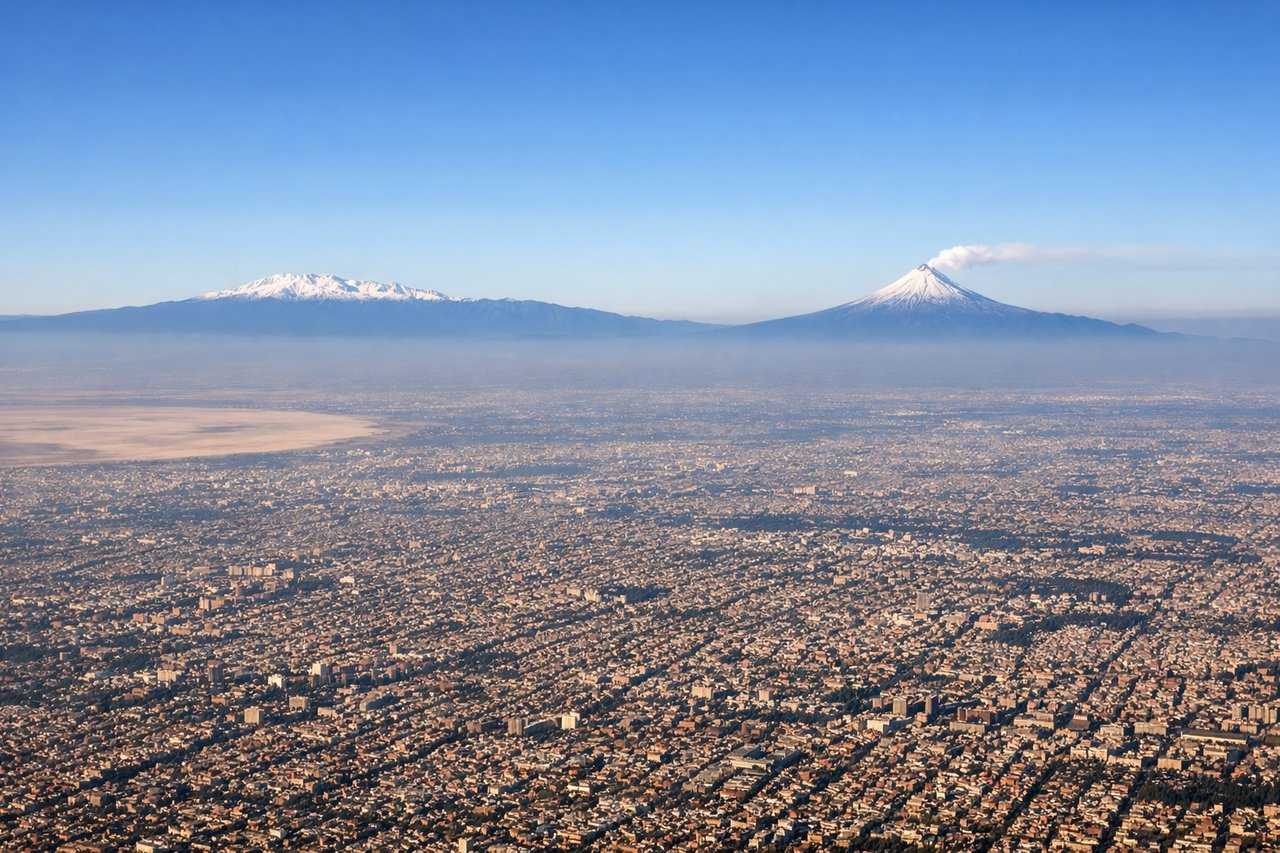
Takeoff from MEX
LEFTMexico City's high-altitude basin (7,382 ft) offers immediate dramatic terrain. The left side captures the Valley of Mexico with surrounding volcanic peaks and the city's sprawl during climb-out, providing urban and geological interest within the first 15 minutes.
Landing at PAC
RIGHTThe approach to Tocumen International (PAC's primary airport) from the northwest crosses the Panama Canal Zone and Gatun Lake, then descends over the Darién region. The right side captures the canal's locks, the artificial lake system, and dense tropical forest—highly distinctive and geographically significant features unique to this route.
Will your flight be in sunlight?
Pick a date and time in the Sun Map to watch the sun move across your whole flight.
About This Route
Which side of the plane should I sit on flying from Licenciado Benito Juarez International (MEX) to Marcos A Gelabert International (PAC)?
Sit on the Right side of the plane for the best views on flights from Mexico City to Panama City. While the left side offers strong takeoff scenery (Mexico City basin and volcanoes), the right side delivers superior landing views with the Panama Canal, Gatun Lake, and tropical forest—geographically unique and visually distinctive features. The landing approach outweighs the takeoff advantage, and the cruise segment over Central America (mountains, coastlines, and forest transitions) favors the right side's cumulative scenic value.
What can I see during takeoff from Licenciado Benito Juarez International in Mexico City?
During takeoff from Licenciado Benito Juarez International (MEX), sit on the Left side for the best views. Mexico City's high-altitude basin (7,382 ft) offers immediate dramatic terrain. The left side captures the Valley of Mexico with surrounding volcanic peaks and the city's sprawl during climb-out, providing urban and geological interest within the first 15 minutes. Notable sights include: Popocatépetl volcano (17,802 ft, southeast), Iztaccíhuatl volcano (17,159 ft, east), Mexico City urban grid and lakes, Sierra Madre Oriental foothills.
What can I see when landing at Marcos A Gelabert International in Panama City?
When landing at Marcos A Gelabert International (PAC), sit on the Right side for the best views. The approach to Tocumen International (PAC's primary airport) from the northwest crosses the Panama Canal Zone and Gatun Lake, then descends over the Darién region. The right side captures the canal's locks, the artificial lake system, and dense tropical forest—highly distinctive and geographically significant features unique to this route. Notable sights include: Gatun Lake (artificial reservoir, 163 sq miles), Panama Canal locks and shipping channels, Darién tropical forest canopy, Caribbean coastal lowlands.
How long is the flight from Mexico City to Panama City?
The flight from Licenciado Benito Juarez International (MEX) to Marcos A Gelabert International (PAC) takes about 3 hours 30 minutes. The shortest flight path between them is 1,491 miles (2,400 km); winds and air traffic control usually add a few percent.
What does the Mexico City to Panama City flight path pass over?
Sierra Madre del Sur (southern Mexico), Isthmus of Tehuantepec lowlands, Guatemala highlands and volcanic chain (Tajumulco, Acatenango visible on clear days), Yucatan Peninsula's northern edge, Belize barrier reef and cayes, Honduras Bay Islands, Central American Caribbean coast, Mosquitia rainforest region