Right-side seats dominate both segments of this flight. Takeoff offers volcanic peaks and Mexico City's dramatic setting, while landing provides Appalachian foothills and Atlanta's sprawling development. The right side captures the most visually distinctive geography for the entire route.
Flown MEX to PDK? Did we get it right?
Flight Path
Mexico City to Atlanta is 1,348 miles (2,170 km), a flight of about 3 hours 15 minutes.
The flight path crosses the Gulf of Mexico's western edge (visible as water and coastline around 1.5 hours into flight), then passes over the Yucatan Peninsula's flat terrain, continues over the Gulf of Mexico proper, and enters the southeastern United States over Louisiana and Mississippi. Notable features include the Mississippi River delta (visible as a complex network of waterways and sediment patterns), the Mississippi River itself as a winding feature through Louisiana and Mississippi, and the transition from coastal lowlands to the rolling terrain of Tennessee and northern Georgia as the aircraft approaches Atlanta.
Great circle distance and headings ›


Phase by phase
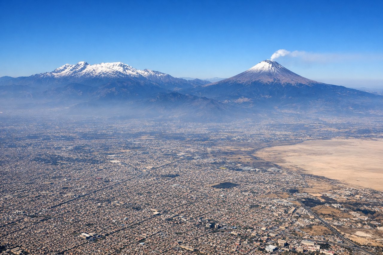
Takeoff from MEX
RIGHTRight-side seats offer the best views during climb-out from Mexico City. You'll see the Valley of Mexico's urban sprawl and the surrounding volcanic peaks as the aircraft banks northeast on its typical departure corridor.
Landing at PDK
RIGHTRight-side seats provide excellent views during approach to Atlanta. You'll see the Appalachian foothills and the city's northern suburbs as the aircraft descends on its typical westerly approach vector into PDK.
Will your flight be in sunlight?
Pick a date and time in the Sun Map to watch the sun move across your whole flight.
About This Route
Which side of the plane should I sit on flying from Licenciado Benito Juarez International (MEX) to DeKalb Peachtree Airport (PDK)?
Sit on the Right side of the plane for the best views on flights from Mexico City to Atlanta. Right-side seats dominate both segments of this flight. Takeoff offers volcanic peaks and Mexico City's dramatic setting, while landing provides Appalachian foothills and Atlanta's sprawling development. The right side captures the most visually distinctive geography for the entire route.
What can I see during takeoff from Licenciado Benito Juarez International in Mexico City?
During takeoff from Licenciado Benito Juarez International (MEX), sit on the Right side for the best views. Right-side seats offer the best views during climb-out from Mexico City. You'll see the Valley of Mexico's urban sprawl and the surrounding volcanic peaks as the aircraft banks northeast on its typical departure corridor. Notable sights include: Popocatépetl volcano (southeast, snow-capped peak), Iztaccíhuatl volcano (east, distinctive saddle shape), Mexico City's urban grid (directly below during initial climb), Lake Texcoco remnants (visible as lighter patches in the valley floor).
What can I see when landing at DeKalb Peachtree Airport in Atlanta?
When landing at DeKalb Peachtree Airport (PDK), sit on the Right side for the best views. Right-side seats provide excellent views during approach to Atlanta. You'll see the Appalachian foothills and the city's northern suburbs as the aircraft descends on its typical westerly approach vector into PDK. Notable sights include: Appalachian Mountains (north and northeast, rolling ridges), Atlanta's northern suburbs and sprawl (visible as grid patterns and development), Chattahoochee River valley (winding through terrain), Lake Allatoona (northwest, visible as blue water body if on approach path).
How long is the flight from Mexico City to Atlanta?
The flight from Licenciado Benito Juarez International (MEX) to DeKalb Peachtree Airport (PDK) takes about 3 hours 15 minutes. The shortest flight path between them is 1,348 miles (2,170 km); winds and air traffic control usually add a few percent.
What does the Mexico City to Atlanta flight path pass over?
The flight path crosses the Gulf of Mexico's western edge (visible as water and coastline around 1.5 hours into flight), then passes over the Yucatan Peninsula's flat terrain, continues over the Gulf of Mexico proper, and enters the southeastern United States over Louisiana and Mississippi. Notable features include the Mississippi River delta (visible as a complex network of waterways and sediment patterns), the Mississippi River itself as a winding feature through Louisiana and Mississippi, and the transition from coastal lowlands to the rolling terrain of Tennessee and northern Georgia as the aircraft approaches Atlanta.