The left side captures the most dramatic scenery: the Sierra Madre mountains during departure and the Yanshan Mountains during approach. The right side offers urban views but less distinctive natural landmarks for most of the flight.
Flown MEX to PEK? Did we get it right?
Flight Path
Mexico City to Beijing is 7,727 miles (12,436 km), a flight of about 14 hours.
The flight path crosses the Pacific Ocean with no visible landmarks for 8-10 hours. Notable geographic transitions include: the North American coastline (California/Oregon coast visible if routed northward), the vast Pacific, the Japanese archipelago (if visible during daylight), and the East China Sea before reaching mainland China. The approach into Beijing crosses the North China Plain, one of the world's most densely populated agricultural regions.
Great circle distance and headings ›


Phase by phase
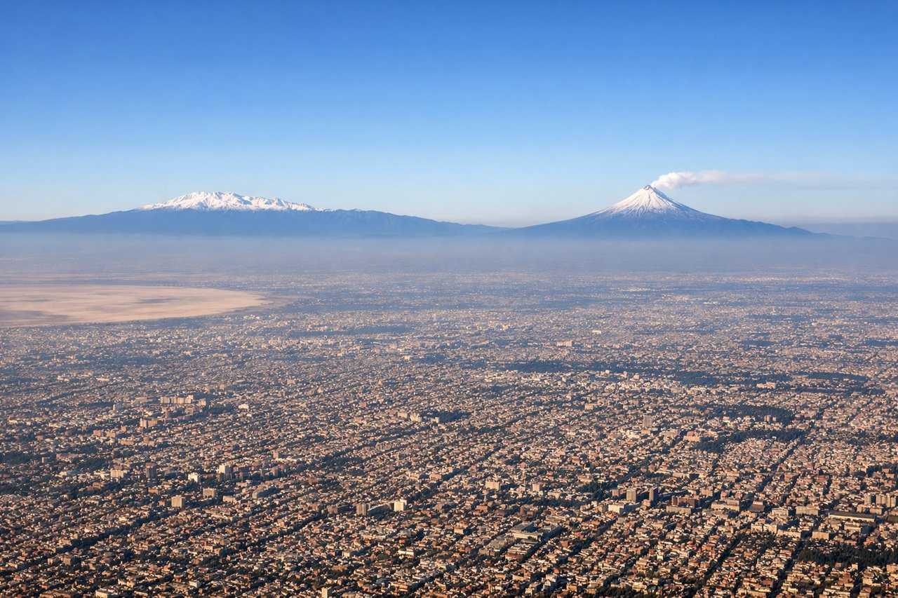
Takeoff from MEX
LEFTLeft side offers views of the Sierra Madre Occidental as the aircraft climbs northwest out of Mexico City. The mountain range becomes visible within 15-20 minutes of departure and provides dramatic elevation contrast against the high Mexican plateau.
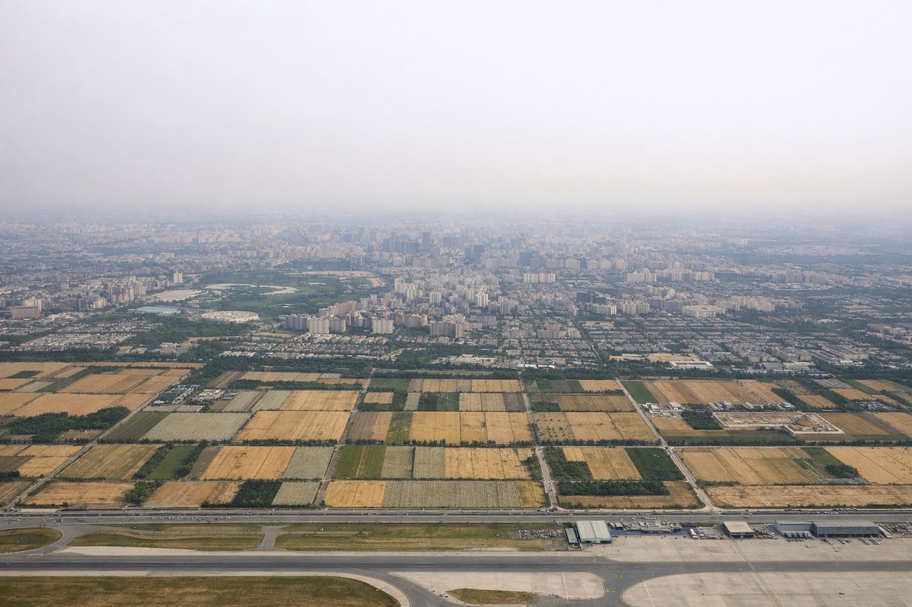
Landing at PEK
RIGHTRight side provides views of the North China Plain and the approach corridor into Beijing. As the aircraft descends from the northwest, the right window shows the urban sprawl of Beijing itself and the surrounding agricultural flatlands that characterize the approach zone.
Will your flight be in sunlight?
Pick a date and time in the Sun Map to watch the sun move across your whole flight.
About This Route
Which side of the plane should I sit on flying from Licenciado Benito Juarez International (MEX) to Capital (PEK)?
Sit on the Left side of the plane for the best views on flights from Mexico City to Beijing. The left side captures the most dramatic scenery: the Sierra Madre mountains during departure and the Yanshan Mountains during approach. The right side offers urban views but less distinctive natural landmarks for most of the flight.
What can I see during takeoff from Licenciado Benito Juarez International in Mexico City?
During takeoff from Licenciado Benito Juarez International (MEX), sit on the Left side for the best views. Left side offers views of the Sierra Madre Occidental as the aircraft climbs northwest out of Mexico City. The mountain range becomes visible within 15-20 minutes of departure and provides dramatic elevation contrast against the high Mexican plateau. Notable sights include: Sierra Madre Occidental, Lake Texcoco (receding behind), Mexico City urban sprawl, Trans-Mexican Volcanic Belt peaks.
What can I see when landing at Capital in Beijing?
When landing at Capital (PEK), sit on the Right side for the best views. Right side provides views of the North China Plain and the approach corridor into Beijing. As the aircraft descends from the northwest, the right window shows the urban sprawl of Beijing itself and the surrounding agricultural flatlands that characterize the approach zone. Notable sights include: North China Plain, Beijing urban districts, Yanshan Mountains (distant, northwest), Yongding River valley.
How long is the flight from Mexico City to Beijing?
The flight from Licenciado Benito Juarez International (MEX) to Capital (PEK) takes about 14 hours. The shortest flight path between them is 7,727 miles (12,436 km); winds and air traffic control usually add a few percent.
What does the Mexico City to Beijing flight path pass over?
The flight path crosses the Pacific Ocean with no visible landmarks for 8-10 hours. Notable geographic transitions include: the North American coastline (California/Oregon coast visible if routed northward), the vast Pacific, the Japanese archipelago (if visible during daylight), and the East China Sea before reaching mainland China. The approach into Beijing crosses the North China Plain, one of the world's most densely populated agricultural regions.