Right side scores higher (3.5 vs 2.5) due to superior scenery at both takeoff and landing. Mexico City's dramatic urban basin and surrounding mountains provide strong departure visuals, while the Delaware River corridor and Philadelphia's downtown skyline deliver compelling arrival views. Left side offers less distinctive features throughout the flight—primarily suburban sprawl and industrial areas with minimal terrain drama.
Flown MEX to PHL? Did we get it right?
Flight Path
Mexico City to Philadelphia is 1,998 miles (3,215 km), a flight of about 4 hours 45 minutes.
Appalachian Mountains (eastern Tennessee and western North Carolina ridges), Ohio River valley, Allegheny Mountains (Pennsylvania), Great Smoky Mountains visible to the south during cruise phase
Great circle distance and headings ›Phase by phase
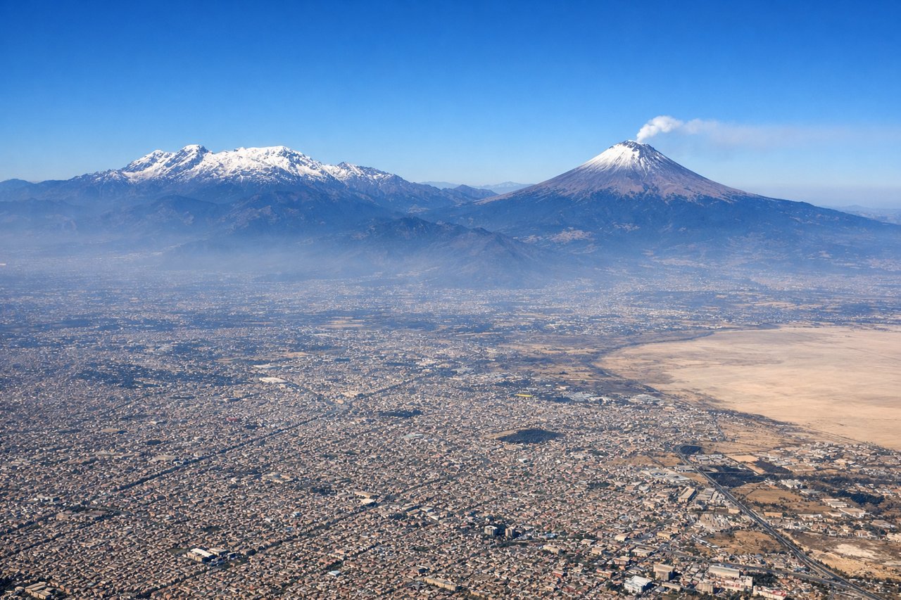
Takeoff from MEX
RIGHTRight side captures Mexico City's urban sprawl and the surrounding Valley of Mexico basin during climb-out. The city's grid pattern and surrounding mountains (Sierra de Guadalupe to the north, Sierra de las Cruces to the west) provide immediate visual interest. Left side faces open terrain with less dramatic features during the initial climb.

Landing at PHL
RIGHTRight side (north bank of Delaware River) provides superior approach scenery. Descending aircraft typically approach PHL from the northwest, giving right-side passengers views of the Delaware River, Philadelphia's downtown skyline, and the city's waterfront districts. The river corridor and urban density create more visual interest than the suburban and industrial areas to the left (west/southwest).
Will your flight be in sunlight?
Pick a date and time in the Sun Map to watch the sun move across your whole flight.
About This Route
Which side of the plane should I sit on flying from Licenciado Benito Juarez International (MEX) to Philadelphia International (PHL)?
Sit on the Right side of the plane for the best views on flights from Mexico City to Philadelphia. Right side scores higher (3.5 vs 2.5) due to superior scenery at both takeoff and landing. Mexico City's dramatic urban basin and surrounding mountains provide strong departure visuals, while the Delaware River corridor and Philadelphia's downtown skyline deliver compelling arrival views. Left side offers less distinctive features throughout the flight—primarily suburban sprawl and industrial areas with minimal terrain drama.
What can I see during takeoff from Licenciado Benito Juarez International in Mexico City?
During takeoff from Licenciado Benito Juarez International (MEX), sit on the Right side for the best views. Right side captures Mexico City's urban sprawl and the surrounding Valley of Mexico basin during climb-out. The city's grid pattern and surrounding mountains (Sierra de Guadalupe to the north, Sierra de las Cruces to the west) provide immediate visual interest. Left side faces open terrain with less dramatic features during the initial climb. Notable sights include: Mexico City urban grid and Zócalo district, Sierra de Guadalupe (north), Sierra de las Cruces (west), Lake Texcoco remnants.
What can I see when landing at Philadelphia International in Philadelphia?
When landing at Philadelphia International (PHL), sit on the Right side for the best views. Right side (north bank of Delaware River) provides superior approach scenery. Descending aircraft typically approach PHL from the northwest, giving right-side passengers views of the Delaware River, Philadelphia's downtown skyline, and the city's waterfront districts. The river corridor and urban density create more visual interest than the suburban and industrial areas to the left (west/southwest). Notable sights include: Delaware River, Philadelphia downtown skyline and Center City, Ben Franklin Bridge, Port of Philadelphia facilities.
How long is the flight from Mexico City to Philadelphia?
The flight from Licenciado Benito Juarez International (MEX) to Philadelphia International (PHL) takes about 4 hours 45 minutes. The shortest flight path between them is 1,998 miles (3,215 km); winds and air traffic control usually add a few percent.
What does the Mexico City to Philadelphia flight path pass over?
Appalachian Mountains (eastern Tennessee and western North Carolina ridges), Ohio River valley, Allegheny Mountains (Pennsylvania), Great Smoky Mountains visible to the south during cruise phase