The right side delivers the full scenic arc of the flight: volcanic peaks near Mexico City on departure, the Sierra Madre del Sur along the cruise track, and the Sumidero Canyon on arrival into Chiapas. The left side offers comparatively flat basin and lowland views throughout.
Flown MEX to TGZ? Did we get it right?
Flight Path
Mexico City to Tuxtla Gutiérrez is 444 miles (715 km), a flight of about 1 hour 15 minutes.
Sierra Madre del Sur ridgelines over Oaxaca, the high plateau transitioning into Chiapas highlands
Great circle distance and headings ›

Phase by phase
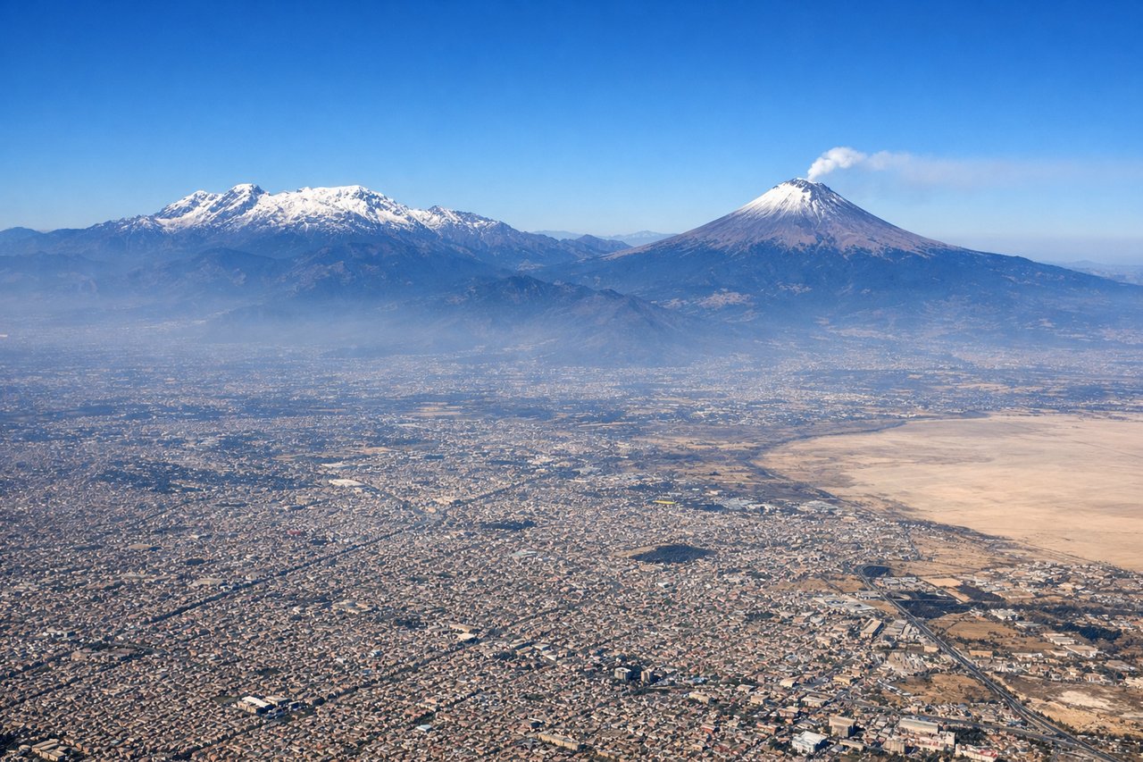
Takeoff from MEX
RIGHTAfter departing MEX to the ENE, the aircraft banks south-southeast toward Chiapas, putting the snow-streaked cones of Popocatépetl and Iztaccíhuatl squarely on the right side of the cabin during the climb. The left side only shows the sprawling flat basin of Mexico City receding northward with no comparable relief.
Landing at TGZ
RIGHTOn descent into TGZ, the flight path crosses the Chiapas highlands and skirts the dramatic Sumidero Canyon, where the Grijalva River cuts a deep gorge just northwest of the airport. Depending on runway direction this canyon and the forested Chiapas ridgelines appear on the right side as the plane turns onto final approach, while the left side mostly faces open lowland scrub.
Will your flight be in sunlight?
Pick a date and time in the Sun Map to watch the sun move across your whole flight.
About This Route
Which side of the plane should I sit on flying from Licenciado Benito Juarez International (MEX) to Angel Albino Corzo International Airport (TGZ)?
Sit on the Right side of the plane for the best views on flights from Mexico City to Tuxtla Gutiérrez. The right side delivers the full scenic arc of the flight: volcanic peaks near Mexico City on departure, the Sierra Madre del Sur along the cruise track, and the Sumidero Canyon on arrival into Chiapas. The left side offers comparatively flat basin and lowland views throughout.
What can I see during takeoff from Licenciado Benito Juarez International in Mexico City?
During takeoff from Licenciado Benito Juarez International (MEX), sit on the Right side for the best views. After departing MEX to the ENE, the aircraft banks south-southeast toward Chiapas, putting the snow-streaked cones of Popocatépetl and Iztaccíhuatl squarely on the right side of the cabin during the climb. The left side only shows the sprawling flat basin of Mexico City receding northward with no comparable relief. Notable sights include: Popocatépetl volcano, Iztaccíhuatl volcano, Valley of Mexico basin, southern edge of Mexico City.
What can I see when landing at Angel Albino Corzo International Airport in Tuxtla Gutiérrez?
When landing at Angel Albino Corzo International Airport (TGZ), sit on the Right side for the best views. On descent into TGZ, the flight path crosses the Chiapas highlands and skirts the dramatic Sumidero Canyon, where the Grijalva River cuts a deep gorge just northwest of the airport. Depending on runway direction this canyon and the forested Chiapas ridgelines appear on the right side as the plane turns onto final approach, while the left side mostly faces open lowland scrub. Notable sights include: Sumidero Canyon, Grijalva River, Chiapas highland ridges, Tuxtla Gutiérrez valley.
How long is the flight from Mexico City to Tuxtla Gutiérrez?
The flight from Licenciado Benito Juarez International (MEX) to Angel Albino Corzo International Airport (TGZ) takes about 1 hour 15 minutes. The shortest flight path between them is 444 miles (715 km); winds and air traffic control usually add a few percent.
What does the Mexico City to Tuxtla Gutiérrez flight path pass over?
Sierra Madre del Sur ridgelines over Oaxaca, the high plateau transitioning into Chiapas highlands