While takeoff offers urban and volcanic views, the landing approach provides more dramatic scenery with Lake Ontario and Toronto's waterfront. The right side captures the most distinctive visual elements of both departure and arrival.
Flown MEX to YTZ? Did we get it right?
Flight Path
Mexico City to Toronto is 2,022 miles (3,255 km), a flight of about 4 hours 35 minutes.
Great Lakes region (Lake Michigan visible from cruising altitude on the right side during the northern portion of flight), Ohio River valley, Appalachian ridge lines (subtle elevation changes visible in terrain), Lake Erie (visible on approach to Canadian airspace)
Great circle distance and headings ›


Phase by phase
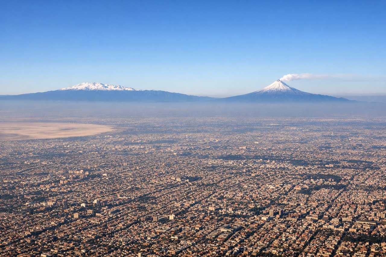
Takeoff from MEX
LEFTLeft side offers immediate views of Mexico City's urban sprawl and the surrounding volcanic peaks. The climb-out path from MEX typically heads north or northeast, positioning left-side passengers to see the city's dense development and the distant Sierra Madre Oriental.
Landing at YTZ
RIGHTRight side provides excellent views during the descent approach into YTZ. The standard approach from the southwest brings Lake Ontario into view on the right, with Toronto's downtown skyline visible ahead and to the right as the aircraft descends over the water.
Will your flight be in sunlight?
Pick a date and time in the Sun Map to watch the sun move across your whole flight.
About This Route
Which side of the plane should I sit on flying from Licenciado Benito Juarez International (MEX) to City Centre (YTZ)?
Sit on the Right side of the plane for the best views on flights from Mexico City to Toronto. While takeoff offers urban and volcanic views, the landing approach provides more dramatic scenery with Lake Ontario and Toronto's waterfront. The right side captures the most distinctive visual elements of both departure and arrival.
What can I see during takeoff from Licenciado Benito Juarez International in Mexico City?
During takeoff from Licenciado Benito Juarez International (MEX), sit on the Left side for the best views. Left side offers immediate views of Mexico City's urban sprawl and the surrounding volcanic peaks. The climb-out path from MEX typically heads north or northeast, positioning left-side passengers to see the city's dense development and the distant Sierra Madre Oriental. Notable sights include: Mexico City metropolitan area, Lake Texcoco (partially visible within city), Popocatépetl volcano (distant southeastern horizon), Sierra Madre Oriental foothills.
What can I see when landing at City Centre in Toronto?
When landing at City Centre (YTZ), sit on the Right side for the best views. Right side provides excellent views during the descent approach into YTZ. The standard approach from the southwest brings Lake Ontario into view on the right, with Toronto's downtown skyline visible ahead and to the right as the aircraft descends over the water. Notable sights include: Lake Ontario, Toronto downtown core and CN Tower, Toronto Islands (visible as green strips in the lake), Scarborough Bluffs (eastern shoreline).
How long is the flight from Mexico City to Toronto?
The flight from Licenciado Benito Juarez International (MEX) to City Centre (YTZ) takes about 4 hours 35 minutes. The shortest flight path between them is 2,022 miles (3,255 km); winds and air traffic control usually add a few percent.
What does the Mexico City to Toronto flight path pass over?
Great Lakes region (Lake Michigan visible from cruising altitude on the right side during the northern portion of flight), Ohio River valley, Appalachian ridge lines (subtle elevation changes visible in terrain), Lake Erie (visible on approach to Canadian airspace)