While takeoff from Miami offers superior coastal views, the landing approach into Albany over the Hudson River valley and Catskill Mountains provides more dramatic terrain variety and distinctive landmarks. The right side captures the most visually interesting portion of the flight—the Appalachian foothills and river valley—which outweighs Miami's coastal advantage. Both sides score equally overall, but the landing experience tips the recommendation rightward.
Flown MIA to ALB? Did we get it right?
Flight Path
Miami to Albany is 1,227 miles (1,975 km), a flight of about 3 hours 15 minutes.
The flight path crosses the Appalachian Mountains (primarily the Blue Ridge and Ridge-and-Valley provinces in Pennsylvania and New York), the Delaware River valley, and numerous river systems including the Susquehanna and Mohawk rivers. The terrain transitions from flat coastal plains through rolling piedmont to the foothills of the Appalachians. Major cities visible along the route include Philadelphia, Harrisburg, and the Hudson Valley corridor.
Great circle distance and headings ›


Phase by phase
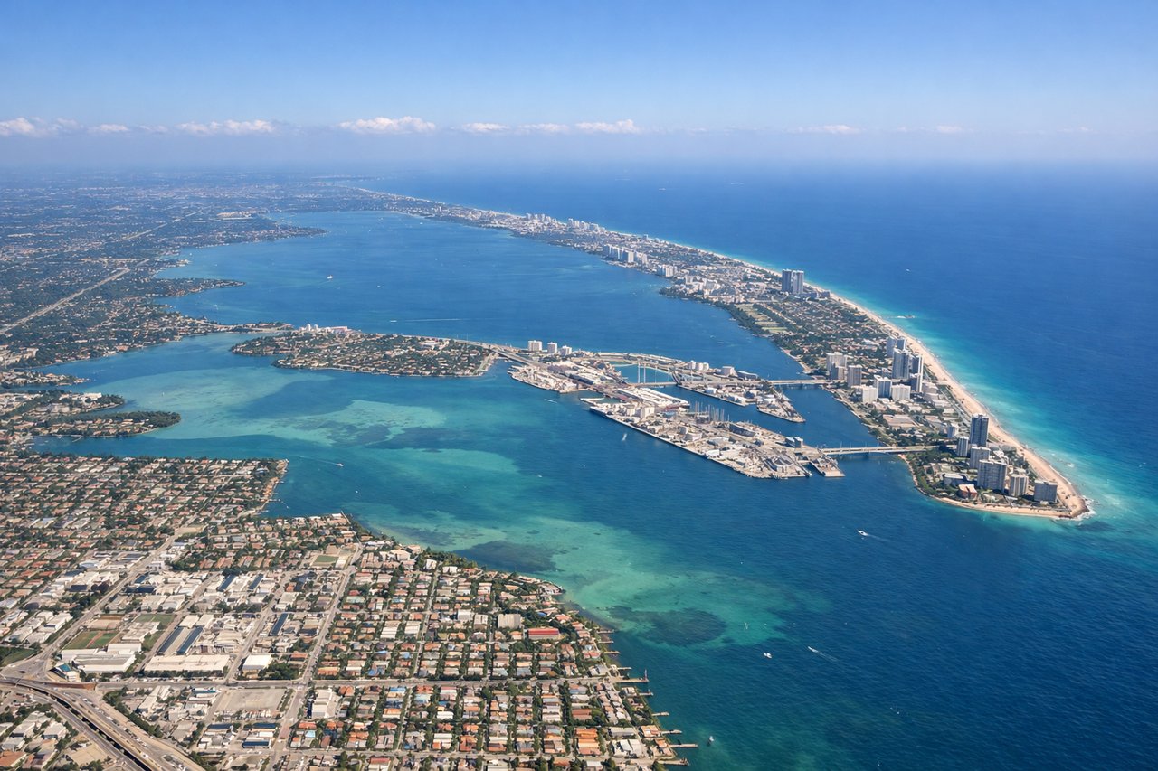
Takeoff from MIA
LEFTMiami's departure offers immediate coastal scenery with Biscayne Bay, the Atlantic shoreline, and urban sprawl visible during climb-out. Right side faces inland swamps and flat terrain with minimal visual interest.
Landing at ALB
RIGHTAlbany's approach from the west provides views of the Hudson River valley, the Catskill Mountains, and the Albany urban area along the river. Left side during descent shows only flat farmland and forests with minimal distinctive features.
Will your flight be in sunlight?
Pick a date and time in the Sun Map to watch the sun move across your whole flight.
About This Route
Which side of the plane should I sit on flying from Miami International (MIA) to Albany International (ALB)?
Sit on the Right side of the plane for the best views on flights from Miami to Albany. While takeoff from Miami offers superior coastal views, the landing approach into Albany over the Hudson River valley and Catskill Mountains provides more dramatic terrain variety and distinctive landmarks. The right side captures the most visually interesting portion of the flight—the Appalachian foothills and river valley—which outweighs Miami's coastal advantage. Both sides score equally overall, but the landing experience tips the recommendation rightward.
What can I see during takeoff from Miami International in Miami?
During takeoff from Miami International (MIA), sit on the Left side for the best views. Miami's departure offers immediate coastal scenery with Biscayne Bay, the Atlantic shoreline, and urban sprawl visible during climb-out. Right side faces inland swamps and flat terrain with minimal visual interest. Notable sights include: Biscayne Bay with barrier islands, Miami downtown skyline and port facilities, Atlantic Ocean coastline, Everglades wetlands to the west.
What can I see when landing at Albany International in Albany?
When landing at Albany International (ALB), sit on the Right side for the best views. Albany's approach from the west provides views of the Hudson River valley, the Catskill Mountains, and the Albany urban area along the river. Left side during descent shows only flat farmland and forests with minimal distinctive features. Notable sights include: Hudson River winding through the valley, Catskill Mountains to the west, Albany downtown and riverfront, surrounding Mohawk Valley farmland.
How long is the flight from Miami to Albany?
The flight from Miami International (MIA) to Albany International (ALB) takes about 3 hours 15 minutes. The shortest flight path between them is 1,227 miles (1,975 km); winds and air traffic control usually add a few percent.
What does the Miami to Albany flight path pass over?
The flight path crosses the Appalachian Mountains (primarily the Blue Ridge and Ridge-and-Valley provinces in Pennsylvania and New York), the Delaware River valley, and numerous river systems including the Susquehanna and Mohawk rivers. The terrain transitions from flat coastal plains through rolling piedmont to the foothills of the Appalachians. Major cities visible along the route include Philadelphia, Harrisburg, and the Hudson Valley corridor.