Right-side seats capture the most dramatic scenery: the Miami departure over Biscayne Bay and the Atlantic, plus the Mediterranean approach to the North African coast. The westbound transatlantic route offers better views on the right side for both takeoff and landing phases.
Flown MIA to BEN? Did we get it right?
Flight Path
Miami to Benghazi is 5,856 miles (9,424 km), a flight of about 9 hours 15 minutes.
The flight crosses the Atlantic Ocean for approximately 4,000 nautical miles. Notable features along the route include the Azores archipelago (if visible during daylight hours around the midpoint), the Strait of Gibraltar at the western entrance to the Mediterranean, and the North African coast approaching Libya. The route typically passes south of mainland Europe and over open ocean for the majority of the transatlantic segment.
Great circle distance and headings ›Phase by phase
Takeoff from MIA
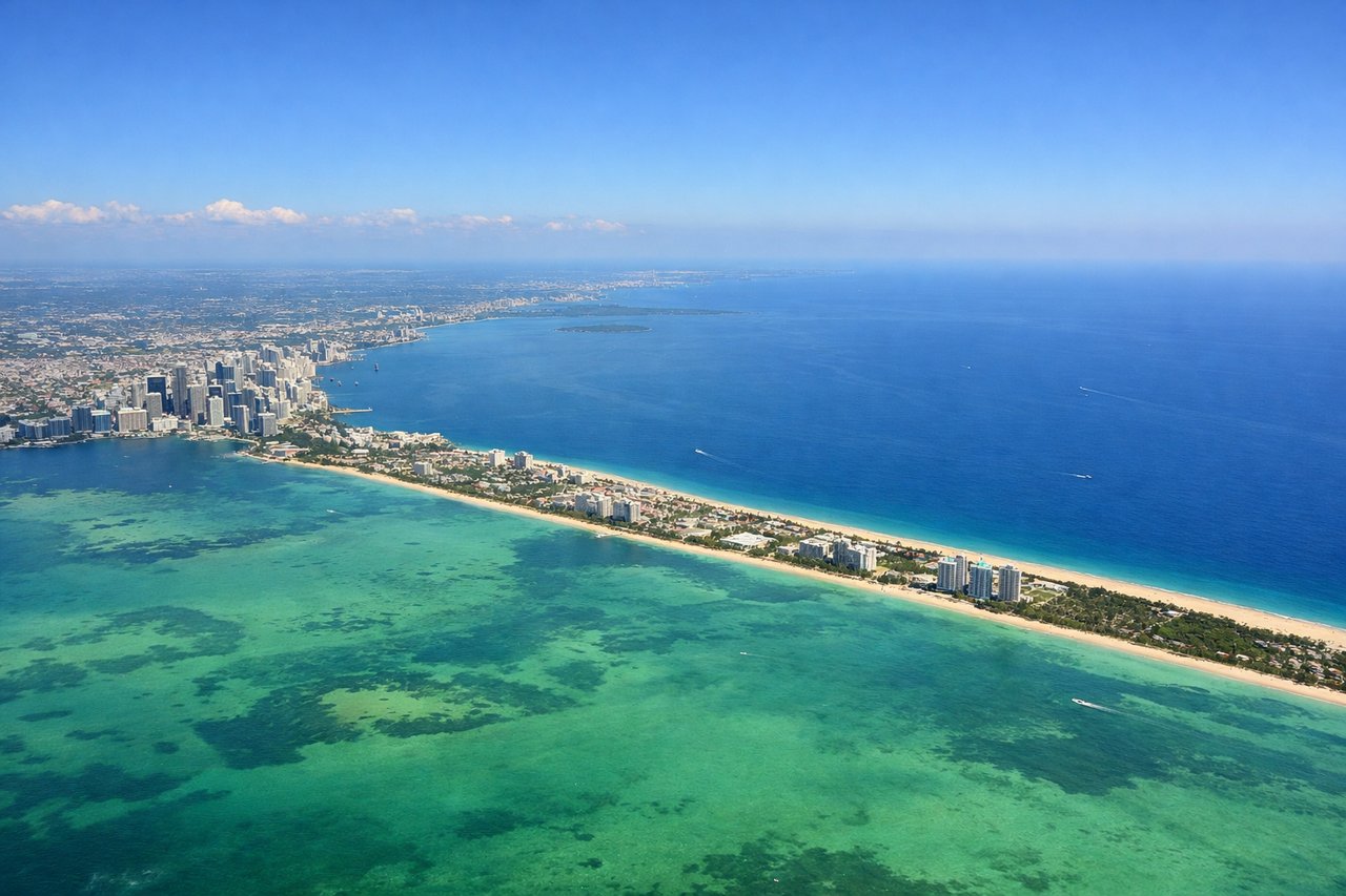
RIGHTRight-side seats offer views of Biscayne Bay and the Atlantic coastline as the aircraft climbs eastward over Miami. You'll see the barrier islands, shallow turquoise waters, and the Miami skyline receding behind.
Landing at BEN
LEFTLeft-side seats provide views of the North African coastline, the Mediterranean Sea, and the approach to Benghazi. You'll see the Libyan desert meeting the coast and the city's urban sprawl as you descend westward.
Will your flight be in sunlight?
Pick a date and time in the Sun Map to watch the sun move across your whole flight.
About This Route
Which side of the plane should I sit on flying from Miami International (MIA) to Benina (BEN)?
Sit on the Right side of the plane for the best views on flights from Miami to Benghazi. Right-side seats capture the most dramatic scenery: the Miami departure over Biscayne Bay and the Atlantic, plus the Mediterranean approach to the North African coast. The westbound transatlantic route offers better views on the right side for both takeoff and landing phases.
What can I see during takeoff from Miami International in Miami?
During takeoff from Miami International (MIA), sit on the Right side for the best views. Right-side seats offer views of Biscayne Bay and the Atlantic coastline as the aircraft climbs eastward over Miami. You'll see the barrier islands, shallow turquoise waters, and the Miami skyline receding behind. Notable sights include: Biscayne Bay, Miami Beach barrier islands, Atlantic Ocean, Port of Miami container terminals.
What can I see when landing at Benina in Benghazi?
When landing at Benina (BEN), sit on the Left side for the best views. Left-side seats provide views of the North African coastline, the Mediterranean Sea, and the approach to Benghazi. You'll see the Libyan desert meeting the coast and the city's urban sprawl as you descend westward. Notable sights include: Mediterranean Sea, Benghazi harbor and waterfront, Libyan coastal desert, Gulf of Sidra.
How long is the flight from Miami to Benghazi?
The flight from Miami International (MIA) to Benina (BEN) takes about 9 hours 15 minutes. The shortest flight path between them is 5,856 miles (9,424 km); winds and air traffic control usually add a few percent.
What does the Miami to Benghazi flight path pass over?
The flight crosses the Atlantic Ocean for approximately 4,000 nautical miles. Notable features along the route include the Azores archipelago (if visible during daylight hours around the midpoint), the Strait of Gibraltar at the western entrance to the Mediterranean, and the North African coast approaching Libya. The route typically passes south of mainland Europe and over open ocean for the majority of the transatlantic segment.