While takeoff offers coastal scenery, the landing descent provides more dramatic and varied visual interest with the Sierra Nevada mountains and extensive agricultural landscape of the San Joaquin Valley.
Flown MIA to BFL? Did we get it right?
Flight Path
Miami to Bakersfield is 2,383 miles (3,835 km), a flight of about 4 hours 45 minutes.
Gulf of Mexico coastline (Louisiana and Texas), Mississippi River delta, Atchafalaya Basin wetlands, Edwards Plateau in central Texas, Pecos River valley, Chisos Mountains near Big Bend, Sonoran Desert in Arizona, Colorado River, and the transition into California's high desert before reaching the Sierra Nevada foothills
Great circle distance and headings ›


Phase by phase
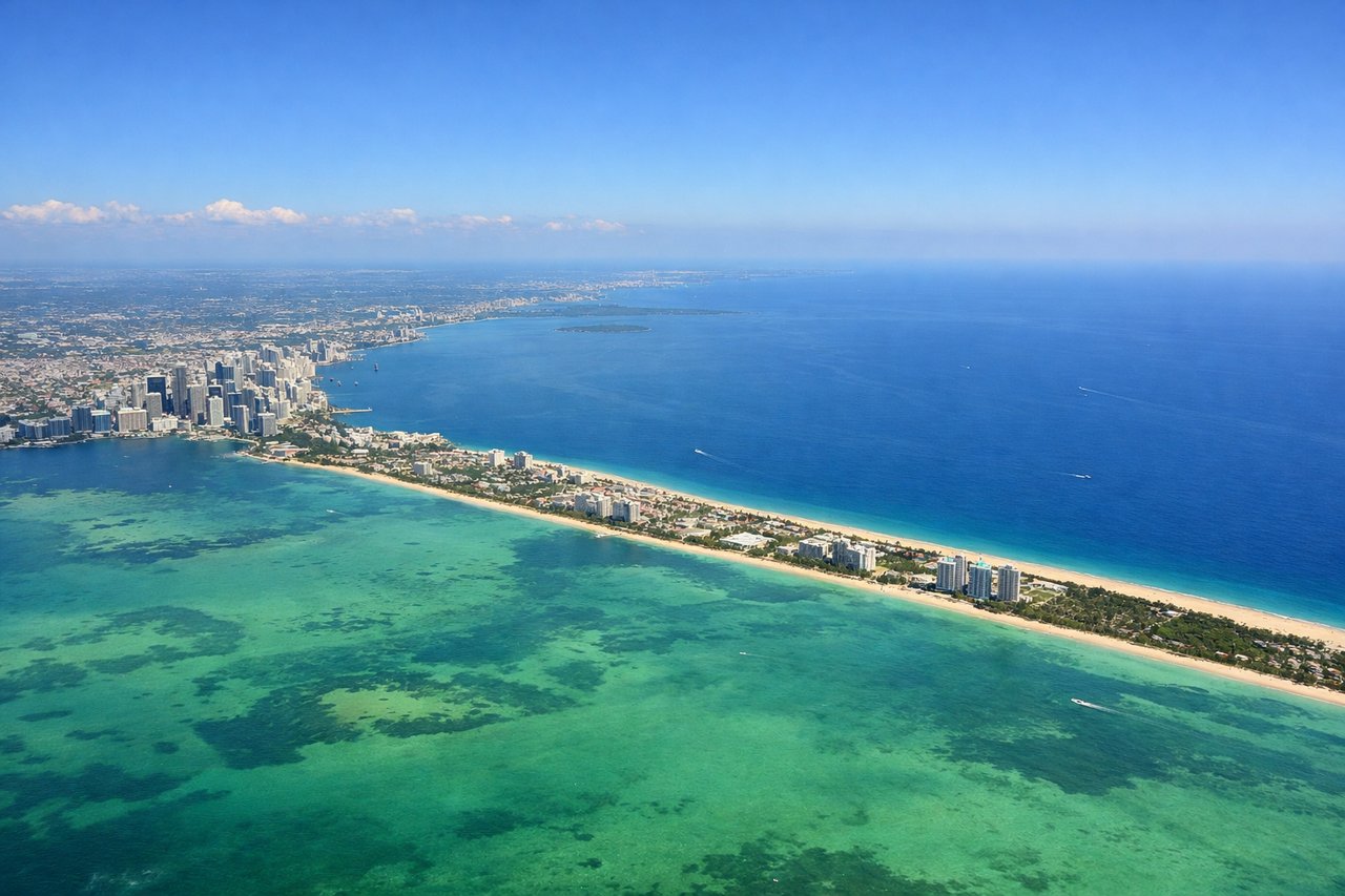
Takeoff from MIA
RIGHTRight side offers views of Biscayne Bay and the Atlantic coastline as you climb out over Miami. The left side faces inland toward the Everglades, which are less visually distinctive at altitude.
Landing at BFL
LEFTLeft side provides views of the Sierra Nevada mountains and the southern San Joaquin Valley as you descend toward Bakersfield. The right side faces toward the Mojave Desert, which is flatter and less visually interesting.
Will your flight be in sunlight?
Pick a date and time in the Sun Map to watch the sun move across your whole flight.
About This Route
Which side of the plane should I sit on flying from Miami International (MIA) to Meadows Fld (BFL)?
Sit on the Left side of the plane for the best views on flights from Miami to Bakersfield. While takeoff offers coastal scenery, the landing descent provides more dramatic and varied visual interest with the Sierra Nevada mountains and extensive agricultural landscape of the San Joaquin Valley.
What can I see during takeoff from Miami International in Miami?
During takeoff from Miami International (MIA), sit on the Right side for the best views. Right side offers views of Biscayne Bay and the Atlantic coastline as you climb out over Miami. The left side faces inland toward the Everglades, which are less visually distinctive at altitude. Notable sights include: Biscayne Bay, Miami Beach barrier islands, Port of Miami container terminals, Atlantic Ocean horizon.
What can I see when landing at Meadows Fld in Bakersfield?
When landing at Meadows Fld (BFL), sit on the Left side for the best views. Left side provides views of the Sierra Nevada mountains and the southern San Joaquin Valley as you descend toward Bakersfield. The right side faces toward the Mojave Desert, which is flatter and less visually interesting. Notable sights include: Sierra Nevada range, San Joaquin Valley agricultural grid, Kern County oil fields, Bakersfield urban area.
How long is the flight from Miami to Bakersfield?
The flight from Miami International (MIA) to Meadows Fld (BFL) takes about 4 hours 45 minutes. The shortest flight path between them is 2,383 miles (3,835 km); winds and air traffic control usually add a few percent.
What does the Miami to Bakersfield flight path pass over?
Gulf of Mexico coastline (Louisiana and Texas), Mississippi River delta, Atchafalaya Basin wetlands, Edwards Plateau in central Texas, Pecos River valley, Chisos Mountains near Big Bend, Sonoran Desert in Arizona, Colorado River, and the transition into California's high desert before reaching the Sierra Nevada foothills