While the right side wins at takeoff with Miami's skyline, the left side delivers the more dramatic payoff on approach into Bogota with the Andes wall rising behind the city. Over the Caribbean and northern Colombia the left side also tracks closer to the Colombian coastline and the Sierra Nevada de Santa Marta range as you cross into South American airspace.
Flown MIA to BOG? Did we get it right?
Flight Path
Miami to Bogota is 1,513 miles (2,435 km), a flight of about 4 hours 15 minutes.
The flight tracks south-southwest over Cuba or the western Caribbean Sea, then crosses the northern coast of Colombia near Cartagena or Barranquilla. The Sierra Nevada de Santa Marta — an isolated coastal massif rising to nearly 19,000 feet — is visible to the left side as you enter Colombian airspace. The route then crosses the lowland Magdalena River valley before climbing toward the Andes and the Bogota plateau.
Great circle distance and headings ›


Phase by phase
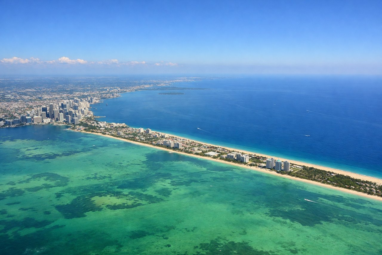
Takeoff from MIA
RIGHTMIA typically departs east on runway 08R/09, then turns south over Biscayne Bay. The right side gives you a clear look at downtown Miami's skyline, the Port of Miami, and the causeway islands before the aircraft heads south over the Florida Keys.
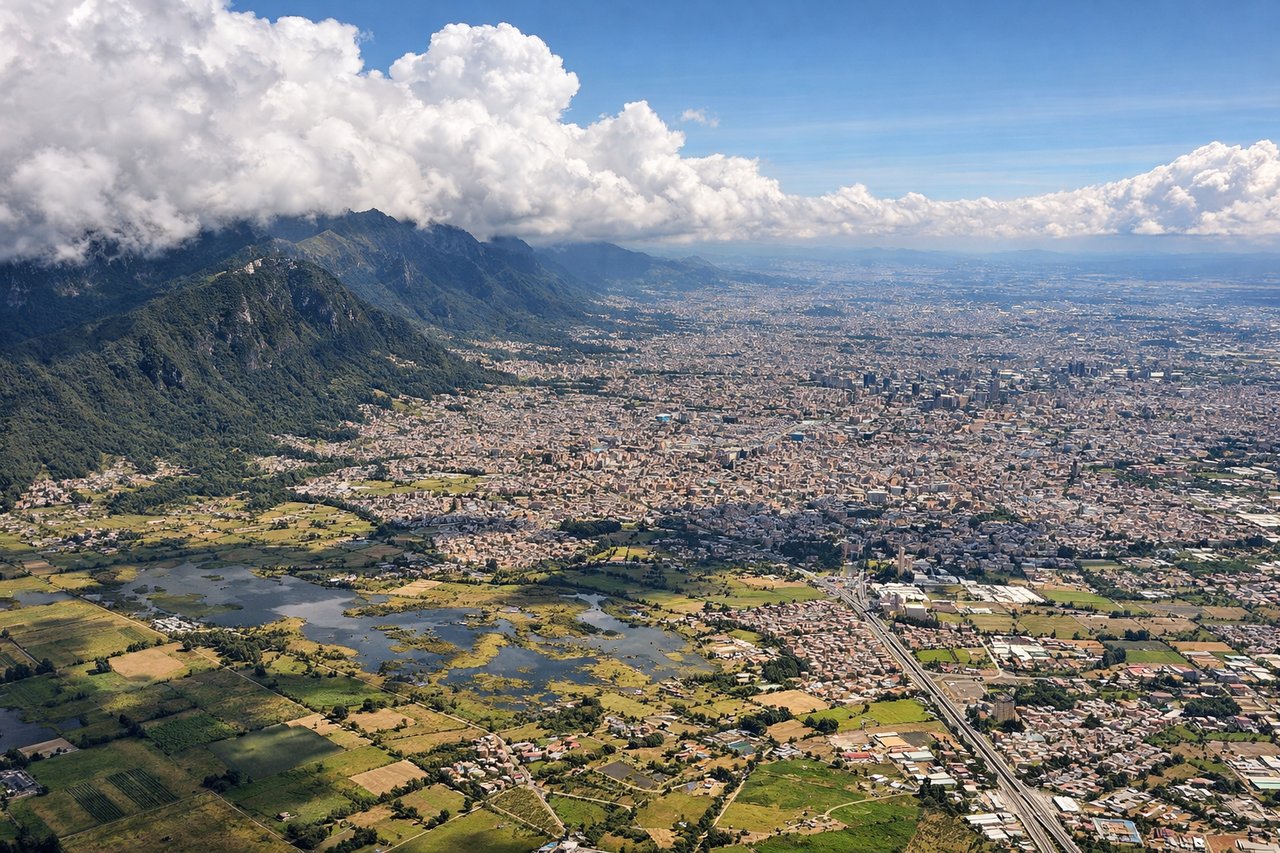
Landing at BOG
LEFTEl Dorado sits on the western edge of Bogota's savanna plateau. Aircraft typically approach from the north or northeast on runway 13, meaning the left side faces east toward the city of Bogota and the dramatic wall of the Eastern Cordillera of the Andes rising sharply behind it.
Will your flight be in sunlight?
Pick a date and time in the Sun Map to watch the sun move across your whole flight.
About This Route
Which side of the plane should I sit on flying from Miami International (MIA) to Eldorado International (BOG)?
Sit on the Left side of the plane for the best views on flights from Miami to Bogota. While the right side wins at takeoff with Miami's skyline, the left side delivers the more dramatic payoff on approach into Bogota with the Andes wall rising behind the city. Over the Caribbean and northern Colombia the left side also tracks closer to the Colombian coastline and the Sierra Nevada de Santa Marta range as you cross into South American airspace.
What can I see during takeoff from Miami International in Miami?
During takeoff from Miami International (MIA), sit on the Right side for the best views. MIA typically departs east on runway 08R/09, then turns south over Biscayne Bay. The right side gives you a clear look at downtown Miami's skyline, the Port of Miami, and the causeway islands before the aircraft heads south over the Florida Keys. Notable sights include: Downtown Miami skyline, Biscayne Bay, Port of Miami, Virginia Key and Key Biscayne.
What can I see when landing at Eldorado International in Bogota?
When landing at Eldorado International (BOG), sit on the Left side for the best views. El Dorado sits on the western edge of Bogota's savanna plateau. Aircraft typically approach from the north or northeast on runway 13, meaning the left side faces east toward the city of Bogota and the dramatic wall of the Eastern Cordillera of the Andes rising sharply behind it. Notable sights include: Bogota city center and urban grid, Eastern Cordillera (Andes), Cerro de Monserrate, Sabana de Bogota plateau.
How long is the flight from Miami to Bogota?
The flight from Miami International (MIA) to Eldorado International (BOG) takes about 4 hours 15 minutes. The shortest flight path between them is 1,513 miles (2,435 km); winds and air traffic control usually add a few percent.
What does the Miami to Bogota flight path pass over?
The flight tracks south-southwest over Cuba or the western Caribbean Sea, then crosses the northern coast of Colombia near Cartagena or Barranquilla. The Sierra Nevada de Santa Marta — an isolated coastal massif rising to nearly 19,000 feet — is visible to the left side as you enter Colombian airspace. The route then crosses the lowland Magdalena River valley before climbing toward the Andes and the Bogota plateau.