The right side captures the spectacular Miami Beach and Biscayne Bay departure, and over the Caribbean en route you get views of Cuba's coastline, Jamaica, and the Colombian coast near Cartagena. The left side wins at landing for the Andes, but the right side delivers more sustained visual interest across the full flight.
Flown MIA to CLO? Did we get it right?
Flight Path
Miami to Cali is 1,559 miles (2,509 km), a flight of about 3 hours 45 minutes.
The flight tracks southwest over the Florida Straits, then crosses Cuba's western provinces near Havana, continues over the Caribbean Sea passing south of Jamaica, crosses the Colombian coast near Cartagena and Barranquilla, then heads inland over the Colombian lowlands before reaching the Cauca Valley and Cali. The Sierra Nevada de Santa Marta massif is visible on the right side as the aircraft crosses the Colombian coast.
Great circle distance and headings ›

Phase by phase
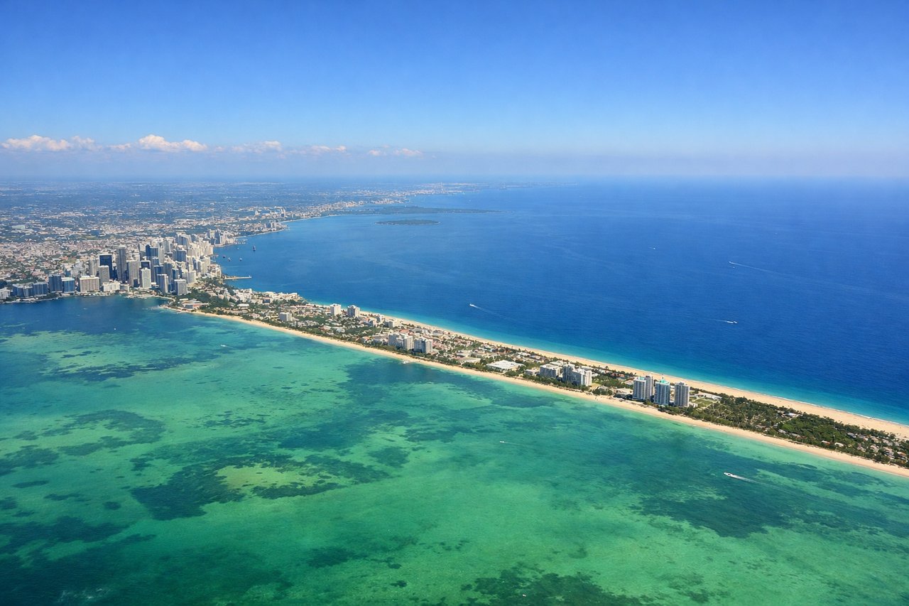
Takeoff from MIA
RIGHTMIA typically departs east on runway 08R/09, then turns south over Biscayne Bay and the Florida Keys chain. The right side gives you the sweep of Miami Beach, the Art Deco district, and the turquoise shallows of Biscayne Bay as the aircraft banks south.
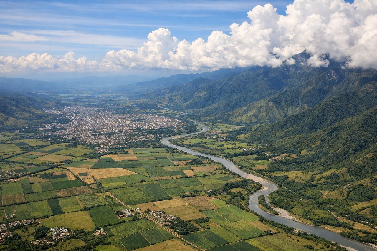
Landing at CLO
LEFTCLO's runway 01/19 means arrivals typically come in from the north heading south, or from the south heading north. Either way, the left side faces east toward the Andes — specifically the Cordillera Central and Cordillera Occidental flanking the Cauca Valley. The city of Cali sits in this valley and is visible on the left as you descend.
Will your flight be in sunlight?
Pick a date and time in the Sun Map to watch the sun move across your whole flight.
About This Route
Which side of the plane should I sit on flying from Miami International (MIA) to Alfonso Bonilla Aragon International (CLO)?
Sit on the Right side of the plane for the best views on flights from Miami to Cali. The right side captures the spectacular Miami Beach and Biscayne Bay departure, and over the Caribbean en route you get views of Cuba's coastline, Jamaica, and the Colombian coast near Cartagena. The left side wins at landing for the Andes, but the right side delivers more sustained visual interest across the full flight.
What can I see during takeoff from Miami International in Miami?
During takeoff from Miami International (MIA), sit on the Right side for the best views. MIA typically departs east on runway 08R/09, then turns south over Biscayne Bay and the Florida Keys chain. The right side gives you the sweep of Miami Beach, the Art Deco district, and the turquoise shallows of Biscayne Bay as the aircraft banks south. Notable sights include: Miami Beach barrier island, Biscayne Bay, the Port of Miami cruise terminal complex, Key Biscayne.
What can I see when landing at Alfonso Bonilla Aragon International in Cali?
When landing at Alfonso Bonilla Aragon International (CLO), sit on the Left side for the best views. CLO's runway 01/19 means arrivals typically come in from the north heading south, or from the south heading north. Either way, the left side faces east toward the Andes — specifically the Cordillera Central and Cordillera Occidental flanking the Cauca Valley. The city of Cali sits in this valley and is visible on the left as you descend. Notable sights include: Cordillera Central (Andes), Cordillera Occidental (Andes), Cauca River valley, city of Cali urban grid.
How long is the flight from Miami to Cali?
The flight from Miami International (MIA) to Alfonso Bonilla Aragon International (CLO) takes about 3 hours 45 minutes. The shortest flight path between them is 1,559 miles (2,509 km); winds and air traffic control usually add a few percent.
What does the Miami to Cali flight path pass over?
The flight tracks southwest over the Florida Straits, then crosses Cuba's western provinces near Havana, continues over the Caribbean Sea passing south of Jamaica, crosses the Colombian coast near Cartagena and Barranquilla, then heads inland over the Colombian lowlands before reaching the Cauca Valley and Cali. The Sierra Nevada de Santa Marta massif is visible on the right side as the aircraft crosses the Colombian coast.