The right side wins overall. The Miami departure view of Biscayne Bay and the downtown skyline is one of the best urban departure views in the US. During the cruise, the right side also tracks closer to the Colombian and Ecuadorian Pacific coastline as the route curves southwest, offering occasional glimpses of coastal terrain. The landing view on the left is excellent but shorter in duration.
Flown MIA to GYE? Did we get it right?
Flight Path
Miami to Guayaquil is 1,932 miles (3,109 km), a flight of about 4 hours 20 minutes.
After departing Miami, the route crosses Cuba or the western Caribbean, then tracks over the Colombian Caribbean coast near Cartagena. The flight then crosses the northern Andes of Colombia at high altitude, where snow-capped peaks of the Cordillera Occidental may be visible on clear days. The route descends toward the Pacific lowlands of Ecuador, crossing the coastal plain and the Guayas River basin before landing at GYE.
Great circle distance and headings ›

Phase by phase
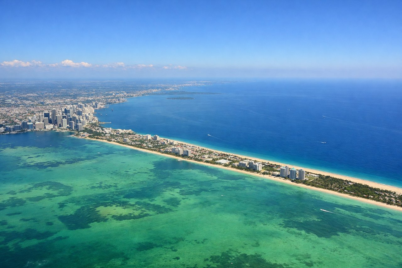
Takeoff from MIA
RIGHTMIA typically departs east on runway 08R/09, then turns south over Biscayne Bay. The right side gives you a clear look at downtown Miami's skyline, the Port of Miami, and the causeway islands before heading out over open water. Left side faces west toward the Everglades, which is flat and featureless at this stage.
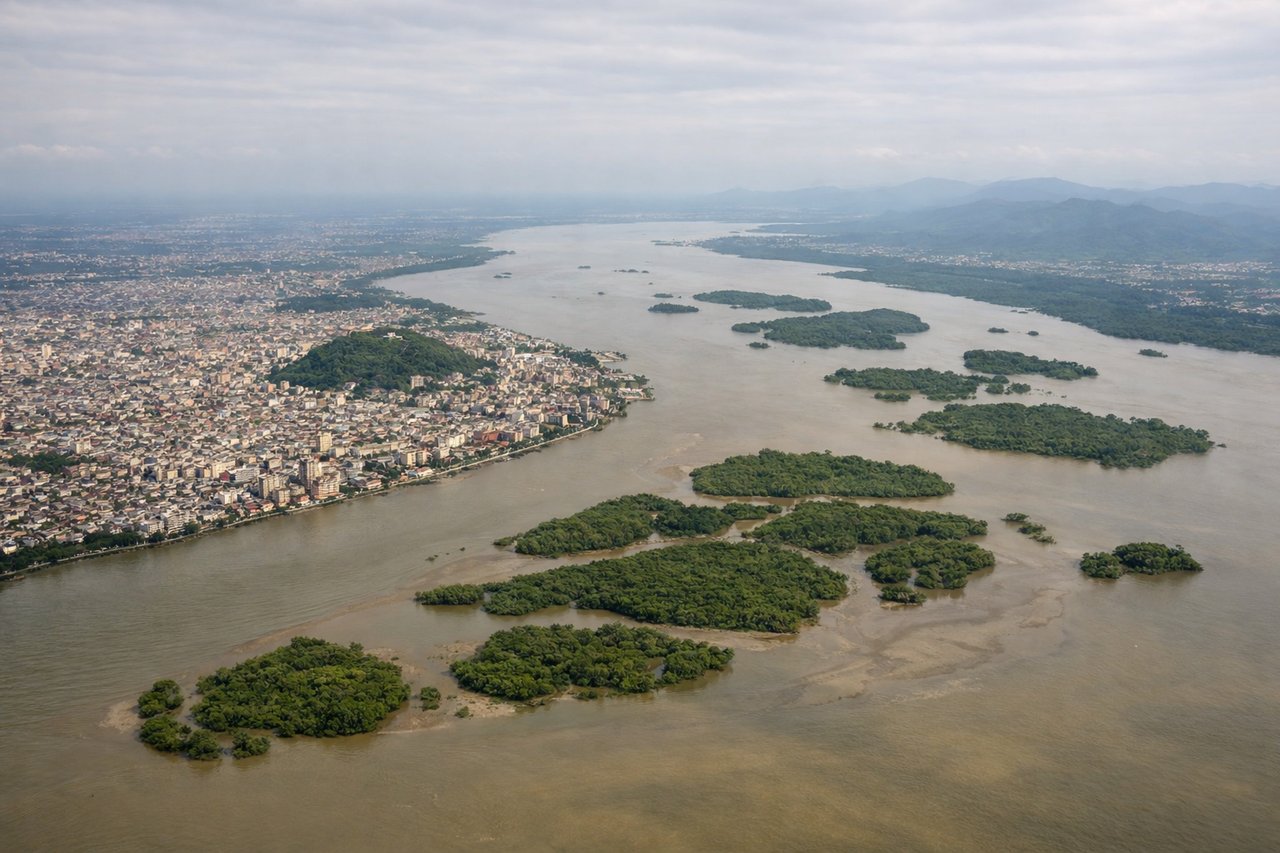
Landing at GYE
LEFTGYE typically lands from the north or northwest on runway 03, meaning the aircraft approaches from over the Gulf of Guayaquil. The left side gives you the best view of the Guayas River estuary, the city of Guayaquil itself, and the Andes foothills rising sharply to the east. The right side faces west over open water and mangrove flats.
Will your flight be in sunlight?
Pick a date and time in the Sun Map to watch the sun move across your whole flight.
About This Route
Which side of the plane should I sit on flying from Miami International (MIA) to Simon Bolivar International (GYE)?
Sit on the Right side of the plane for the best views on flights from Miami to Guayaquil. The right side wins overall. The Miami departure view of Biscayne Bay and the downtown skyline is one of the best urban departure views in the US. During the cruise, the right side also tracks closer to the Colombian and Ecuadorian Pacific coastline as the route curves southwest, offering occasional glimpses of coastal terrain. The landing view on the left is excellent but shorter in duration.
What can I see during takeoff from Miami International in Miami?
During takeoff from Miami International (MIA), sit on the Right side for the best views. MIA typically departs east on runway 08R/09, then turns south over Biscayne Bay. The right side gives you a clear look at downtown Miami's skyline, the Port of Miami, and the causeway islands before heading out over open water. Left side faces west toward the Everglades, which is flat and featureless at this stage. Notable sights include: Downtown Miami skyline, Biscayne Bay, Port of Miami cruise terminals, Virginia Key and Key Biscayne.
What can I see when landing at Simon Bolivar International in Guayaquil?
When landing at Simon Bolivar International (GYE), sit on the Left side for the best views. GYE typically lands from the north or northwest on runway 03, meaning the aircraft approaches from over the Gulf of Guayaquil. The left side gives you the best view of the Guayas River estuary, the city of Guayaquil itself, and the Andes foothills rising sharply to the east. The right side faces west over open water and mangrove flats. Notable sights include: Guayas River estuary, Guayaquil city center and Cerro Santa Ana hill, Gulf of Guayaquil mangrove islands, Andes foothills to the east.
How long is the flight from Miami to Guayaquil?
The flight from Miami International (MIA) to Simon Bolivar International (GYE) takes about 4 hours 20 minutes. The shortest flight path between them is 1,932 miles (3,109 km); winds and air traffic control usually add a few percent.
What does the Miami to Guayaquil flight path pass over?
After departing Miami, the route crosses Cuba or the western Caribbean, then tracks over the Colombian Caribbean coast near Cartagena. The flight then crosses the northern Andes of Colombia at high altitude, where snow-capped peaks of the Cordillera Occidental may be visible on clear days. The route descends toward the Pacific lowlands of Ecuador, crossing the coastal plain and the Guayas River basin before landing at GYE.