Memanbetsu to Sapporo is 146 miles (235 km), a flight of about 50 minutes.
While takeoff offers views of the Daisetsu Mountains and interior Hokkaido, the landing approach provides more dramatic and concentrated scenery—Sapporo's urban sprawl, Maruyama's distinctive volcanic cone, and Ishikari Bay. Left seats capture the most visually interesting portion of the flight.
Flight Path
The flight path crosses central Hokkaido from east to west, passing over or near the Akan volcanic lakes region, the Daisetsu Mountains to the north, and the Ishikari Plain. The route descends gradually from the volcanic plateau of eastern Hokkaido toward the coastal plains surrounding Sapporo.
Great circle distance and headings ›Phase by phase
Takeoff from MMB
RIGHTMemanbetsu sits on the eastern coast of Hokkaido. Right-side seats face west toward the interior of the island and the Daisetsu Mountains, the dominant volcanic range visible during climb-out. Left seats look east over the Pacific Ocean with minimal scenic content.
Landing at CTS
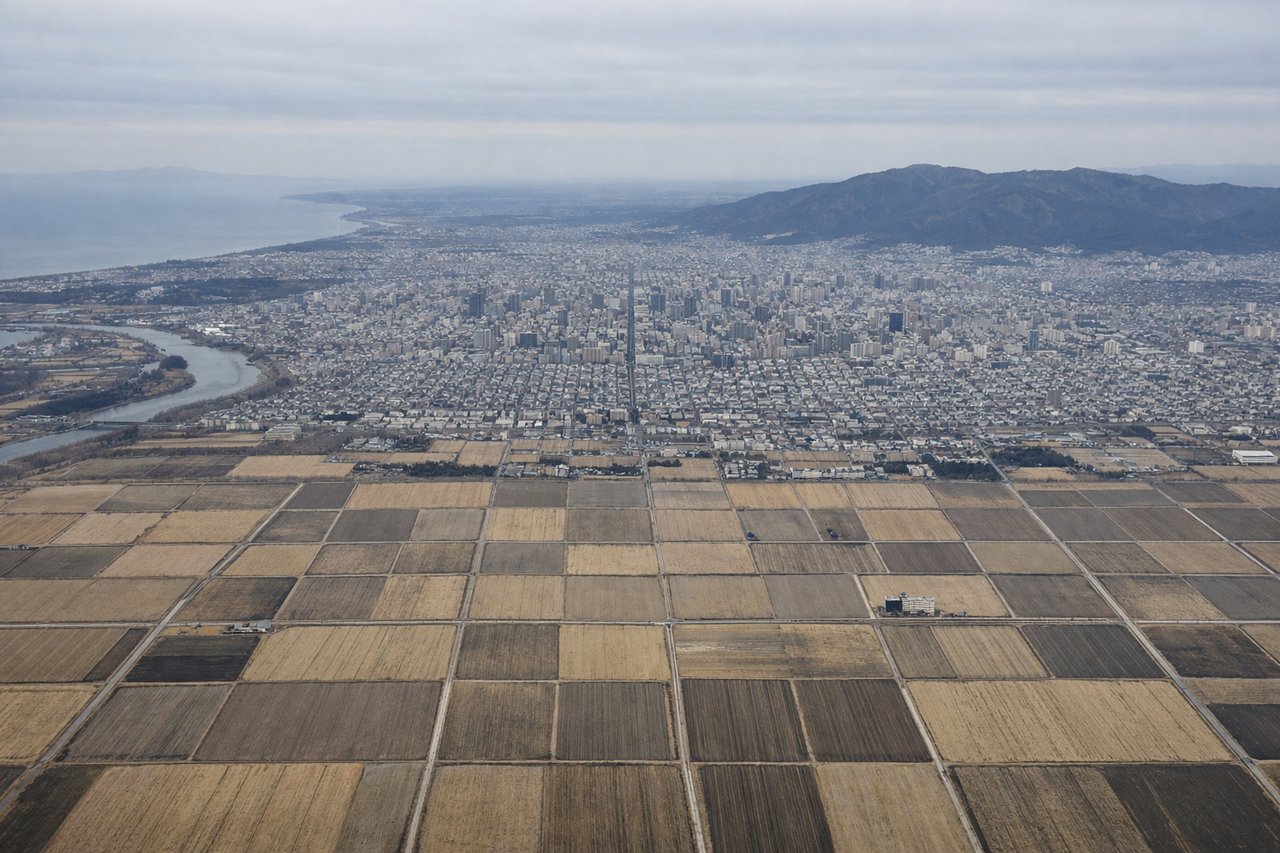
LEFTThe approach to Chitose (New Chitose) from the east brings aircraft over the Ishikari Plain and Sapporo urban area. Left-side seats face south and southwest toward Sapporo city, the Ishikari Bay coastline, and the Maruyama volcanic dome. Right seats look north toward less distinctive terrain.
Will your flight be in sunlight?
Pick a date and time in the Sun Map to watch the sun move across your whole flight.
About This Route
Which side of the plane should I sit on flying from Memanbetsu (MMB) to Chitose International Airport (CTS)?
Sit on the Left side of the plane for the best views on flights from Memanbetsu to Sapporo. While takeoff offers views of the Daisetsu Mountains and interior Hokkaido, the landing approach provides more dramatic and concentrated scenery—Sapporo's urban sprawl, Maruyama's distinctive volcanic cone, and Ishikari Bay. Left seats capture the most visually interesting portion of the flight.
What can I see during takeoff from Memanbetsu in Memanbetsu?
During takeoff from Memanbetsu (MMB), sit on the Right side for the best views. Memanbetsu sits on the eastern coast of Hokkaido. Right-side seats face west toward the interior of the island and the Daisetsu Mountains, the dominant volcanic range visible during climb-out. Left seats look east over the Pacific Ocean with minimal scenic content. Notable sights include: Daisetsu Mountains (volcanic peaks, 50+ km southwest), Kushiro Wetlands (extensive marshland visible as a patchwork of water and vegetation to the south), Akan National Park lakes (Akan, Mashu, and Kussharo lakes visible as distinct blue water bodies in the southeast).
What can I see when landing at Chitose International Airport in Sapporo?
When landing at Chitose International Airport (CTS), sit on the Left side for the best views. The approach to Chitose (New Chitose) from the east brings aircraft over the Ishikari Plain and Sapporo urban area. Left-side seats face south and southwest toward Sapporo city, the Ishikari Bay coastline, and the Maruyama volcanic dome. Right seats look north toward less distinctive terrain. Notable sights include: Sapporo city (urban sprawl visible as a dense grid of buildings and streets, approximately 20 km south of the airport), Maruyama volcano (distinctive conical peak, 500 m elevation, visible on the western edge of Sapporo), Ishikari Bay (broad coastal water body with visible shoreline and port facilities at Ishikari city).
How long is the flight from Memanbetsu to Sapporo?
The flight from Memanbetsu (MMB) to Chitose International Airport (CTS) takes about 50 minutes. The shortest flight path between them is 146 miles (235 km); winds and air traffic control usually add a few percent.
What does the Memanbetsu to Sapporo flight path pass over?
The flight path crosses central Hokkaido from east to west, passing over or near the Akan volcanic lakes region, the Daisetsu Mountains to the north, and the Ishikari Plain. The route descends gradually from the volcanic plateau of eastern Hokkaido toward the coastal plains surrounding Sapporo.