The left side offers more cumulative variety across the flight — glimpses of the Vietnamese coastline and Cam Ranh Bay, Cambodia's massive Tonle Sap Lake, and a scenic final approach past Bangkok's skyline and the Chao Phraya delta — outweighing the brief but strong Manila skyline view on the right during takeoff.
Flown MNL to BKK? Did we get it right?
Flight Path
Manila to Bangkok is 1,359 miles (2,188 km), a flight of about 3 hours 35 minutes.
The route crosses the South China Sea before clipping the central Vietnamese coast near Nha Trang and Cam Ranh Bay, then continues over Cambodia passing close to the vast Tonle Sap Lake and the Mekong River floodplain before descending into Thailand's flat central plain toward Bangkok.
Great circle distance and headings ›

Phase by phase
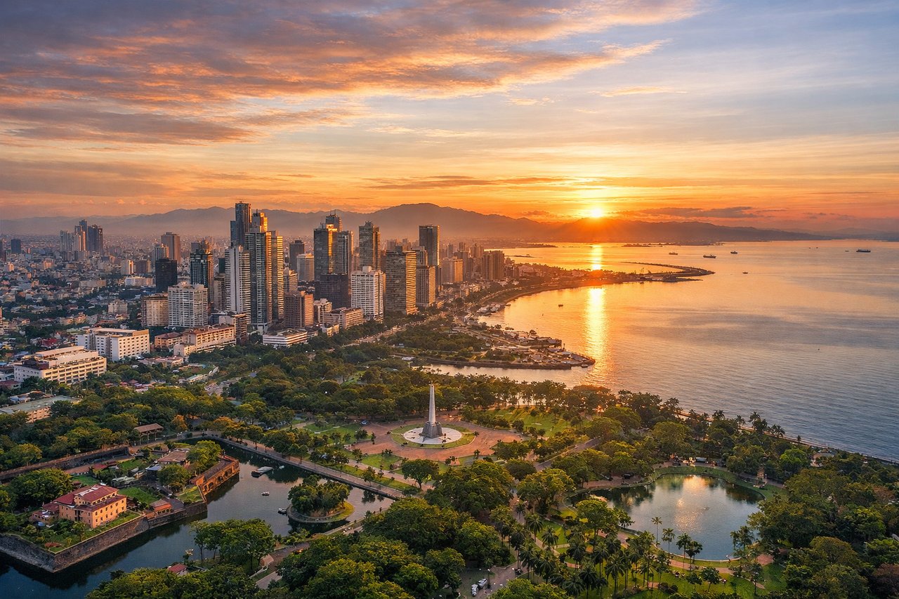
Takeoff from MNL
RIGHTDeparting NAIA toward the southwest over Manila Bay puts the city on the right side of the aircraft — Makati and BGC's skyscraper clusters, the Pasig River mouth, and the old walled district of Intramuros are all visible as the plane climbs before turning west over the bay.
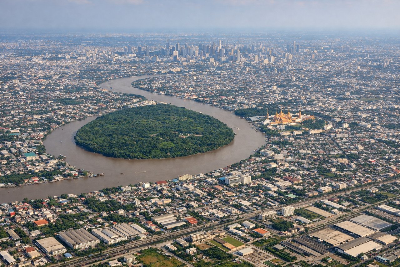
Landing at BKK
LEFTOn approach into Suvarnabhumi from the east, the final turn toward the north-south runways brings the flat Chao Phraya delta into view on the left, with Bangkok's skyline and the silver ribbon of the river visible in the distance before the aircraft crosses over aquaculture ponds and rice paddies near touchdown.
Will your flight be in sunlight?
Pick a date and time in the Sun Map to watch the sun move across your whole flight.
About This Route
Which side of the plane should I sit on flying from Ninoy Aquino International (MNL) to Suvarnabhumi Airport (BKK)?
Sit on the Left side of the plane for the best views on flights from Manila to Bangkok. The left side offers more cumulative variety across the flight — glimpses of the Vietnamese coastline and Cam Ranh Bay, Cambodia's massive Tonle Sap Lake, and a scenic final approach past Bangkok's skyline and the Chao Phraya delta — outweighing the brief but strong Manila skyline view on the right during takeoff.
What can I see during takeoff from Ninoy Aquino International in Manila?
During takeoff from Ninoy Aquino International (MNL), sit on the Right side for the best views. Departing NAIA toward the southwest over Manila Bay puts the city on the right side of the aircraft — Makati and BGC's skyscraper clusters, the Pasig River mouth, and the old walled district of Intramuros are all visible as the plane climbs before turning west over the bay. Notable sights include: Manila Bay, Makati/BGC skyline, Intramuros, Pasig River mouth.
What can I see when landing at Suvarnabhumi Airport in Bangkok?
When landing at Suvarnabhumi Airport (BKK), sit on the Left side for the best views. On approach into Suvarnabhumi from the east, the final turn toward the north-south runways brings the flat Chao Phraya delta into view on the left, with Bangkok's skyline and the silver ribbon of the river visible in the distance before the aircraft crosses over aquaculture ponds and rice paddies near touchdown. Notable sights include: Chao Phraya River, Bangkok skyline (Sathorn/Silom towers), Samut Prakan shrimp farms and rice paddies, Gulf of Thailand's edge.
How long is the flight from Manila to Bangkok?
The flight from Ninoy Aquino International (MNL) to Suvarnabhumi Airport (BKK) takes about 3 hours 35 minutes. The shortest flight path between them is 1,359 miles (2,188 km); winds and air traffic control usually add a few percent.
What does the Manila to Bangkok flight path pass over?
The route crosses the South China Sea before clipping the central Vietnamese coast near Nha Trang and Cam Ranh Bay, then continues over Cambodia passing close to the vast Tonle Sap Lake and the Mekong River floodplain before descending into Thailand's flat central plain toward Bangkok.