The east-facing side wins out overall because of the closing sequence into Bali, where the volcanic peaks of Agung and Batur plus Nusa Penida island provide a dramatic, recognizable finale that outweighs the mostly open-water cruise phase.
Flown MNL to DPS? Did we get it right?
Flight Path
Manila to Denpasar is 1,656 miles (2,665 km), a flight of about 3 hours 35 minutes.
Sulu Sea, northern Borneo (Sabah) coastline, Makassar Strait between Borneo and Sulawesi, Java Sea, Bali Strait
Great circle distance and headings ›


Phase by phase
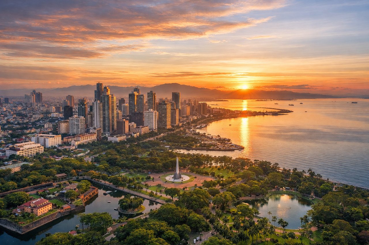
Takeoff from MNL
RIGHTDeparting NAIA to the south, the west-facing side gets a good look at Manila Bay, Corregidor Island, and the Bataan Peninsula's hills as the aircraft climbs out over the water before turning south. The east side mostly shows Metro Manila's dense urban sprawl fading into haze.
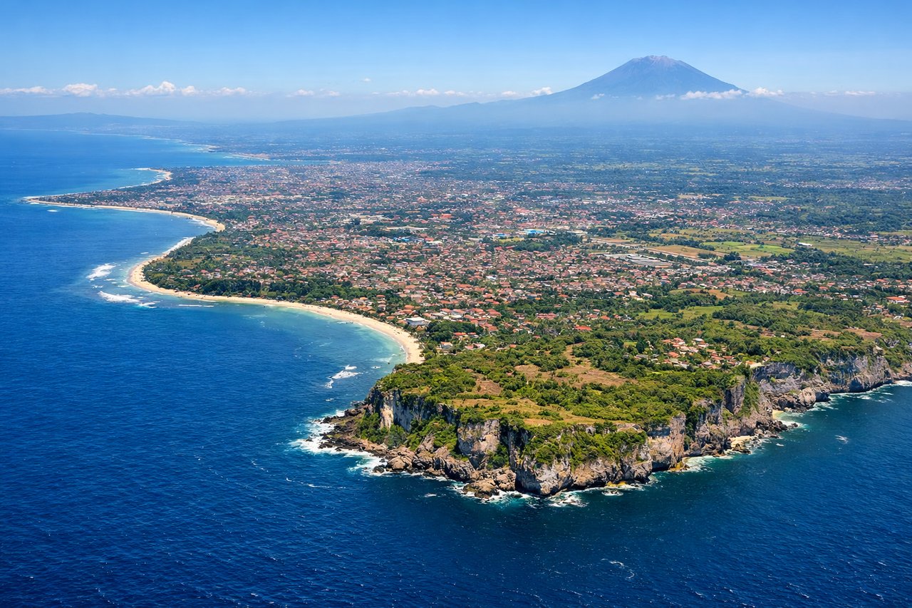
Landing at DPS
LEFTOn approach into Denpasar from the north, the east-facing side offers views of Bali's volcanic spine, including Gunung Agung and Gunung Batur, along with the small island of Nusa Penida off the southeast coast. The west side mostly shows open sea and the flatter Buleleng coastline.
Will your flight be in sunlight?
Pick a date and time in the Sun Map to watch the sun move across your whole flight.
About This Route
Which side of the plane should I sit on flying from Ninoy Aquino International (MNL) to Denpasar I Gusti Ngurah Rai International Airport (DPS)?
Sit on the Left side of the plane for the best views on flights from Manila to Denpasar. The east-facing side wins out overall because of the closing sequence into Bali, where the volcanic peaks of Agung and Batur plus Nusa Penida island provide a dramatic, recognizable finale that outweighs the mostly open-water cruise phase.
What can I see during takeoff from Ninoy Aquino International in Manila?
During takeoff from Ninoy Aquino International (MNL), sit on the Right side for the best views. Departing NAIA to the south, the west-facing side gets a good look at Manila Bay, Corregidor Island, and the Bataan Peninsula's hills as the aircraft climbs out over the water before turning south. The east side mostly shows Metro Manila's dense urban sprawl fading into haze. Notable sights include: Manila Bay, Corregidor Island, Bataan Peninsula, Cavite coastline.
What can I see when landing at Denpasar I Gusti Ngurah Rai International Airport in Denpasar?
When landing at Denpasar I Gusti Ngurah Rai International Airport (DPS), sit on the Left side for the best views. On approach into Denpasar from the north, the east-facing side offers views of Bali's volcanic spine, including Gunung Agung and Gunung Batur, along with the small island of Nusa Penida off the southeast coast. The west side mostly shows open sea and the flatter Buleleng coastline. Notable sights include: Gunung Agung, Gunung Batur, Nusa Penida island, Bali's southern coastline.
How long is the flight from Manila to Denpasar?
The flight from Ninoy Aquino International (MNL) to Denpasar I Gusti Ngurah Rai International Airport (DPS) takes about 3 hours 35 minutes. The shortest flight path between them is 1,656 miles (2,665 km); winds and air traffic control usually add a few percent.
What does the Manila to Denpasar flight path pass over?
Sulu Sea, northern Borneo (Sabah) coastline, Makassar Strait between Borneo and Sulawesi, Java Sea, Bali Strait