Manila to Montpelier is 8,291 miles (13,343 km), a flight of about 15 hours 45 minutes.
The right seat at takeoff delivers the most dramatic and unique scenery of the whole journey — Laguna de Bay and the Sierra Madre are genuinely spectacular from the air and hard to see otherwise. The landing views from the left are excellent but Vermont's Green Mountains are relatively modest in scale. The Manila departure right-side view edges it overall.
Flight Path
Departing northeast from Manila, the route crosses the Philippine Sea and the Ryukyu Islands chain (Japan), then the Japanese home islands including Honshu. Over the North Pacific the route arcs across the Aleutian Island chain or sub-Arctic Pacific, then crosses the Canadian Rockies and the Great Plains. The final leg from a US hub to Montpelier crosses the Appalachian Mountains and the Connecticut River valley before descending into central Vermont.
Great circle distance and headings ›Phase by phase
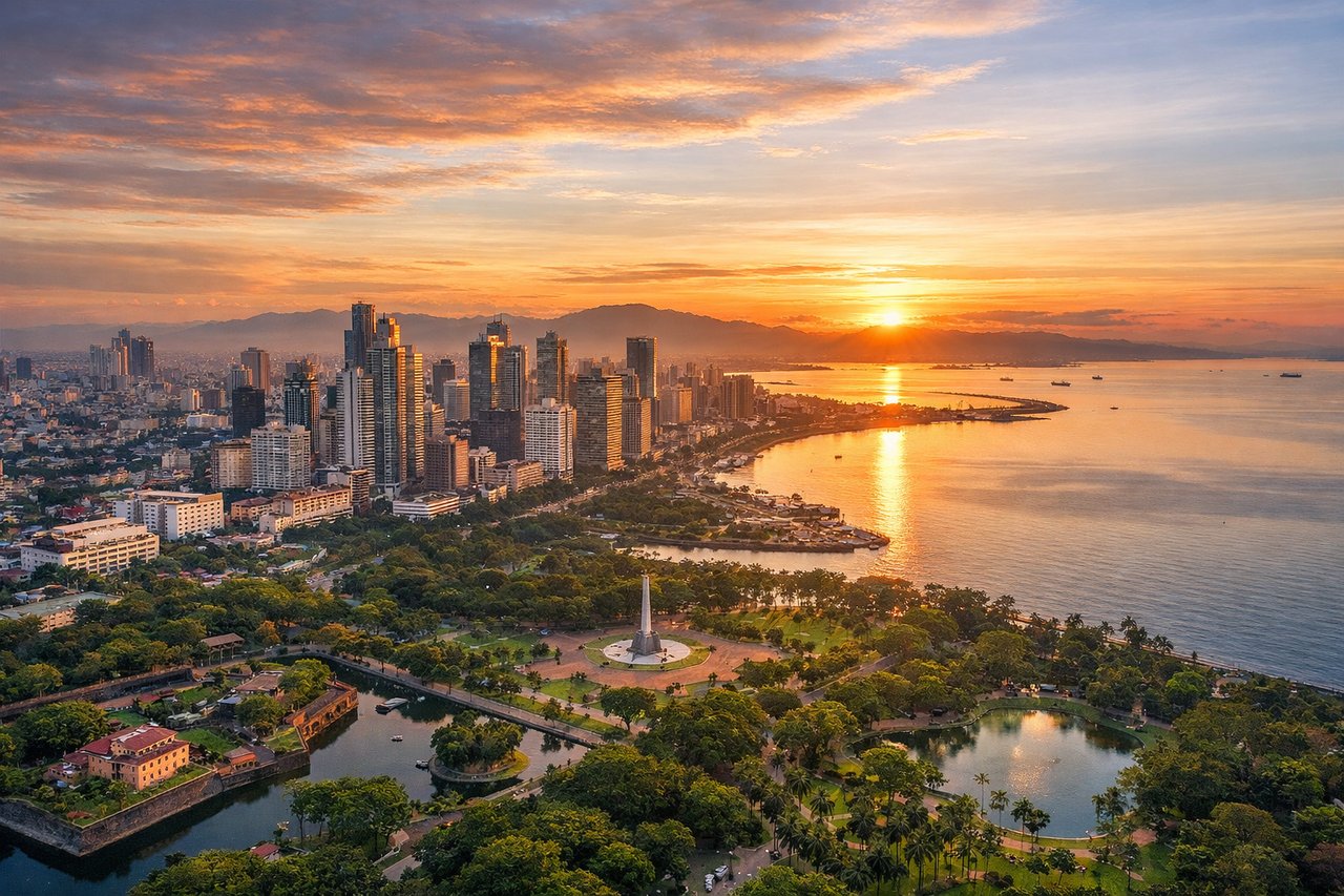
Takeoff from MNL
RIGHTNAIA's primary departure runway 06 sends aircraft northeast over Manila Bay on the left, but the right side gives you the dense urban sprawl of Metro Manila, Laguna de Bay (one of Southeast Asia's largest lakes), and the Sierra Madre mountain range rising to the east. Runway 24 departures heading southwest put Manila Bay on the right with the Cavite peninsula visible.
Landing at MPV
LEFTEdward F. Knapp State Airport sits just northwest of Montpelier. Approaches typically come from the south or southwest on runway 35, meaning the left side faces west toward the Green Mountains spine including Camel's Hump and Mount Mansfield, while the right looks east toward the White Mountains of New Hampshire on the distant horizon. The left side wins for the dramatic Vermont ridgelines.
Landmarks on this routeAll landmarks →
Will your flight be in sunlight?
Pick a date and time in the Sun Map to watch the sun move across your whole flight.
About This Route
Which side of the plane should I sit on flying from Ninoy Aquino International (MNL) to Edward F Knapp State (MPV)?
Sit on the Right side of the plane for the best views on flights from Manila to Montpelier. The right seat at takeoff delivers the most dramatic and unique scenery of the whole journey — Laguna de Bay and the Sierra Madre are genuinely spectacular from the air and hard to see otherwise. The landing views from the left are excellent but Vermont's Green Mountains are relatively modest in scale. The Manila departure right-side view edges it overall.
What can I see during takeoff from Ninoy Aquino International in Manila?
During takeoff from Ninoy Aquino International (MNL), sit on the Right side for the best views. NAIA's primary departure runway 06 sends aircraft northeast over Manila Bay on the left, but the right side gives you the dense urban sprawl of Metro Manila, Laguna de Bay (one of Southeast Asia's largest lakes), and the Sierra Madre mountain range rising to the east. Runway 24 departures heading southwest put Manila Bay on the right with the Cavite peninsula visible. Notable sights include: Laguna de Bay (large inland lake to the southeast), Sierra Madre mountain range (eastern horizon), Metro Manila urban grid, Manila Bay coastline.
What can I see when landing at Edward F Knapp State in Montpelier?
When landing at Edward F Knapp State (MPV), sit on the Left side for the best views. Edward F. Knapp State Airport sits just northwest of Montpelier. Approaches typically come from the south or southwest on runway 35, meaning the left side faces west toward the Green Mountains spine including Camel's Hump and Mount Mansfield, while the right looks east toward the White Mountains of New Hampshire on the distant horizon. The left side wins for the dramatic Vermont ridgelines. Notable sights include: Green Mountains ridgeline (Camel's Hump and Mount Mansfield), Winooski River valley, Montpelier city center and Vermont State House dome, Worcester Range to the east.
How long is the flight from Manila to Montpelier?
The flight from Ninoy Aquino International (MNL) to Edward F Knapp State (MPV) takes about 15 hours 45 minutes. The shortest flight path between them is 8,291 miles (13,343 km); winds and air traffic control usually add a few percent.
What does the Manila to Montpelier flight path pass over?
Departing northeast from Manila, the route crosses the Philippine Sea and the Ryukyu Islands chain (Japan), then the Japanese home islands including Honshu. Over the North Pacific the route arcs across the Aleutian Island chain or sub-Arctic Pacific, then crosses the Canadian Rockies and the Great Plains. The final leg from a US hub to Montpelier crosses the Appalachian Mountains and the Connecticut River valley before descending into central Vermont.