The left side captures Sulawesi's mountainous, bay-lined coast at departure and passes closer to Bangkok and the Gulf of Thailand during cruise, giving more varied scenery. The right side spends most of the flight over open water (South China Sea, Andaman Sea) with only the Delhi skyline as a highlight at the very end.
Flown MOH to DEL? Did we get it right?
Flight Path
Morowali to Delhi is 3,636 miles (5,852 km), a flight of about 7 hours 20 minutes.
The great-circle path crosses the South China Sea near the Natuna Islands, passes close to Bangkok and the Gulf of Thailand, continues over the Andaman Sea and Myanmar's coast, then crosses the Bay of Bengal near the Sundarbans mangrove delta of the Ganges-Brahmaputra before flying over the flat Gangetic plain of Bihar and Uttar Pradesh into Delhi.
Great circle distance and headings ›


Phase by phase
Takeoff from MOH
LEFTClimbing out of Maleo Airport, the left side faces Sulawesi's rugged, jungle-covered interior highlands as the aircraft turns toward its northwest routing, with the turquoise curve of Tomori Bay visible below. The right side mostly shows open water of the Banda Sea with little variation.
Landing at DEL
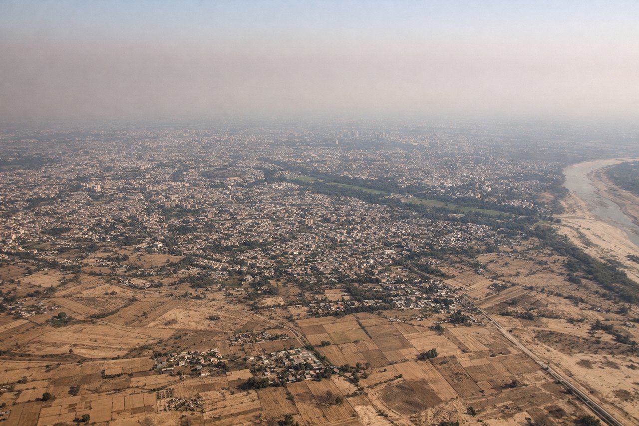
RIGHTOn the descent into Delhi from the east, the right side looks north across the Yamuna River toward the dense, tree-lined core of the capital, including the government district and the older city grid, before the final turn onto the runway. The left side faces mostly flat, undifferentiated farmland south of the approach path.
Will your flight be in sunlight?
Pick a date and time in the Sun Map to watch the sun move across your whole flight.
About This Route
Which side of the plane should I sit on flying from Maleo Airport (MOH) to Indira Gandhi International (DEL)?
Sit on the Left side of the plane for the best views on flights from Morowali to Delhi. The left side captures Sulawesi's mountainous, bay-lined coast at departure and passes closer to Bangkok and the Gulf of Thailand during cruise, giving more varied scenery. The right side spends most of the flight over open water (South China Sea, Andaman Sea) with only the Delhi skyline as a highlight at the very end.
What can I see during takeoff from Maleo Airport in Morowali?
During takeoff from Maleo Airport (MOH), sit on the Left side for the best views. Climbing out of Maleo Airport, the left side faces Sulawesi's rugged, jungle-covered interior highlands as the aircraft turns toward its northwest routing, with the turquoise curve of Tomori Bay visible below. The right side mostly shows open water of the Banda Sea with little variation. Notable sights include: Tomori Bay, Central Sulawesi highland ridges, Banggai Islands offshore, Makassar Strait.
What can I see when landing at Indira Gandhi International in Delhi?
When landing at Indira Gandhi International (DEL), sit on the Right side for the best views. On the descent into Delhi from the east, the right side looks north across the Yamuna River toward the dense, tree-lined core of the capital, including the government district and the older city grid, before the final turn onto the runway. The left side faces mostly flat, undifferentiated farmland south of the approach path. Notable sights include: Yamuna River, central Delhi government district (India Gate/Rashtrapati Bhavan area), Old Delhi's dense grid near Red Fort, Noida/Ghaziabad high-rises.
How long is the flight from Morowali to Delhi?
The flight from Maleo Airport (MOH) to Indira Gandhi International (DEL) takes about 7 hours 20 minutes. The shortest flight path between them is 3,636 miles (5,852 km); winds and air traffic control usually add a few percent.
What does the Morowali to Delhi flight path pass over?
The great-circle path crosses the South China Sea near the Natuna Islands, passes close to Bangkok and the Gulf of Thailand, continues over the Andaman Sea and Myanmar's coast, then crosses the Bay of Bengal near the Sundarbans mangrove delta of the Ganges-Brahmaputra before flying over the flat Gangetic plain of Bihar and Uttar Pradesh into Delhi.