The left side tracks the more geographically varied northern edge of the route — Delhi's skyline, the Gangetic plain, Myanmar's mountains and delta, Borneo's highlands, and Sulawesi's rugged interior on arrival — while the right side is dominated by long stretches of open water across the Bay of Bengal, Andaman Sea, and Makassar Strait.
Flown DEL to MOH? Did we get it right?
Flight Path
Delhi to Morowali is 3,636 miles (5,852 km), a flight of about 7 hours 40 minutes.
The route crosses the Sundarbans delta of the Ganges-Brahmaputra, the open waters of the Bay of Bengal, Myanmar's Ayeyarwady delta and the Arakan mountain range, the Strait of Malacca, the central highlands of Borneo, and the Makassar Strait before reaching Sulawesi's mountainous terrain near Morowali.
Great circle distance and headings ›


Phase by phase
Takeoff from DEL
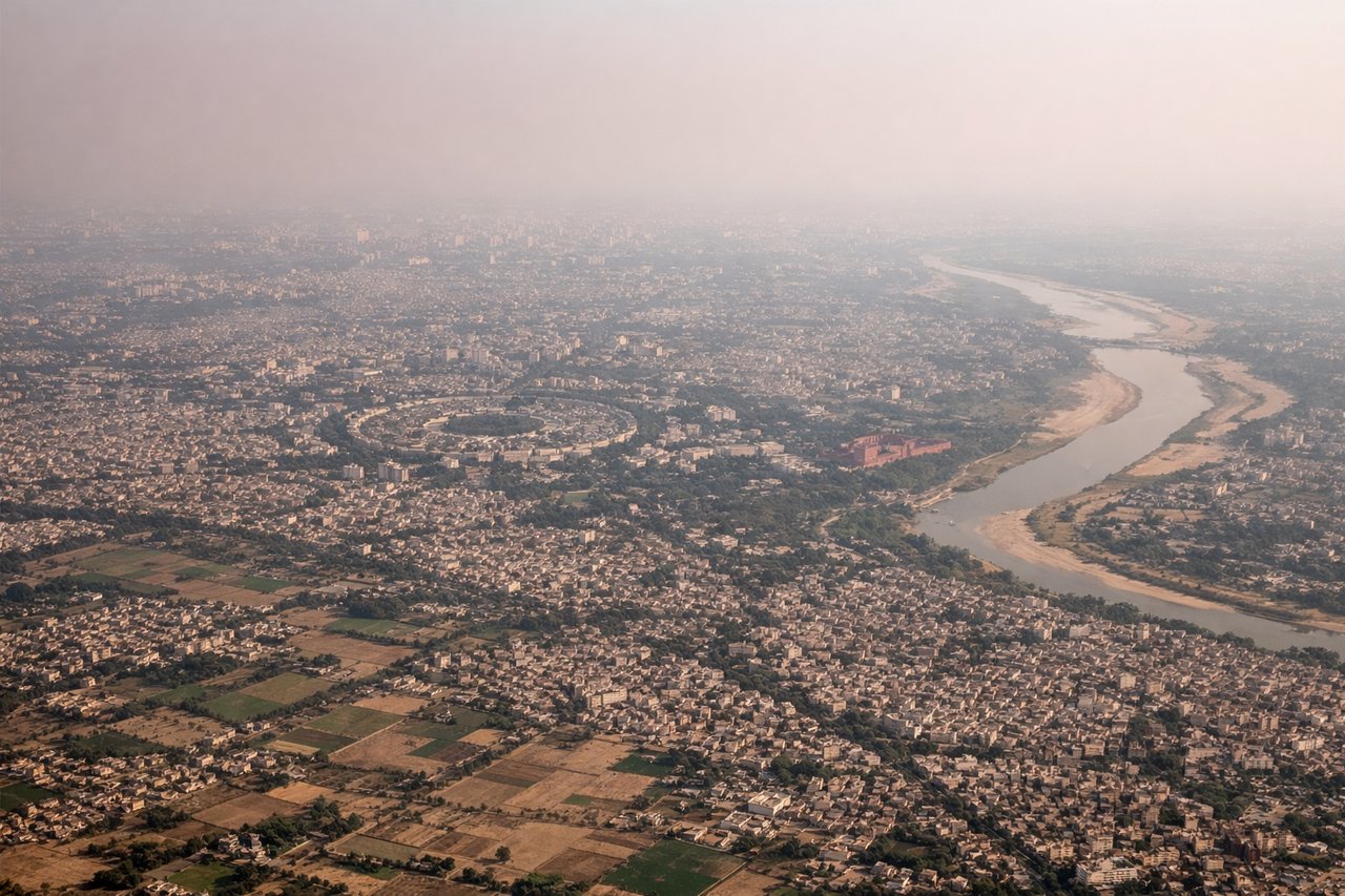
LEFTDeparting DEL toward the southeast on runway 11, the aircraft's initial track keeps Delhi's historic core to the north, putting it on the left side during climb-out. The right side only shows flat Haryana farmland stretching to the horizon.
Landing at MOH
LEFTOn approach into Morowali, the flight path skirts the rugged, forest-covered mountain spine of central Sulawesi, which sits to the left of the descending aircraft. The right side faces the open waters of Tomori Bay and the Banda Sea, offering less textured scenery.
Will your flight be in sunlight?
Pick a date and time in the Sun Map to watch the sun move across your whole flight.
About This Route
Which side of the plane should I sit on flying from Indira Gandhi International (DEL) to Maleo Airport (MOH)?
Sit on the Left side of the plane for the best views on flights from Delhi to Morowali. The left side tracks the more geographically varied northern edge of the route — Delhi's skyline, the Gangetic plain, Myanmar's mountains and delta, Borneo's highlands, and Sulawesi's rugged interior on arrival — while the right side is dominated by long stretches of open water across the Bay of Bengal, Andaman Sea, and Makassar Strait.
What can I see during takeoff from Indira Gandhi International in Delhi?
During takeoff from Indira Gandhi International (DEL), sit on the Left side for the best views. Departing DEL toward the southeast on runway 11, the aircraft's initial track keeps Delhi's historic core to the north, putting it on the left side during climb-out. The right side only shows flat Haryana farmland stretching to the horizon. Notable sights include: Red Fort and India Gate skyline, Yamuna River, Delhi's dense urban grid fading into Gangetic plain farmland.
What can I see when landing at Maleo Airport in Morowali?
When landing at Maleo Airport (MOH), sit on the Left side for the best views. On approach into Morowali, the flight path skirts the rugged, forest-covered mountain spine of central Sulawesi, which sits to the left of the descending aircraft. The right side faces the open waters of Tomori Bay and the Banda Sea, offering less textured scenery. Notable sights include: Central Sulawesi's forested mountain ridges, Tomori Bay coastline, scattered offshore islands, winding river valleys feeding the bay.
How long is the flight from Delhi to Morowali?
The flight from Indira Gandhi International (DEL) to Maleo Airport (MOH) takes about 7 hours 40 minutes. The shortest flight path between them is 3,636 miles (5,852 km); winds and air traffic control usually add a few percent.
What does the Delhi to Morowali flight path pass over?
The route crosses the Sundarbans delta of the Ganges-Brahmaputra, the open waters of the Bay of Bengal, Myanmar's Ayeyarwady delta and the Arakan mountain range, the Strait of Malacca, the central highlands of Borneo, and the Makassar Strait before reaching Sulawesi's mountainous terrain near Morowali.