While takeoff from Madison is marginally better on the left, the landing approach on the right side to Honolulu is significantly more scenic with the Ko'olau volcanic mountains, Kailua Bay, and Windward Oahu cliffs providing dramatic terrain. The cruise segment over open Pacific is equally uninteresting on both sides, but the landing experience tips the overall advantage to the right. Both sides score equally at 2.5 because the 5+ hour ocean crossing dominates the flight and caps the maximum scenic value.
Flight Path
The flight path crosses the Great Plains (Nebraska, Kansas, Colorado) during the first 2 hours with flat to gently rolling terrain, then transitions over the Rocky Mountains (Colorado/Wyoming border region) with visible peaks and valleys around 3 hours into flight. After crossing the Rockies, the route enters open Pacific Ocean approximately 3.5 hours into the flight and maintains ocean views for the remaining 2+ hours until approaching the Hawaiian Islands. No significant landmarks are visible during the long ocean crossing. The Hawaiian Islands become visible approximately 30 minutes before landing, with the Big Island's volcanic peaks appearing first on the horizon, followed by Maui and finally Oahu.
Great circle distance and headings ›
.jpg?width=600)


Phase by phase
Takeoff from MSN
LEFTMadison's urban core and the Yahara River system are visible on the left side during climb-out, providing brief city scenery before transitioning to flat terrain. The right side offers only flat agricultural landscape immediately.
Landing at HNL
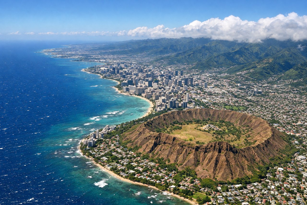
RIGHTThe right side captures Oahu's dramatic volcanic landscape and the Ko'olau mountain range during approach to Honolulu. The left side faces the open Pacific Ocean with no significant landmarks visible during the final descent.
Landmarks on this routeAll landmarks →
Will your flight be in sunlight?
See exactly which side of the plane gets sun and shade at your departure time.
About This Route
Which side of the plane should I sit on flying from Dane Co Rgnl Truax Fld (MSN) to Honolulu International (HNL)?
Sit on the Right side of the plane for the best views on flights from Madison to Honolulu. While takeoff from Madison is marginally better on the left, the landing approach on the right side to Honolulu is significantly more scenic with the Ko'olau volcanic mountains, Kailua Bay, and Windward Oahu cliffs providing dramatic terrain. The cruise segment over open Pacific is equally uninteresting on both sides, but the landing experience tips the overall advantage to the right. Both sides score equally at 2.5 because the 5+ hour ocean crossing dominates the flight and caps the maximum scenic value.
What can I see during takeoff from Dane Co Rgnl Truax Fld in Madison?
During takeoff from Dane Co Rgnl Truax Fld (MSN), sit on the Left side for the best views. Madison's urban core and the Yahara River system are visible on the left side during climb-out, providing brief city scenery before transitioning to flat terrain. The right side offers only flat agricultural landscape immediately. Notable sights include: Madison downtown and Capitol building, Yahara River valley, Lake Mendota, Dane County farmland grid.
What can I see when landing at Honolulu International in Honolulu?
When landing at Honolulu International (HNL), sit on the Right side for the best views. The right side captures Oahu's dramatic volcanic landscape and the Ko'olau mountain range during approach to Honolulu. The left side faces the open Pacific Ocean with no significant landmarks visible during the final descent. Notable sights include: Ko'olau mountain range, Kailua Bay, Windward Oahu cliffs, Honolulu harbor and urban sprawl.
How long is the flight from Madison to Honolulu?
The flight from Dane Co Rgnl Truax Fld (MSN) to Honolulu International (HNL) takes 5h 45m.
What does the Madison to Honolulu flight path pass over?
The flight path crosses the Great Plains (Nebraska, Kansas, Colorado) during the first 2 hours with flat to gently rolling terrain, then transitions over the Rocky Mountains (Colorado/Wyoming border region) with visible peaks and valleys around 3 hours into flight. After crossing the Rockies, the route enters open Pacific Ocean approximately 3.5 hours into the flight and maintains ocean views for the remaining 2+ hours until approaching the Hawaiian Islands. No significant landmarks are visible during the long ocean crossing. The Hawaiian Islands become visible approximately 30 minutes before landing, with the Big Island's volcanic peaks appearing first on the horizon, followed by Maui and finally Oahu.