The westbound route from Minneapolis to Billings favors the right (south) side. While the left side offers good urban scenery during Minneapolis departure, the right side delivers superior cruise and landing views: the transition from Great Plains to the Beartooth and Absaroka Mountains during descent is dramatic and visually distinctive. The mountain approach significantly outweighs the flat prairie cruise segment, scoring 3.5 overall versus 2.5 for the left side.
Flown MSP to BIL? Did we get it right?
Flight Path
Minneapolis to Billings is 746 miles (1,200 km), a flight of about 2 hours 15 minutes.
Missouri River valley near Fort Peck Lake area, transition from Minnesota farmland through North Dakota prairie, gradual rise into Montana high plains, Musselshell River drainage, approach to Yellowstone River valley
Great circle distance and headings ›Phase by phase
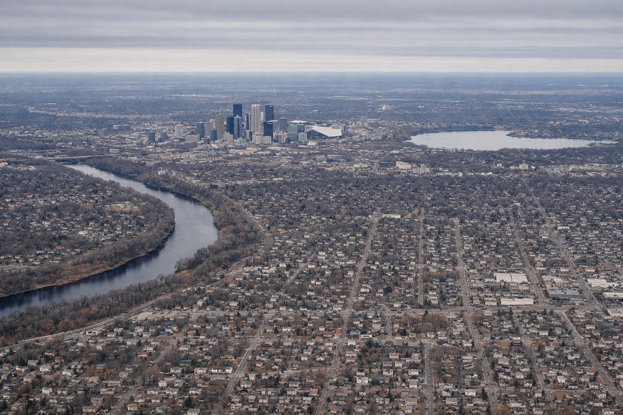
Takeoff from MSP
LEFTMinneapolis-St. Paul metropolitan area and surrounding lakes provide urban texture and water features during climb-out. The Twin Cities sprawl and chain of lakes (Calhoun, Harriet, Minnetonka) are visible from altitude heading northwest.
Landing at BIL
RIGHTThe approach to Billings from the east reveals the Beartooth Mountains and Absaroka Range as dramatic backdrops, plus the Yellowstone River valley and surrounding high plains. The terrain transitions from flat prairie to foothills, creating visual variety during descent.
Will your flight be in sunlight?
Pick a date and time in the Sun Map to watch the sun move across your whole flight.
About This Route
Which side of the plane should I sit on flying from Minneapolis St Paul International (MSP) to Billings Logan International Airport (BIL)?
Sit on the Right side of the plane for the best views on flights from Minneapolis to Billings. The westbound route from Minneapolis to Billings favors the right (south) side. While the left side offers good urban scenery during Minneapolis departure, the right side delivers superior cruise and landing views: the transition from Great Plains to the Beartooth and Absaroka Mountains during descent is dramatic and visually distinctive. The mountain approach significantly outweighs the flat prairie cruise segment, scoring 3.5 overall versus 2.5 for the left side.
What can I see during takeoff from Minneapolis St Paul International in Minneapolis?
During takeoff from Minneapolis St Paul International (MSP), sit on the Left side for the best views. Minneapolis-St. Paul metropolitan area and surrounding lakes provide urban texture and water features during climb-out. The Twin Cities sprawl and chain of lakes (Calhoun, Harriet, Minnetonka) are visible from altitude heading northwest. Notable sights include: Minneapolis-St. Paul skyline, Lake Minnetonka, Chain of Lakes (Calhoun, Harriet), Minnesota River valley.
What can I see when landing at Billings Logan International Airport in Billings?
When landing at Billings Logan International Airport (BIL), sit on the Right side for the best views. The approach to Billings from the east reveals the Beartooth Mountains and Absaroka Range as dramatic backdrops, plus the Yellowstone River valley and surrounding high plains. The terrain transitions from flat prairie to foothills, creating visual variety during descent. Notable sights include: Beartooth Mountains, Absaroka Range, Yellowstone River valley, Billings city and surrounding high plains.
How long is the flight from Minneapolis to Billings?
The flight from Minneapolis St Paul International (MSP) to Billings Logan International Airport (BIL) takes about 2 hours 15 minutes. The shortest flight path between them is 746 miles (1,200 km); winds and air traffic control usually add a few percent.
What does the Minneapolis to Billings flight path pass over?
Missouri River valley near Fort Peck Lake area, transition from Minnesota farmland through North Dakota prairie, gradual rise into Montana high plains, Musselshell River drainage, approach to Yellowstone River valley