The right side follows the flight path's northern edge, catching the Rocky Mountain foothills near Colorado, glimpses of Utah's red-rock canyon country, and the dramatic Lake Mead/Hoover Dam approach into Las Vegas — giving it more varied, higher-relief scenery than the left side's flatter southern exposure.
Flown MSP to LAS? Did we get it right?
Flight Path
Minneapolis to Las Vegas is 1,297 miles (2,087 km), a flight of about 2 hours 45 minutes.
Great Plains of Nebraska, Rocky Mountain foothills near the Colorado-Wyoming border, Colorado Plateau canyon country of eastern Utah, and the Mojave Desert basins of Nevada approaching Las Vegas
Great circle distance and headings ›


Phase by phase
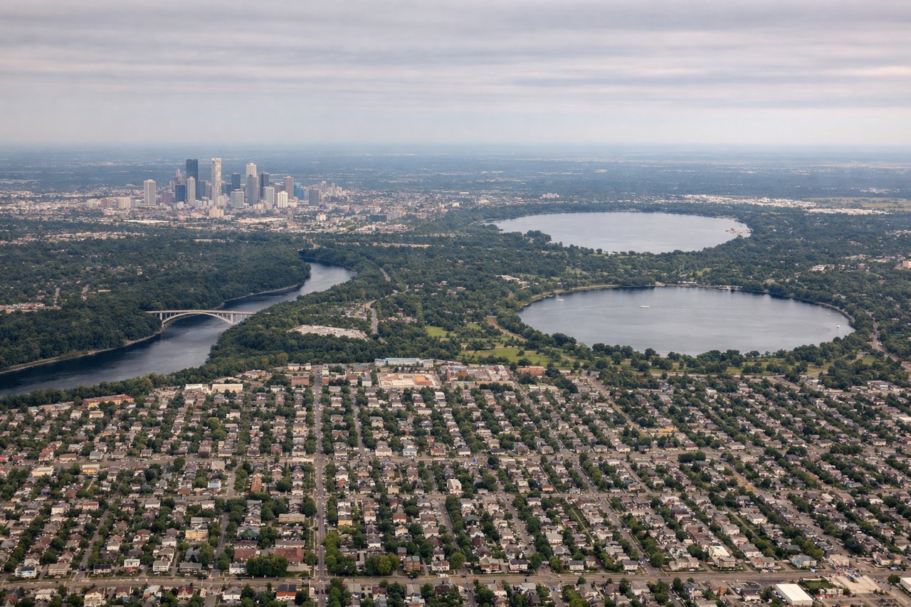
Takeoff from MSP
RIGHTAs the aircraft climbs out of MSP and banks onto its southwesterly routing, the Minneapolis skyline and the Mississippi-Minnesota River confluence near Fort Snelling fall on the right side of the cabin. The left side mostly shows suburban sprawl and flat farmland with less definition.
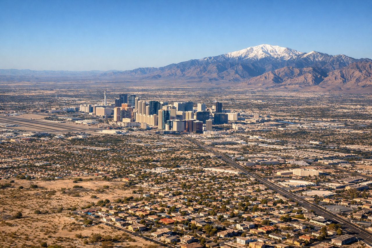
Landing at LAS
RIGHTOn the descent into LAS from the northeast, the turn toward the east-west runways brings Lake Mead's turquoise water and the Hoover Dam into view on the right side, followed by the rugged Spring Mountains rising sharply to the west. The left side mostly faces open desert basin with fewer distinct features until the final turn.
Will your flight be in sunlight?
Pick a date and time in the Sun Map to watch the sun move across your whole flight.
About This Route
Which side of the plane should I sit on flying from Minneapolis St Paul International (MSP) to Mc Carran International (LAS)?
Sit on the Right side of the plane for the best views on flights from Minneapolis to Las Vegas. The right side follows the flight path's northern edge, catching the Rocky Mountain foothills near Colorado, glimpses of Utah's red-rock canyon country, and the dramatic Lake Mead/Hoover Dam approach into Las Vegas — giving it more varied, higher-relief scenery than the left side's flatter southern exposure.
What can I see during takeoff from Minneapolis St Paul International in Minneapolis?
During takeoff from Minneapolis St Paul International (MSP), sit on the Right side for the best views. As the aircraft climbs out of MSP and banks onto its southwesterly routing, the Minneapolis skyline and the Mississippi-Minnesota River confluence near Fort Snelling fall on the right side of the cabin. The left side mostly shows suburban sprawl and flat farmland with less definition. Notable sights include: Minneapolis downtown skyline, Mississippi River, Minnesota River confluence, Twin Cities suburbs.
What can I see when landing at Mc Carran International in Las Vegas?
When landing at Mc Carran International (LAS), sit on the Right side for the best views. On the descent into LAS from the northeast, the turn toward the east-west runways brings Lake Mead's turquoise water and the Hoover Dam into view on the right side, followed by the rugged Spring Mountains rising sharply to the west. The left side mostly faces open desert basin with fewer distinct features until the final turn. Notable sights include: Lake Mead, Hoover Dam, Spring Mountains, River Mountains.
How long is the flight from Minneapolis to Las Vegas?
The flight from Minneapolis St Paul International (MSP) to Mc Carran International (LAS) takes about 2 hours 45 minutes. The shortest flight path between them is 1,297 miles (2,087 km); winds and air traffic control usually add a few percent.
What does the Minneapolis to Las Vegas flight path pass over?
Great Plains of Nebraska, Rocky Mountain foothills near the Colorado-Wyoming border, Colorado Plateau canyon country of eastern Utah, and the Mojave Desert basins of Nevada approaching Las Vegas