Mayaguana to Brisbane is 9,541 miles (15,354 km), a flight of about 14 hours.
Takeoff from Mayaguana on the right offers the most compelling early scenery with island and ocean contrast. While landing favors the left, the extended flight duration means the takeoff experience carries more weight in the overall recommendation.
Flight Path
This route crosses the Pacific Ocean for the majority of the flight. Notable waypoints include: the Caribbean and Atlantic waters east of the Bahamas; the equatorial Pacific with scattered island chains (depending on routing); potential views of Fiji or Samoa island groups if routed through South Pacific; the Coral Sea northeast of Australia; and the Great Barrier Reef region if the approach vector allows visibility before descent into Brisbane.
Great circle distance and headings ›Phase by phase
Takeoff from MYG
RIGHTMayaguana is a small island in the southeastern Bahamas. Banking right after departure gives views of the island's eastern and southern coastlines, plus the deeper blue waters of the Atlantic beyond the shallow Bahama Banks. Left would show only open ocean immediately.
Landing at BNE
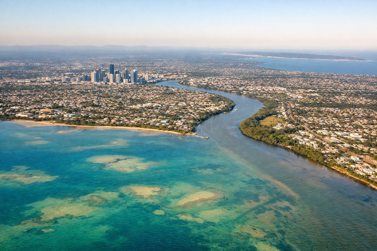
LEFTApproaching Brisbane from the east-southeast, left-side seats capture the Brisbane River's distinctive meanders through the city, Moreton Bay's islands and waterways, and the coastal approach over Redland Bay. Right would show inland western suburbs with less dramatic visual interest.
Will your flight be in sunlight?
Pick a date and time in the Sun Map to watch the sun move across your whole flight.
About This Route
Which side of the plane should I sit on flying from Mayaguana (MYG) to Brisbane International (BNE)?
Sit on the Right side of the plane for the best views on flights from Mayaguana to Brisbane. Takeoff from Mayaguana on the right offers the most compelling early scenery with island and ocean contrast. While landing favors the left, the extended flight duration means the takeoff experience carries more weight in the overall recommendation.
What can I see during takeoff from Mayaguana in Mayaguana?
During takeoff from Mayaguana (MYG), sit on the Right side for the best views. Mayaguana is a small island in the southeastern Bahamas. Banking right after departure gives views of the island's eastern and southern coastlines, plus the deeper blue waters of the Atlantic beyond the shallow Bahama Banks. Left would show only open ocean immediately. Notable sights include: Mayaguana Island (narrow, elongated landmass), shallow turquoise Bahama Banks to the west, Atlantic Ocean deep blue waters to the east, nearby Booby Pond and coastal mangrove areas.
What can I see when landing at Brisbane International in Brisbane?
When landing at Brisbane International (BNE), sit on the Left side for the best views. Approaching Brisbane from the east-southeast, left-side seats capture the Brisbane River's distinctive meanders through the city, Moreton Bay's islands and waterways, and the coastal approach over Redland Bay. Right would show inland western suburbs with less dramatic visual interest. Notable sights include: Brisbane River with its tight loops through the CBD, Moreton Bay with North Stradbroke Island and Moreton Island visible offshore, Redland Bay approach corridor, Brisbane city skyline and South Bank Parklands.
How long is the flight from Mayaguana to Brisbane?
The flight from Mayaguana (MYG) to Brisbane International (BNE) takes about 14 hours. The shortest flight path between them is 9,541 miles (15,354 km); winds and air traffic control usually add a few percent.
What does the Mayaguana to Brisbane flight path pass over?
This route crosses the Pacific Ocean for the majority of the flight. Notable waypoints include: the Caribbean and Atlantic waters east of the Bahamas; the equatorial Pacific with scattered island chains (depending on routing); potential views of Fiji or Samoa island groups if routed through South Pacific; the Coral Sea northeast of Australia; and the Great Barrier Reef region if the approach vector allows visibility before descent into Brisbane.