Right seats win overall because the landing approach into Naha offers more dramatic and visually distinctive scenery—the turquoise reef systems and island coastlines are striking. The takeoff from Oakland is comparable on both sides, but the landing experience is superior on the right.
Flown OAK to OKA? Did we get it right?
Flight Path
Oakland to Naha is 6,117 miles (9,844 km), a flight of about 11 hours 30 minutes.
The flight crosses the North Pacific, passing north of Hawaii (typically 200+ miles north of the islands, so not visible). You'll traverse open ocean for most of the journey. As you approach Japan, the Izu Islands may be visible on the approach to Okinawa, and the Ryukyu Island chain becomes visible in the final descent phase. The Pacific coastline of Japan's main islands (Honshu) is typically south of the standard approach path to Naha.
Great circle distance and headings ›

Phase by phase
Takeoff from OAK
LEFTLeft seats offer views of the San Francisco Bay and surrounding geography during the typical eastbound or northbound initial climb. You'll see the bay's distinctive shape, the Oakland Hills, and the broader Bay Area urban sprawl.
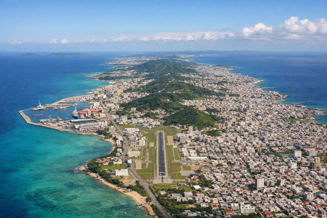
Landing at OKA
RIGHTRight seats provide excellent views during descent into Naha. You'll see the Okinawa coastline, the distinctive turquoise shallow waters around the island, and the East China Sea. The approach typically brings aircraft over water before landing, maximizing coastal scenery.
Will your flight be in sunlight?
Pick a date and time in the Sun Map to watch the sun move across your whole flight.
About This Route
Which side of the plane should I sit on flying from Metropolitan Oakland International (OAK) to Naha (OKA)?
Sit on the Right side of the plane for the best views on flights from Oakland to Naha. Right seats win overall because the landing approach into Naha offers more dramatic and visually distinctive scenery—the turquoise reef systems and island coastlines are striking. The takeoff from Oakland is comparable on both sides, but the landing experience is superior on the right.
What can I see during takeoff from Metropolitan Oakland International in Oakland?
During takeoff from Metropolitan Oakland International (OAK), sit on the Left side for the best views. Left seats offer views of the San Francisco Bay and surrounding geography during the typical eastbound or northbound initial climb. You'll see the bay's distinctive shape, the Oakland Hills, and the broader Bay Area urban sprawl. Notable sights include: San Francisco Bay, Oakland Hills, San Mateo Bridge or Bay Bridge (depending on runway), Mount Diablo (distant, southeast).
What can I see when landing at Naha in Naha?
When landing at Naha (OKA), sit on the Right side for the best views. Right seats provide excellent views during descent into Naha. You'll see the Okinawa coastline, the distinctive turquoise shallow waters around the island, and the East China Sea. The approach typically brings aircraft over water before landing, maximizing coastal scenery. Notable sights include: Okinawa coastline and reef systems, East China Sea, Kerama Islands (southwest of Naha), Nakijin or central Okinawa plateau.
How long is the flight from Oakland to Naha?
The flight from Metropolitan Oakland International (OAK) to Naha (OKA) takes about 11 hours 30 minutes. The shortest flight path between them is 6,117 miles (9,844 km); winds and air traffic control usually add a few percent.
What does the Oakland to Naha flight path pass over?
The flight crosses the North Pacific, passing north of Hawaii (typically 200+ miles north of the islands, so not visible). You'll traverse open ocean for most of the journey. As you approach Japan, the Izu Islands may be visible on the approach to Okinawa, and the Ryukyu Island chain becomes visible in the final descent phase. The Pacific coastline of Japan's main islands (Honshu) is typically south of the standard approach path to Naha.