The left side wins overall because the Maui departure views of Haleakala and the West Maui Mountains are genuinely spectacular and hard to beat. Mid-flight over the Pacific and Mojave is largely featureless on both sides, so the takeoff experience tips the balance. The landing views are good on the right but the Strip approach is relatively brief.
Flight Path
After leaving Maui, the flight crosses open Pacific Ocean for roughly 2 hours with no land visible. The California coastline appears near Point Conception or the Channel Islands area. The route then crosses the Mojave Desert, with the Sierra Nevada visible to the north on clear days, followed by the Mojave's dry lake beds including Rogers Dry Lake near Edwards AFB, before descending into the Las Vegas Valley.
Great circle distance and headings ›.jpg?width=600)


Phase by phase
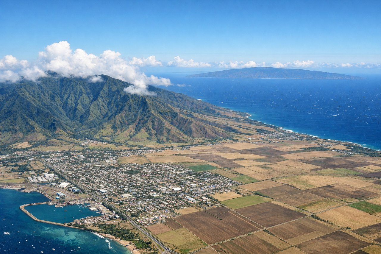
Takeoff from OGG
LEFTDeparting Kahului on runway 02 heading northeast, the left (west) side gives you a sweeping view of the West Maui Mountains and the isthmus connecting them to Haleakala. As you climb out and bank northward, you also get a clear look back at the central valley and the ocean channel toward Molokai.

Landing at LAS
RIGHTLas Vegas arrivals typically come in from the west or northwest on runway 26L/26R or 19, meaning the right (north) side gives you the Las Vegas Strip laid out clearly before touchdown. You can see the full length of the Strip, downtown Las Vegas, and the surrounding valley ringed by Spring Mountains to the west.
Landmarks on this routeAll landmarks →
Will your flight be in sunlight?
See exactly which side of the plane gets sun and shade at your departure time.
About This Route
Which side of the plane should I sit on flying from Kahului (OGG) to Mc Carran International (LAS)?
Sit on the Left side of the plane for the best views on flights from Kahului to Las Vegas. The left side wins overall because the Maui departure views of Haleakala and the West Maui Mountains are genuinely spectacular and hard to beat. Mid-flight over the Pacific and Mojave is largely featureless on both sides, so the takeoff experience tips the balance. The landing views are good on the right but the Strip approach is relatively brief.
What can I see during takeoff from Kahului in Kahului?
During takeoff from Kahului (OGG), sit on the Left side for the best views. Departing Kahului on runway 02 heading northeast, the left (west) side gives you a sweeping view of the West Maui Mountains and the isthmus connecting them to Haleakala. As you climb out and bank northward, you also get a clear look back at the central valley and the ocean channel toward Molokai. Notable sights include: Haleakala volcano (10,023 ft), West Maui Mountains, Maui isthmus/central valley, Molokai across the Pailolo Channel.
What can I see when landing at Mc Carran International in Las Vegas?
When landing at Mc Carran International (LAS), sit on the Right side for the best views. Las Vegas arrivals typically come in from the west or northwest on runway 26L/26R or 19, meaning the right (north) side gives you the Las Vegas Strip laid out clearly before touchdown. You can see the full length of the Strip, downtown Las Vegas, and the surrounding valley ringed by Spring Mountains to the west. Notable sights include: Las Vegas Strip, Spring Mountains/Charleston Peak to the west, Lake Mead to the east (visible on approach from distance), Frenchman Mountain.
How long is the flight from Kahului to Las Vegas?
The flight from Kahului (OGG) to Mc Carran International (LAS) takes Approximately 5 hours 15 minutes.
What does the Kahului to Las Vegas flight path pass over?
After leaving Maui, the flight crosses open Pacific Ocean for roughly 2 hours with no land visible. The California coastline appears near Point Conception or the Channel Islands area. The route then crosses the Mojave Desert, with the Sierra Nevada visible to the north on clear days, followed by the Mojave's dry lake beds including Rogers Dry Lake near Edwards AFB, before descending into the Las Vegas Valley.