The Andes approach into Pereira on the right side is the most dramatic and unique visual of the entire flight. The Chicago departure on the left is excellent but the Andean descent is rarer and more spectacular for most travelers.
Flight Path
The flight tracks south over the US Gulf Coast states, crosses the Gulf of Mexico, passes over the Yucatan Peninsula of Mexico, then crosses Central America over Guatemala and possibly Honduras or Nicaragua, before entering Colombian airspace over the Caribbean coast near Cartagena and tracking inland over the Colombian lowlands toward the Andes and Pereira.
Great circle distance and headings ›
.jpeg?width=600)


Phase by phase
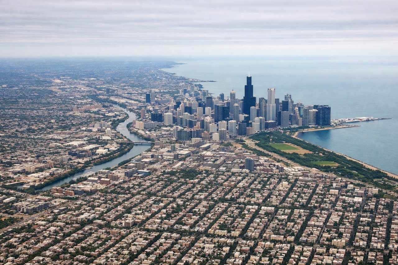
Takeoff from ORD
LEFTORD's most common departures head south or southeast. A left/east-facing seat gives you the Chicago skyline along Lake Michigan's shoreline, with the downtown loop clearly visible. The lakefront parks and Navy Pier are distinct from altitude.
Landing at PEI
RIGHTMatecana airport sits in the Cauca River valley with the Andes rising steeply on both sides. Arrivals typically come from the north or northeast, and a right/west-facing seat puts the Cordillera Occidental directly in view as you descend into the valley. The coffee-region hillsides and Pereira's urban sprawl on the valley slopes are clearly visible on approach.
Landmarks on this routeAll landmarks →
Will your flight be in sunlight?
See exactly which side of the plane gets sun and shade at your departure time.
About This Route
Which side of the plane should I sit on flying from Chicago Ohare International (ORD) to Matecana (PEI)?
Sit on the Right side of the plane for the best views on flights from Chicago to Pereira. The Andes approach into Pereira on the right side is the most dramatic and unique visual of the entire flight. The Chicago departure on the left is excellent but the Andean descent is rarer and more spectacular for most travelers.
What can I see during takeoff from Chicago Ohare International in Chicago?
During takeoff from Chicago Ohare International (ORD), sit on the Left side for the best views. ORD's most common departures head south or southeast. A left/east-facing seat gives you the Chicago skyline along Lake Michigan's shoreline, with the downtown loop clearly visible. The lakefront parks and Navy Pier are distinct from altitude. Notable sights include: Chicago Loop skyline, Lake Michigan shoreline, Navy Pier, Grant Park and Museum Campus.
What can I see when landing at Matecana in Pereira?
When landing at Matecana (PEI), sit on the Right side for the best views. Matecana airport sits in the Cauca River valley with the Andes rising steeply on both sides. Arrivals typically come from the north or northeast, and a right/west-facing seat puts the Cordillera Occidental directly in view as you descend into the valley. The coffee-region hillsides and Pereira's urban sprawl on the valley slopes are clearly visible on approach. Notable sights include: Cordillera Occidental ridgeline, Cauca River valley, Pereira urban area on hillside terrain, coffee plantation patchwork on Andean slopes.
How long is the flight from Chicago to Pereira?
The flight from Chicago Ohare International (ORD) to Matecana (PEI) takes Approximately 6.5 to 7.5 hours depending on routing and winds.
What does the Chicago to Pereira flight path pass over?
The flight tracks south over the US Gulf Coast states, crosses the Gulf of Mexico, passes over the Yucatan Peninsula of Mexico, then crosses Central America over Guatemala and possibly Honduras or Nicaragua, before entering Colombian airspace over the Caribbean coast near Cartagena and tracking inland over the Colombian lowlands toward the Andes and Pereira.