The right side dominates this route. Takeoff offers the dramatic Cordillera Central and Cauca valley, while the flight path northwestward across the Caribbean and Great Lakes means the right side captures more of the scenic approach to Chicago. Left has the landing advantage, but right wins overall for the superior climbing scenery.
Flight Path
Caribbean Sea (crossing from Colombia toward Central America and the Gulf of Mexico), Yucatan Peninsula (visible as a low, flat landmass with cenotes and limestone terrain), Gulf of Mexico coastline, Mississippi River delta region, Mississippi River valley extending north, Great Lakes region with Lake Michigan as the final major water feature before descent into Chicago
Great circle distance and headings ›


.jpeg?width=600)

Phase by phase
Takeoff from PEI
RIGHTRight-side seats capture the Cordillera Central and the Cauca River valley as the aircraft climbs northwestward from Pereira. The mountain range rises dramatically to the east, creating a striking backdrop during the initial climb-out phase.
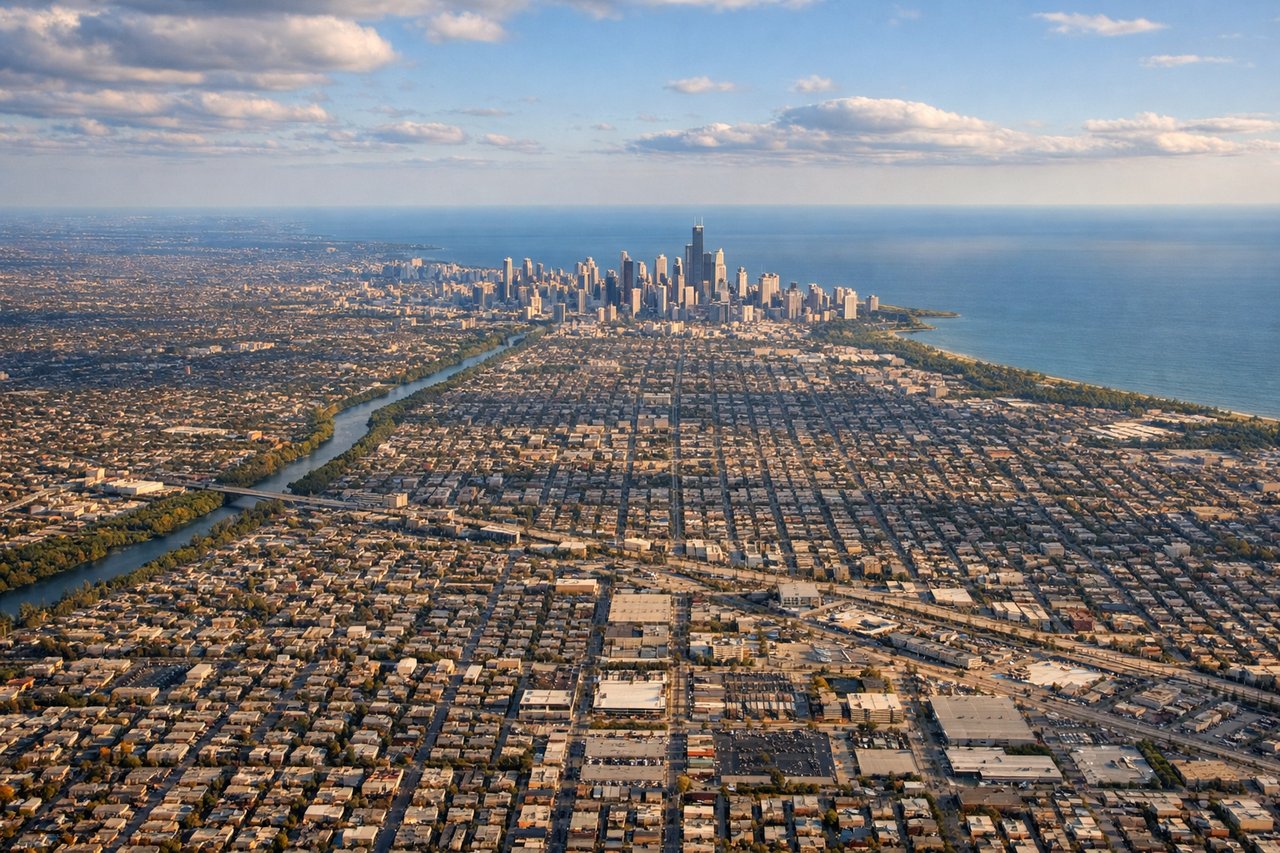
Landing at ORD
LEFTLeft-side seats offer the best view during the final approach into Chicago O'Hare. As the aircraft descends from the northeast, the left side reveals Lake Michigan's shoreline, downtown Chicago's skyline, and the grid of the city's neighborhoods spreading inland.
Landmarks on this routeAll landmarks →
Will your flight be in sunlight?
See exactly which side of the plane gets sun and shade at your departure time.
About This Route
Which side of the plane should I sit on flying from Matecana (PEI) to Chicago Ohare International (ORD)?
Sit on the Right side of the plane for the best views on flights from Pereira to Chicago. The right side dominates this route. Takeoff offers the dramatic Cordillera Central and Cauca valley, while the flight path northwestward across the Caribbean and Great Lakes means the right side captures more of the scenic approach to Chicago. Left has the landing advantage, but right wins overall for the superior climbing scenery.
What can I see during takeoff from Matecana in Pereira?
During takeoff from Matecana (PEI), sit on the Right side for the best views. Right-side seats capture the Cordillera Central and the Cauca River valley as the aircraft climbs northwestward from Pereira. The mountain range rises dramatically to the east, creating a striking backdrop during the initial climb-out phase. Notable sights include: Cordillera Central (Colombian Andes), Cauca River valley, Pereira city grid, coffee plantation terraces on surrounding slopes.
What can I see when landing at Chicago Ohare International in Chicago?
When landing at Chicago Ohare International (ORD), sit on the Left side for the best views. Left-side seats offer the best view during the final approach into Chicago O'Hare. As the aircraft descends from the northeast, the left side reveals Lake Michigan's shoreline, downtown Chicago's skyline, and the grid of the city's neighborhoods spreading inland. Notable sights include: Lake Michigan shoreline, downtown Chicago skyline, Chicago grid street pattern, suburban sprawl extending west and south.
How long is the flight from Pereira to Chicago?
The flight from Matecana (PEI) to Chicago Ohare International (ORD) takes 4h 15m.
What does the Pereira to Chicago flight path pass over?
Caribbean Sea (crossing from Colombia toward Central America and the Gulf of Mexico), Yucatan Peninsula (visible as a low, flat landmass with cenotes and limestone terrain), Gulf of Mexico coastline, Mississippi River delta region, Mississippi River valley extending north, Great Lakes region with Lake Michigan as the final major water feature before descent into Chicago