Chicago to Santa Fe is 1,070 miles (1,723 km), a flight of about 2 hours 40 minutes.
Left side wins both ends of the flight. During the cruise over the Great Plains and into New Mexico, the left side also faces south, giving better views of the transition from Illinois farmland to the Kansas and Oklahoma plains, and eventually the high desert terrain of northeastern New Mexico including the Sangre de Cristo foothills as you descend.
Flight Path
The flight crosses the flat agricultural grid of central Illinois, then the rolling plains of Missouri and Kansas. Around the midpoint over Kansas or the Oklahoma panhandle, the terrain transitions from green farmland to drier shortgrass prairie. Crossing into New Mexico, the Raton Pass area and the high plateau of northeastern New Mexico become visible, with the terrain rising noticeably toward the southern Rockies as you begin descent into Santa Fe.
Great circle distance and headings ›

.jpg?width=600)
Phase by phase
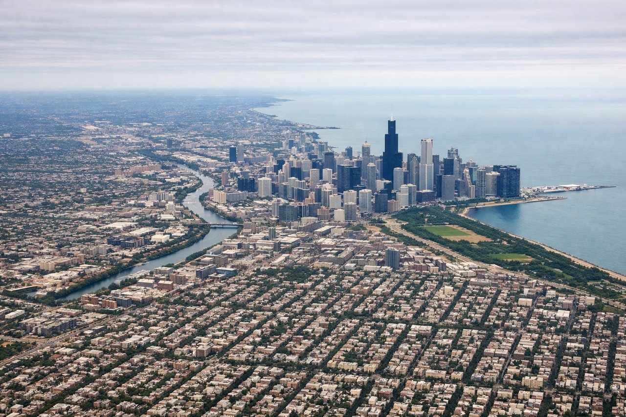
Takeoff from ORD
LEFTORD's most common departures head southwest or west on runways 10L/10C/10R or 28L/28R. A westbound departure puts the Chicago skyline and Lake Michigan to the left (south-southeast). You'll see the downtown loop, Grant Park, and the lakefront clearly before the aircraft turns southwest toward the route.
Landing at SAF
LEFTSanta Fe Municipal typically uses runway 20 for southerly approaches or runway 02 for northerly arrivals. On the common runway 20 approach heading south, the left side faces east toward the Sangre de Cristo Mountains, which rise dramatically above the high desert plateau and are the dominant visual feature on approach. The city of Santa Fe sits at the foot of these mountains and is clearly visible.
Landmarks on this routeAll landmarks →
Will your flight be in sunlight?
Pick a date and time in the Sun Map to watch the sun move across your whole flight.
About This Route
Which side of the plane should I sit on flying from Chicago Ohare International (ORD) to Santa Fe Muni (SAF)?
Sit on the Left side of the plane for the best views on flights from Chicago to Santa Fe. Left side wins both ends of the flight. During the cruise over the Great Plains and into New Mexico, the left side also faces south, giving better views of the transition from Illinois farmland to the Kansas and Oklahoma plains, and eventually the high desert terrain of northeastern New Mexico including the Sangre de Cristo foothills as you descend.
What can I see during takeoff from Chicago Ohare International in Chicago?
During takeoff from Chicago Ohare International (ORD), sit on the Left side for the best views. ORD's most common departures head southwest or west on runways 10L/10C/10R or 28L/28R. A westbound departure puts the Chicago skyline and Lake Michigan to the left (south-southeast). You'll see the downtown loop, Grant Park, and the lakefront clearly before the aircraft turns southwest toward the route. Notable sights include: Chicago downtown Loop skyline, Lake Michigan shoreline, Grant Park/Museum Campus, Midway Airport to the south.
What can I see when landing at Santa Fe Muni in Santa Fe?
When landing at Santa Fe Muni (SAF), sit on the Left side for the best views. Santa Fe Municipal typically uses runway 20 for southerly approaches or runway 02 for northerly arrivals. On the common runway 20 approach heading south, the left side faces east toward the Sangre de Cristo Mountains, which rise dramatically above the high desert plateau and are the dominant visual feature on approach. The city of Santa Fe sits at the foot of these mountains and is clearly visible. Notable sights include: Sangre de Cristo Mountains, Santa Fe city grid at mountain base, Rio Grande valley to the west, Jemez Mountains on the western horizon.
How long is the flight from Chicago to Santa Fe?
The flight from Chicago Ohare International (ORD) to Santa Fe Muni (SAF) takes about 2 hours 40 minutes. The shortest flight path between them is 1,070 miles (1,723 km); winds and air traffic control usually add a few percent.
What does the Chicago to Santa Fe flight path pass over?
The flight crosses the flat agricultural grid of central Illinois, then the rolling plains of Missouri and Kansas. Around the midpoint over Kansas or the Oklahoma panhandle, the terrain transitions from green farmland to drier shortgrass prairie. Crossing into New Mexico, the Raton Pass area and the high plateau of northeastern New Mexico become visible, with the terrain rising noticeably toward the southern Rockies as you begin descent into Santa Fe.