Chicago to San Jose is 1,825 miles (2,937 km), a flight of about 4 hours 15 minutes.
While the left side offers good Lake Michigan views on departure, the right side during descent provides more dramatic and varied scenery: the Santa Cruz Mountains, San Francisco Bay, and the Silicon Valley landscape create a more visually compelling final hour of flight.
Flight Path
The flight path crosses the Sierra Nevada mountains (visible around 2 hours into flight, appearing as a north-south ridge with snow-capped peaks in winter/spring), the Central Valley of California (flat agricultural landscape with irrigation patterns), and the transition zone where the valley meets the coastal ranges east of the Bay Area.
Great circle distance and headings ›

.jpg?width=600)


Phase by phase
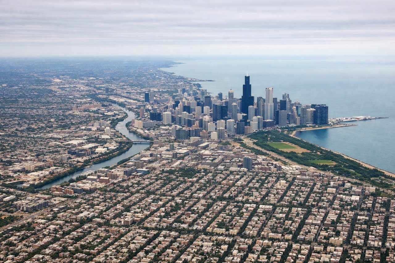
Takeoff from ORD
LEFTLeft side offers views of Lake Michigan and the Chicago shoreline as the aircraft climbs westbound. You'll see the downtown skyline receding and the lake's eastern edge clearly defined.

Landing at SJC
RIGHTRight side provides excellent views during the eastbound descent into SJC. You'll see the San Francisco Bay, the Santa Cruz Mountains, and the Silicon Valley urban grid spreading across the landscape.
Landmarks on this routeAll landmarks →
Will your flight be in sunlight?
Pick a date and time in the Sun Map to watch the sun move across your whole flight.
About This Route
Which side of the plane should I sit on flying from Chicago Ohare International (ORD) to Norman Y Mineta San Jose International (SJC)?
Sit on the Right side of the plane for the best views on flights from Chicago to San Jose. While the left side offers good Lake Michigan views on departure, the right side during descent provides more dramatic and varied scenery: the Santa Cruz Mountains, San Francisco Bay, and the Silicon Valley landscape create a more visually compelling final hour of flight.
What can I see during takeoff from Chicago Ohare International in Chicago?
During takeoff from Chicago Ohare International (ORD), sit on the Left side for the best views. Left side offers views of Lake Michigan and the Chicago shoreline as the aircraft climbs westbound. You'll see the downtown skyline receding and the lake's eastern edge clearly defined. Notable sights include: Lake Michigan, Chicago downtown skyline, Chicago River, Grant Park waterfront.
What can I see when landing at Norman Y Mineta San Jose International in San Jose?
When landing at Norman Y Mineta San Jose International (SJC), sit on the Right side for the best views. Right side provides excellent views during the eastbound descent into SJC. You'll see the San Francisco Bay, the Santa Cruz Mountains, and the Silicon Valley urban grid spreading across the landscape. Notable sights include: San Francisco Bay, Santa Cruz Mountains, Silicon Valley urban development, San Jose downtown area.
How long is the flight from Chicago to San Jose?
The flight from Chicago Ohare International (ORD) to Norman Y Mineta San Jose International (SJC) takes about 4 hours 15 minutes. The shortest flight path between them is 1,825 miles (2,937 km); winds and air traffic control usually add a few percent.
What does the Chicago to San Jose flight path pass over?
The flight path crosses the Sierra Nevada mountains (visible around 2 hours into flight, appearing as a north-south ridge with snow-capped peaks in winter/spring), the Central Valley of California (flat agricultural landscape with irrigation patterns), and the transition zone where the valley meets the coastal ranges east of the Bay Area.