Right-side seats dominate both segments of this flight. Takeoff offers Lake Michigan views, and landing provides the most dramatic scenery—the Caribbean islands and their volcanic topography are far more visually striking than anything visible from the left side during descent.
Flight Path
The flight path crosses the Appalachian Mountains (visible as a series of parallel ridges in Tennessee and North Carolina during cruise), then transitions over the Atlantic Ocean. The Bahamas archipelago becomes visible during the southern descent phase, with the shallow turquoise banks and island chains providing distinctive visual markers before reaching the US Virgin Islands.
Great circle distance and headings ›Phase by phase
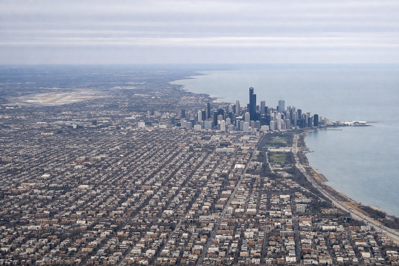
Takeoff from ORD
RIGHTRight-side seats offer views of Lake Michigan's shoreline as the aircraft climbs northeastward over the lake. You'll see the Chicago waterfront and the transition from urban landscape to open water, which provides clear visual contrast during the initial climb.
Landing at STT
RIGHTRight-side seats provide excellent views of the Caribbean islands during descent. You'll see St. Croix to the west and the Sir Francis Drake Channel, with St. Thomas and its distinctive topography becoming increasingly clear as you descend toward Cyril E King Airport.
Landmarks on this routeAll landmarks →
Will your flight be in sunlight?
See exactly which side of the plane gets sun and shade at your departure time.
About This Route
Which side of the plane should I sit on flying from Chicago Ohare International (ORD) to Cyril E King (STT)?
Sit on the Right side of the plane for the best views on flights from Chicago to St. Thomas. Right-side seats dominate both segments of this flight. Takeoff offers Lake Michigan views, and landing provides the most dramatic scenery—the Caribbean islands and their volcanic topography are far more visually striking than anything visible from the left side during descent.
What can I see during takeoff from Chicago Ohare International in Chicago?
During takeoff from Chicago Ohare International (ORD), sit on the Right side for the best views. Right-side seats offer views of Lake Michigan's shoreline as the aircraft climbs northeastward over the lake. You'll see the Chicago waterfront and the transition from urban landscape to open water, which provides clear visual contrast during the initial climb. Notable sights include: Lake Michigan shoreline, Chicago downtown skyline, Indiana coastline to the south.
What can I see when landing at Cyril E King in St. Thomas?
When landing at Cyril E King (STT), sit on the Right side for the best views. Right-side seats provide excellent views of the Caribbean islands during descent. You'll see St. Croix to the west and the Sir Francis Drake Channel, with St. Thomas and its distinctive topography becoming increasingly clear as you descend toward Cyril E King Airport. Notable sights include: St. Croix island to the west, Sir Francis Drake Channel, St. Thomas mountainous terrain, Water Island and Hassel Island in the harbor.
How long is the flight from Chicago to St. Thomas?
The flight from Chicago Ohare International (ORD) to Cyril E King (STT) takes 4h 15m.
What does the Chicago to St. Thomas flight path pass over?
The flight path crosses the Appalachian Mountains (visible as a series of parallel ridges in Tennessee and North Carolina during cruise), then transitions over the Atlantic Ocean. The Bahamas archipelago becomes visible during the southern descent phase, with the shallow turquoise banks and island chains providing distinctive visual markers before reaching the US Virgin Islands.