Left side wins at both ends of the flight — Caribbean island views on departure and the Chicago lakefront on arrival. The left side also tracks closer to the Gulf Coast and Mississippi River valley during the cruise portion of the flight.
Flight Path
The flight tracks northwest over Puerto Rico, then across the Bahamas and Florida Straits, over central Florida and the Gulf Coast near Tampa, then north over Georgia and Tennessee, crossing the Ohio River valley, before entering the flat agricultural plains of Indiana and Illinois approaching Chicago. The Mississippi River is crossed in the southern Illinois region and is visible as a wide, meandering brown ribbon from altitude.
Great circle distance and headings ›Phase by phase
Takeoff from STT
LEFTSTT's primary runway 10/28 means departures heading west put the left side facing south toward St. John, the British Virgin Islands, and the turquoise waters of the Caribbean. You get a sweeping look back at St. Thomas harbor and Charlotte Amalie as the plane climbs out.
Landing at ORD
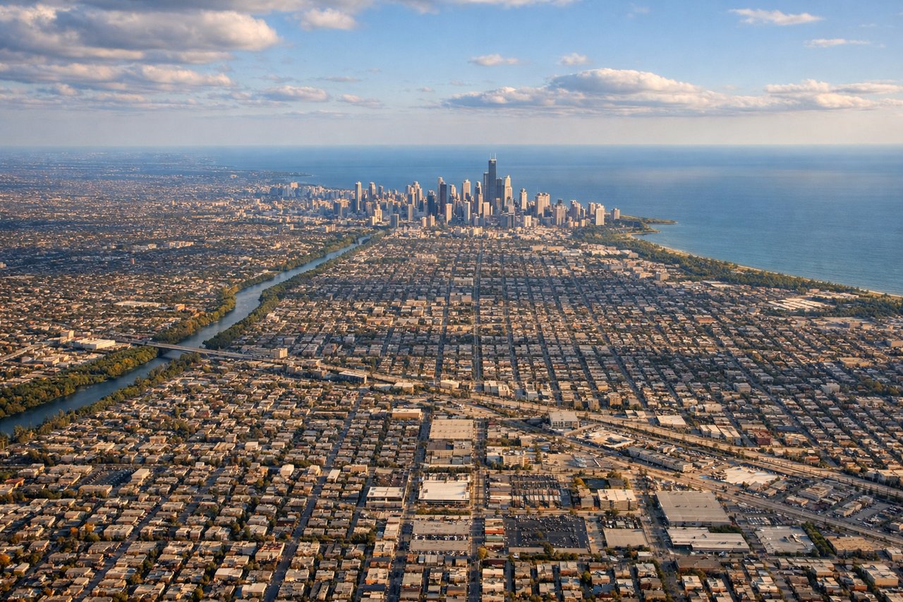
LEFTO'Hare arrivals from the southeast on runway 10L/10R put the left side facing north toward the Chicago skyline and Lake Michigan shoreline. You get a clear view of the downtown Loop, the lakefront, and the grid of the city spreading inland.
Landmarks on this routeAll landmarks →
Will your flight be in sunlight?
See exactly which side of the plane gets sun and shade at your departure time.
About This Route
Which side of the plane should I sit on flying from Cyril E King (STT) to Chicago Ohare International (ORD)?
Sit on the Left side of the plane for the best views on flights from St. Thomas to Chicago. Left side wins at both ends of the flight — Caribbean island views on departure and the Chicago lakefront on arrival. The left side also tracks closer to the Gulf Coast and Mississippi River valley during the cruise portion of the flight.
What can I see during takeoff from Cyril E King in St. Thomas?
During takeoff from Cyril E King (STT), sit on the Left side for the best views. STT's primary runway 10/28 means departures heading west put the left side facing south toward St. John, the British Virgin Islands, and the turquoise waters of the Caribbean. You get a sweeping look back at St. Thomas harbor and Charlotte Amalie as the plane climbs out. Notable sights include: Charlotte Amalie harbor, St. John island, Tortola and the BVI chain, Pillsbury Sound.
What can I see when landing at Chicago Ohare International in Chicago?
When landing at Chicago Ohare International (ORD), sit on the Left side for the best views. O'Hare arrivals from the southeast on runway 10L/10R put the left side facing north toward the Chicago skyline and Lake Michigan shoreline. You get a clear view of the downtown Loop, the lakefront, and the grid of the city spreading inland. Notable sights include: Chicago Loop skyline, Lake Michigan shoreline, Wrigley Field area (North Side), O'Hare approach over suburban grid.
How long is the flight from St. Thomas to Chicago?
The flight from Cyril E King (STT) to Chicago Ohare International (ORD) takes Approximately 4 hours 15 minutes to 4 hours 45 minutes.
What does the St. Thomas to Chicago flight path pass over?
The flight tracks northwest over Puerto Rico, then across the Bahamas and Florida Straits, over central Florida and the Gulf Coast near Tampa, then north over Georgia and Tennessee, crossing the Ohio River valley, before entering the flat agricultural plains of Indiana and Illinois approaching Chicago. The Mississippi River is crossed in the southern Illinois region and is visible as a wide, meandering brown ribbon from altitude.