The right side wins across all three phases: fjord and city views on takeoff from Oslo, a likely glimpse of the Tibetan Plateau's southern edge and Himalayan foothills during the mid-flight track over Central Asia, and a river/city approach into Bangkok.
Flown OSL to BKK? Did we get it right?
Flight Path
Oslo to Bangkok is 5,388 miles (8,671 km), a flight of about 9 hours 50 minutes.
The great-circle route crosses western Russia and Kazakhstan's steppe, skirts the Tian Shan and northern edge of the Tibetan Plateau, then passes over the mountainous borderlands of Yunnan/Myanmar before descending into the Chao Phraya river basin.
Great circle distance and headings ›


Phase by phase

Takeoff from OSL
RIGHTDeparting Oslo Gardermoen typically heads south before turning toward Russia, giving right-side passengers a good look at the Oslofjord, the city of Oslo, and the forested ridgelines flanking the fjord as the aircraft climbs.
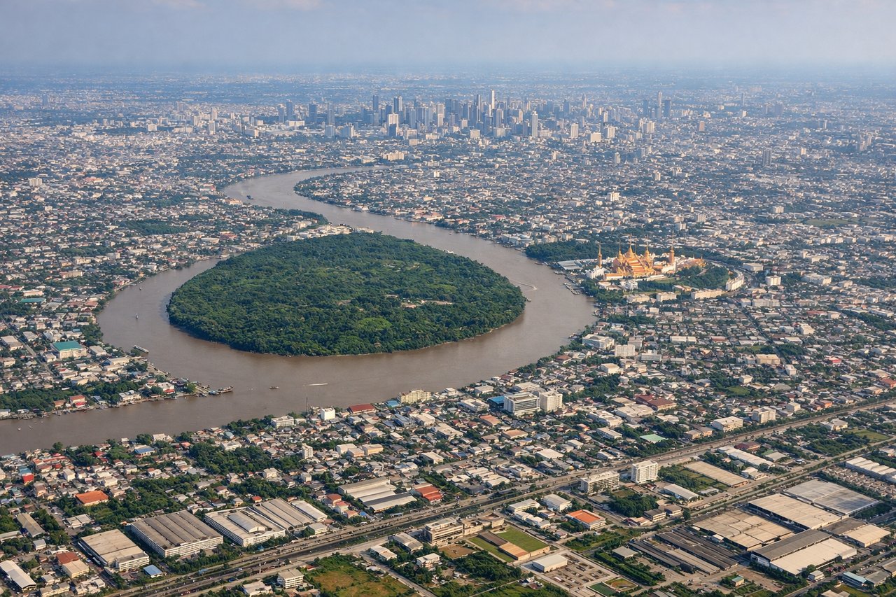
Landing at BKK
RIGHTArrivals into Suvarnabhumi from the north typically track south over Bangkok's sprawling urban grid and the Chao Phraya River before turning onto final approach, giving right-side passengers the best skyline and river views.
Will your flight be in sunlight?
Pick a date and time in the Sun Map to watch the sun move across your whole flight.
About This Route
Which side of the plane should I sit on flying from Oslo Gardermoen (OSL) to Suvarnabhumi Airport (BKK)?
Sit on the Right side of the plane for the best views on flights from Oslo to Bangkok. The right side wins across all three phases: fjord and city views on takeoff from Oslo, a likely glimpse of the Tibetan Plateau's southern edge and Himalayan foothills during the mid-flight track over Central Asia, and a river/city approach into Bangkok.
What can I see during takeoff from Oslo Gardermoen in Oslo?
During takeoff from Oslo Gardermoen (OSL), sit on the Right side for the best views. Departing Oslo Gardermoen typically heads south before turning toward Russia, giving right-side passengers a good look at the Oslofjord, the city of Oslo, and the forested ridgelines flanking the fjord as the aircraft climbs. Notable sights include: Oslofjord, Oslo city center, Nordmarka forested hills, Bunnefjorden inlet.
What can I see when landing at Suvarnabhumi Airport in Bangkok?
When landing at Suvarnabhumi Airport (BKK), sit on the Right side for the best views. Arrivals into Suvarnabhumi from the north typically track south over Bangkok's sprawling urban grid and the Chao Phraya River before turning onto final approach, giving right-side passengers the best skyline and river views. Notable sights include: Chao Phraya River, Bangkok skyline and skyscrapers, Gulf of Thailand coastline, canals (khlongs) of the Bangkok basin.
How long is the flight from Oslo to Bangkok?
The flight from Oslo Gardermoen (OSL) to Suvarnabhumi Airport (BKK) takes about 9 hours 50 minutes. The shortest flight path between them is 5,388 miles (8,671 km); winds and air traffic control usually add a few percent.
What does the Oslo to Bangkok flight path pass over?
The great-circle route crosses western Russia and Kazakhstan's steppe, skirts the Tian Shan and northern edge of the Tibetan Plateau, then passes over the mountainous borderlands of Yunnan/Myanmar before descending into the Chao Phraya river basin.