Takeoff offers superior scenery with Mount Hood and the Cascade Range as dominant features. Landing views are less dramatic, making the outbound climb the stronger scenic experience for this short 60-mile flight.
Flown PDX to EUG? Did we get it right?
Flight Path
Portland to Eugene is 106 miles (170 km), a flight of about 25 minutes.
Willamette Valley floor (agricultural and forested lowland), Cascade Range foothills, scattered lakes and reservoirs in the mid-valley region, transition from Portland metro area to rural southern Willamette Valley
Great circle distance and headings ›Phase by phase
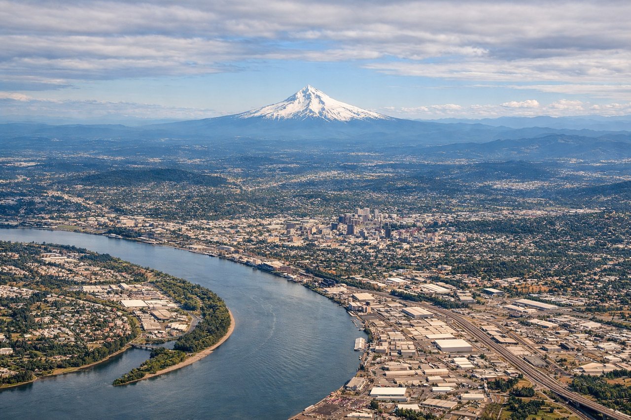
Takeoff from PDX
LEFTLeft side captures the Cascade Range immediately south and east of Portland, with Mount Hood dominating the skyline. Right side shows only the flat Willamette Valley floor and suburban sprawl.
Landing at EUG
RIGHTRight side offers views of the Cascade foothills and Spencer Butte (2,054 ft) rising directly above Eugene during descent. Left side shows only flat valley floor and distant ridges.
Will your flight be in sunlight?
Pick a date and time in the Sun Map to watch the sun move across your whole flight.
About This Route
Which side of the plane should I sit on flying from Portland International (PDX) to Eugene Airport (EUG)?
Sit on the Left side of the plane for the best views on flights from Portland to Eugene. Takeoff offers superior scenery with Mount Hood and the Cascade Range as dominant features. Landing views are less dramatic, making the outbound climb the stronger scenic experience for this short 60-mile flight.
What can I see during takeoff from Portland International in Portland?
During takeoff from Portland International (PDX), sit on the Left side for the best views. Left side captures the Cascade Range immediately south and east of Portland, with Mount Hood dominating the skyline. Right side shows only the flat Willamette Valley floor and suburban sprawl. Notable sights include: Mount Hood (11,240 ft, ~50 miles southeast), Cascade Range foothills, Willamette River valley floor, Portland urban grid.
What can I see when landing at Eugene Airport in Eugene?
When landing at Eugene Airport (EUG), sit on the Right side for the best views. Right side offers views of the Cascade foothills and Spencer Butte (2,054 ft) rising directly above Eugene during descent. Left side shows only flat valley floor and distant ridges. Notable sights include: Spencer Butte (prominent local landmark above Eugene), Cascade Range foothills, Willamette River, Eugene urban area.
How long is the flight from Portland to Eugene?
The flight from Portland International (PDX) to Eugene Airport (EUG) takes about 25 minutes. The shortest flight path between them is 106 miles (170 km); winds and air traffic control usually add a few percent.
What does the Portland to Eugene flight path pass over?
Willamette Valley floor (agricultural and forested lowland), Cascade Range foothills, scattered lakes and reservoirs in the mid-valley region, transition from Portland metro area to rural southern Willamette Valley