The left side wins on the strength of the Mount Hood departure view and glimpses of the Great Salt Lake basin and southern Rocky Mountain foothills during cruise, giving it more topographic variety than the right side, which is dominated by flat desert and plains until the Houston skyline appears just before landing.
Flown PDX to IAH? Did we get it right?
Flight Path
Portland to Houston is 1,823 miles (2,934 km), a flight of about 3 hours 55 minutes.
The route tracks southeast from the Cascades across the Snake River Plain into Utah, passing near the Great Salt Lake and Wasatch Range, then continues over the southern Rocky Mountains near the Colorado-New Mexico border before crossing the flat Texas Panhandle and Hill Country on the way into Houston.
Great circle distance and headings ›

Phase by phase
Takeoff from PDX
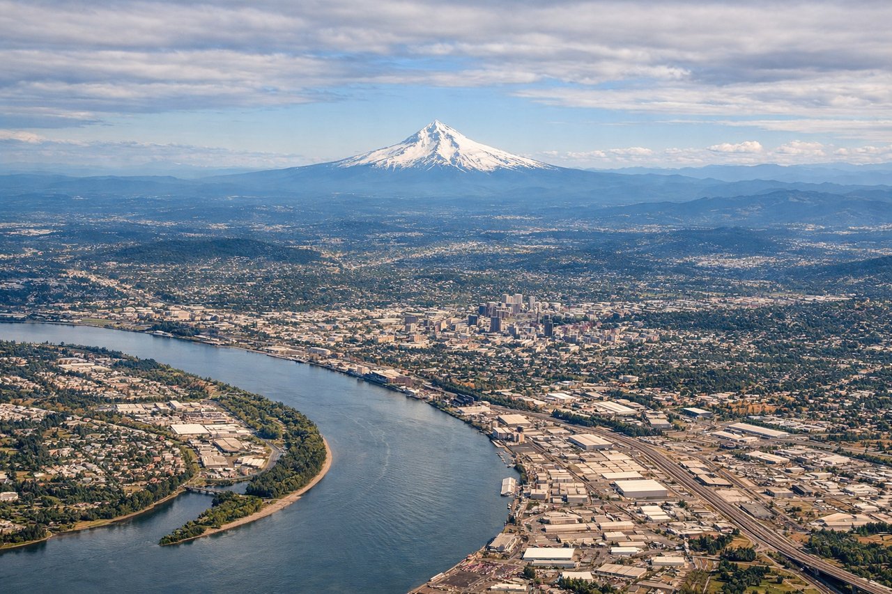
LEFTDeparting PDX to the west then arcing left onto a southeast heading, the turn puts Mount Hood's glacier-capped summit right into view on the left side, with the Willamette Valley farmland unrolling below. The right side mostly shows the flat grid of Portland's northern suburbs and the Columbia River without a dramatic backdrop.
Landing at IAH
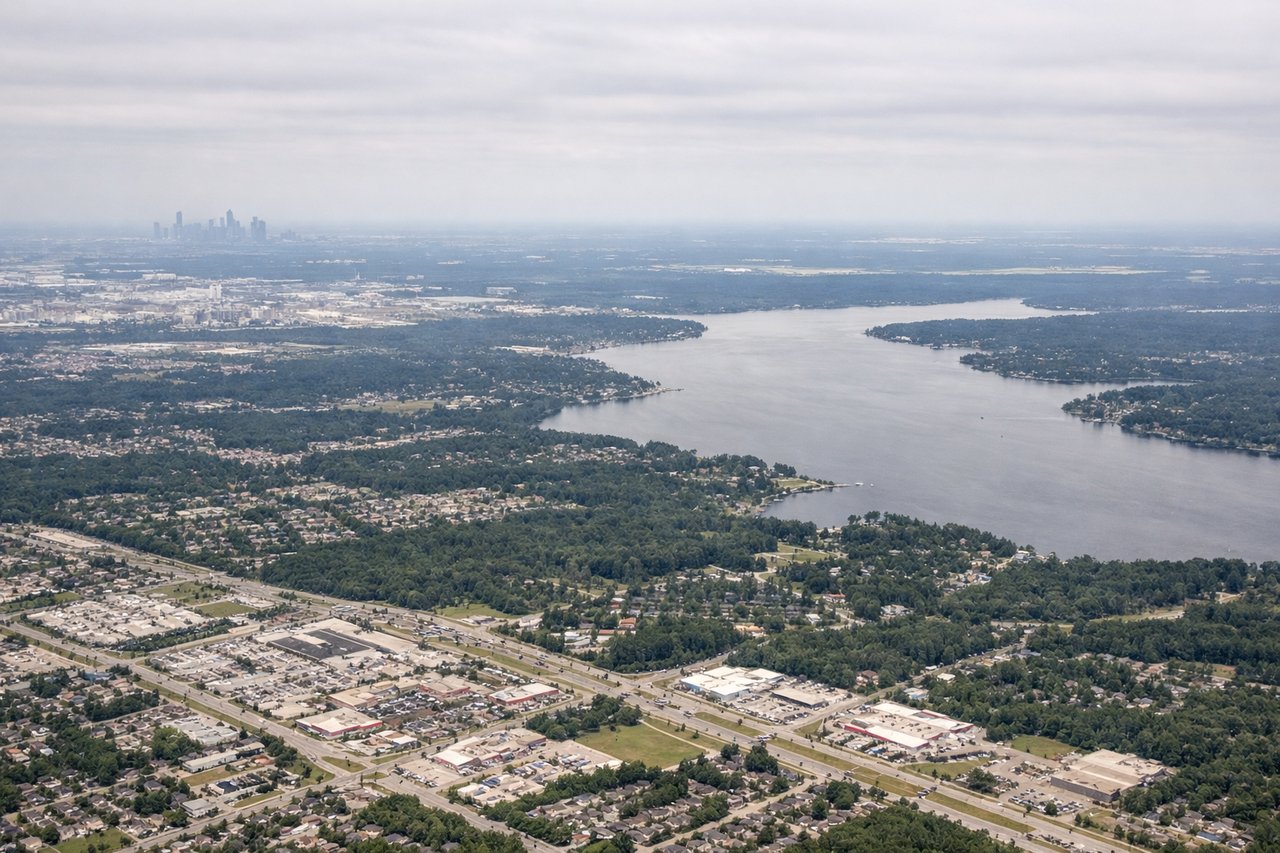
RIGHTOn final approach into IAH from the northwest, the turn toward the southbound runways brings downtown Houston's skyline into view on the right side, rising above the flat pine-forested plain. The left side during this turn faces mostly open suburban sprawl and highway interchanges with no comparable landmark.
Will your flight be in sunlight?
Pick a date and time in the Sun Map to watch the sun move across your whole flight.
About This Route
Which side of the plane should I sit on flying from Portland International (PDX) to George Bush Intcntl Houston (IAH)?
Sit on the Left side of the plane for the best views on flights from Portland to Houston. The left side wins on the strength of the Mount Hood departure view and glimpses of the Great Salt Lake basin and southern Rocky Mountain foothills during cruise, giving it more topographic variety than the right side, which is dominated by flat desert and plains until the Houston skyline appears just before landing.
What can I see during takeoff from Portland International in Portland?
During takeoff from Portland International (PDX), sit on the Left side for the best views. Departing PDX to the west then arcing left onto a southeast heading, the turn puts Mount Hood's glacier-capped summit right into view on the left side, with the Willamette Valley farmland unrolling below. The right side mostly shows the flat grid of Portland's northern suburbs and the Columbia River without a dramatic backdrop. Notable sights include: Mount Hood, Willamette Valley farmland, Cascade foothills, Columbia River.
What can I see when landing at George Bush Intcntl Houston in Houston?
When landing at George Bush Intcntl Houston (IAH), sit on the Right side for the best views. On final approach into IAH from the northwest, the turn toward the southbound runways brings downtown Houston's skyline into view on the right side, rising above the flat pine-forested plain. The left side during this turn faces mostly open suburban sprawl and highway interchanges with no comparable landmark. Notable sights include: Downtown Houston skyline, Sam Houston Tollway loop, piney woods of the northern suburbs, Buffalo Bayou.
How long is the flight from Portland to Houston?
The flight from Portland International (PDX) to George Bush Intcntl Houston (IAH) takes about 3 hours 55 minutes. The shortest flight path between them is 1,823 miles (2,934 km); winds and air traffic control usually add a few percent.
What does the Portland to Houston flight path pass over?
The route tracks southeast from the Cascades across the Snake River Plain into Utah, passing near the Great Salt Lake and Wasatch Range, then continues over the southern Rocky Mountains near the Colorado-New Mexico border before crossing the flat Texas Panhandle and Hill Country on the way into Houston.