The takeoff view of Mount Hood and the Cascade Range is more visually striking and geographically distinctive than the landing approach. The volcanic peaks and snow coverage provide dramatic scenery that outweighs the more subtle prairie and river features visible during descent into Wichita.
Flown PDX to ICT? Did we get it right?
Flight Path
Portland to Wichita is 1,403 miles (2,259 km), a flight of about 3 hours 15 minutes.
Blue Mountains of northeastern Oregon, Snake River Plain in Idaho, Owyhee Mountains, transition from volcanic terrain to high desert plateau, then descent into the Great Plains with the North Platte River valley visible in western Nebraska before reaching Kansas grasslands
Great circle distance and headings ›Phase by phase
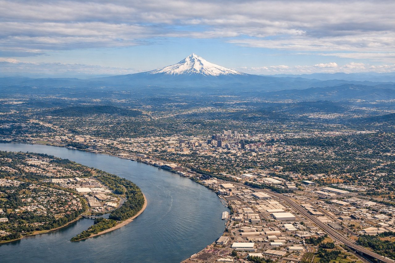
Takeoff from PDX
LEFTLeft side offers views of the Cascade Range immediately east of Portland, including Mount Hood's snow-capped peak. Right side faces westward toward the Pacific coastal range, which is lower and less visually distinctive from altitude.
Landing at ICT
RIGHTRight side provides views of the Arkansas River valley and the approach into Wichita from the west. Left side faces toward open prairie with fewer distinctive landmarks during descent.
Will your flight be in sunlight?
Pick a date and time in the Sun Map to watch the sun move across your whole flight.
About This Route
Which side of the plane should I sit on flying from Portland International (PDX) to Wichita Mid Continent (ICT)?
Sit on the Left side of the plane for the best views on flights from Portland to Wichita. The takeoff view of Mount Hood and the Cascade Range is more visually striking and geographically distinctive than the landing approach. The volcanic peaks and snow coverage provide dramatic scenery that outweighs the more subtle prairie and river features visible during descent into Wichita.
What can I see during takeoff from Portland International in Portland?
During takeoff from Portland International (PDX), sit on the Left side for the best views. Left side offers views of the Cascade Range immediately east of Portland, including Mount Hood's snow-capped peak. Right side faces westward toward the Pacific coastal range, which is lower and less visually distinctive from altitude. Notable sights include: Mount Hood (11,240 ft), Cascade Range, Willamette Valley floor, Columbia River gorge to the north.
What can I see when landing at Wichita Mid Continent in Wichita?
When landing at Wichita Mid Continent (ICT), sit on the Right side for the best views. Right side provides views of the Arkansas River valley and the approach into Wichita from the west. Left side faces toward open prairie with fewer distinctive landmarks during descent. Notable sights include: Arkansas River, Wichita city grid, Flint Hills grassland to the north, Cimarron River valley to the south.
How long is the flight from Portland to Wichita?
The flight from Portland International (PDX) to Wichita Mid Continent (ICT) takes about 3 hours 15 minutes. The shortest flight path between them is 1,403 miles (2,259 km); winds and air traffic control usually add a few percent.
What does the Portland to Wichita flight path pass over?
Blue Mountains of northeastern Oregon, Snake River Plain in Idaho, Owyhee Mountains, transition from volcanic terrain to high desert plateau, then descent into the Great Plains with the North Platte River valley visible in western Nebraska before reaching Kansas grasslands