Right-side seats offer the most consistent scenic value across the flight. Takeoff provides dramatic mountain views of the Taihang range, and the westbound flight path carries right-side passengers along the northern edge of the Gobi Desert and toward the Tianshan Mountains in the midpoint of the journey—a longer period of visually interesting terrain than the left side offers.
Flown PEK to ALA? Did we get it right?
Flight Path
Beijing to Almaty is 2,033 miles (3,272 km), a flight of about 5 hours 15 minutes.
The flight path crosses the Gobi Desert (sparse, tan-colored terrain with occasional dried riverbeds visible as faint linear features), passes near the Yanqing District and Zhangjiakou region with its rolling plateaus, and approaches the Tianshan Mountains as the aircraft moves westward into Xinjiang airspace. The Yinshan Mountains may be visible to the north depending on exact routing. The landscape transitions from green agricultural zones near Beijing to increasingly arid steppe and desert as the flight progresses west. The Juyongguan Pass area (a narrow mountain corridor) is crossed during the initial westbound leg. By midpoint, passengers see predominantly high-altitude desert plateau with minimal vegetation and scattered settlements.
Great circle distance and headings ›


Phase by phase
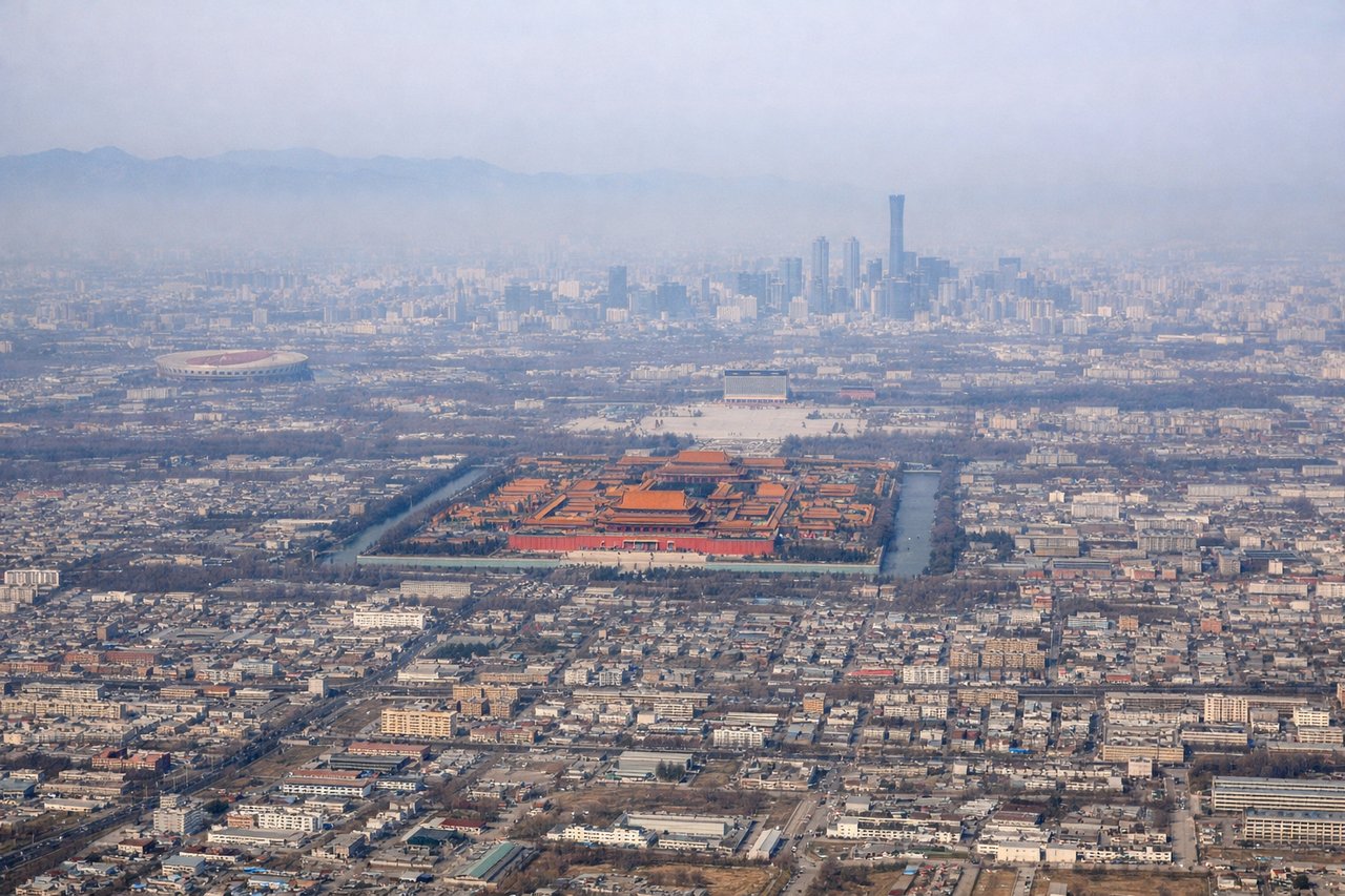
Takeoff from PEK
RIGHTRight-side seats offer views of the Ming Tombs and Yanqing District mountains as the aircraft climbs northwest from Beijing Capital. The terrain rises progressively toward the Taihang Mountains, which form a dramatic backdrop on the right side during initial climb.
Landing at ALA
LEFTLeft-side seats provide excellent views during descent into Almaty. The Trans-Ili Alatau mountains dominate the approach from the north, with snow-capped peaks visible on the left as the aircraft descends. The Ili River valley and the city grid become visible in the final approach phase.
Will your flight be in sunlight?
Pick a date and time in the Sun Map to watch the sun move across your whole flight.
About This Route
Which side of the plane should I sit on flying from Capital (PEK) to Almaty (ALA)?
Sit on the Right side of the plane for the best views on flights from Beijing to Almaty. Right-side seats offer the most consistent scenic value across the flight. Takeoff provides dramatic mountain views of the Taihang range, and the westbound flight path carries right-side passengers along the northern edge of the Gobi Desert and toward the Tianshan Mountains in the midpoint of the journey—a longer period of visually interesting terrain than the left side offers.
What can I see during takeoff from Capital in Beijing?
During takeoff from Capital (PEK), sit on the Right side for the best views. Right-side seats offer views of the Ming Tombs and Yanqing District mountains as the aircraft climbs northwest from Beijing Capital. The terrain rises progressively toward the Taihang Mountains, which form a dramatic backdrop on the right side during initial climb. Notable sights include: Ming Tombs (north of Beijing), Yanqing District urban sprawl, Taihang Mountains (western ridge), Guanting Reservoir (visible as a blue expanse to the northwest).
What can I see when landing at Almaty in Almaty?
When landing at Almaty (ALA), sit on the Left side for the best views. Left-side seats provide excellent views during descent into Almaty. The Trans-Ili Alatau mountains dominate the approach from the north, with snow-capped peaks visible on the left as the aircraft descends. The Ili River valley and the city grid become visible in the final approach phase. Notable sights include: Trans-Ili Alatau mountains (snow-capped peaks), Ili River valley (green ribbon running east-west), Almaty city grid (southern approach), Big Almaty Lake (turquoise alpine lake, visible on clear days).
How long is the flight from Beijing to Almaty?
The flight from Capital (PEK) to Almaty (ALA) takes about 5 hours 15 minutes. The shortest flight path between them is 2,033 miles (3,272 km); winds and air traffic control usually add a few percent.
What does the Beijing to Almaty flight path pass over?
The flight path crosses the Gobi Desert (sparse, tan-colored terrain with occasional dried riverbeds visible as faint linear features), passes near the Yanqing District and Zhangjiakou region with its rolling plateaus, and approaches the Tianshan Mountains as the aircraft moves westward into Xinjiang airspace. The Yinshan Mountains may be visible to the north depending on exact routing. The landscape transitions from green agricultural zones near Beijing to increasingly arid steppe and desert as the flight progresses west. The Juyongguan Pass area (a narrow mountain corridor) is crossed during the initial westbound leg. By midpoint, passengers see predominantly high-altitude desert plateau with minimal vegetation and scattered settlements.