Beijing to Kunming is 1,301 miles (2,094 km), a flight of about 3 hours 20 minutes.
The right side tracks the mountainous spine of the route—from Beijing's western hills through the Qinling and Hengduan ranges to the Yunnan plateau near Kunming—offering far more topographic drama than the flatter plains and basin scenery visible on the left.
Flight Path
The route crosses the southern Loess Plateau and the northern edge of the Sichuan Basin before climbing into the folded ridges of the Hengduan Mountains that mark the eastern edge of the Tibetan Plateau's foothills, transitioning into the karst-dotted Yunnan-Guizhou Plateau near the descent into Kunming.
Great circle distance and headings ›


Phase by phase
Takeoff from PEK
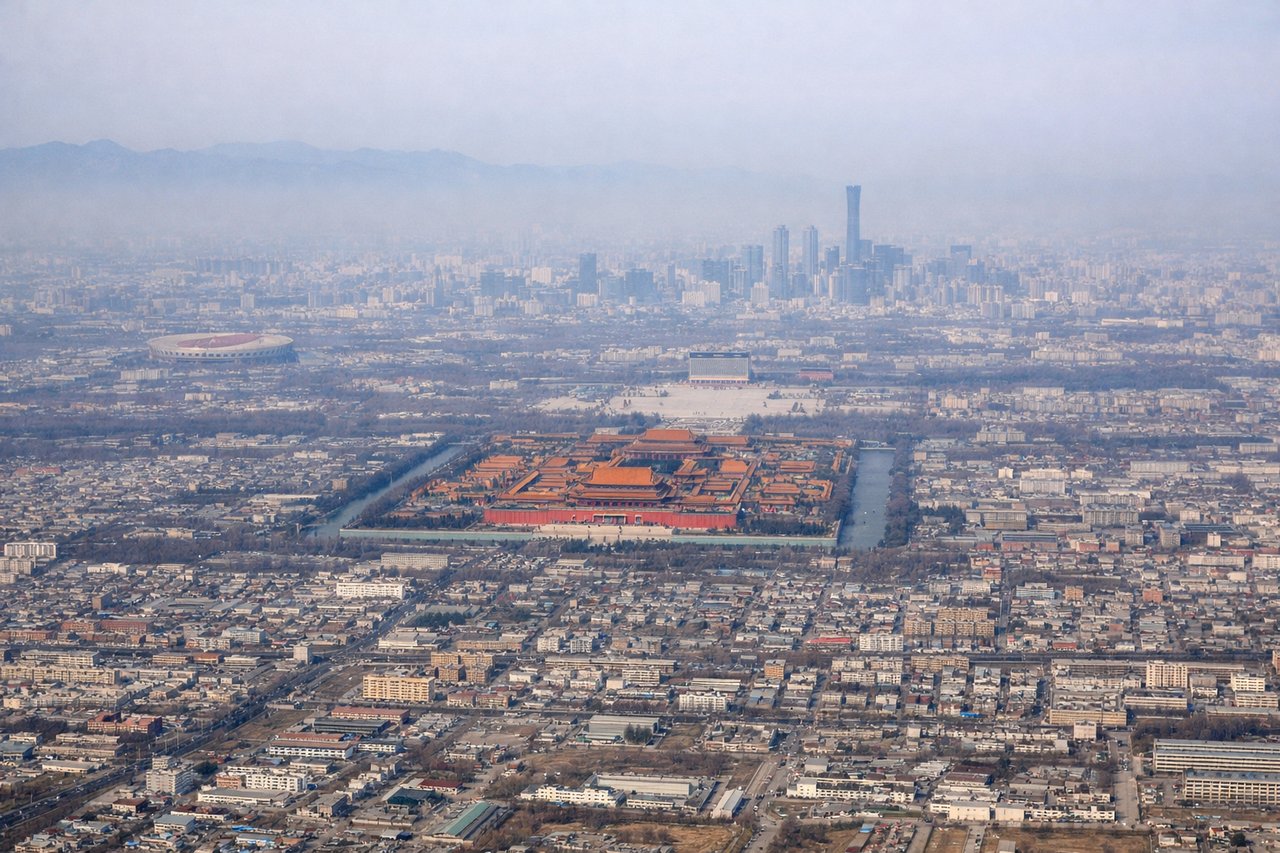
RIGHTAs the aircraft climbs out of PEK and banks southwest, the Western Hills and the edge of the Taihang mountain range become visible off the right side, giving an early hint of the terrain to come, while the left side shows the flat North China Plain.
Landing at KMG
RIGHTOn approach into KMG from the northeast, the aircraft descends over the rugged Yunnan plateau, and passengers on the right side get views of folded ridgelines and, closer to landing, glimpses of Dianchi Lake southwest of the city before the final turn.
Landmarks on this routeAll landmarks →
Will your flight be in sunlight?
Pick a date and time in the Sun Map to watch the sun move across your whole flight.
About This Route
Which side of the plane should I sit on flying from Capital (PEK) to Kunming Changshui International Airport (KMG)?
Sit on the Right side of the plane for the best views on flights from Beijing to Kunming. The right side tracks the mountainous spine of the route—from Beijing's western hills through the Qinling and Hengduan ranges to the Yunnan plateau near Kunming—offering far more topographic drama than the flatter plains and basin scenery visible on the left.
What can I see during takeoff from Capital in Beijing?
During takeoff from Capital (PEK), sit on the Right side for the best views. As the aircraft climbs out of PEK and banks southwest, the Western Hills and the edge of the Taihang mountain range become visible off the right side, giving an early hint of the terrain to come, while the left side shows the flat North China Plain. Notable sights include: Western Hills (Xishan), Taihang Mountains foothills, Beijing's northern suburbs.
What can I see when landing at Kunming Changshui International Airport in Kunming?
When landing at Kunming Changshui International Airport (KMG), sit on the Right side for the best views. On approach into KMG from the northeast, the aircraft descends over the rugged Yunnan plateau, and passengers on the right side get views of folded ridgelines and, closer to landing, glimpses of Dianchi Lake southwest of the city before the final turn. Notable sights include: Yunnan plateau ridgelines, Dianchi Lake, Kunming city outskirts.
How long is the flight from Beijing to Kunming?
The flight from Capital (PEK) to Kunming Changshui International Airport (KMG) takes about 3 hours 20 minutes. The shortest flight path between them is 1,301 miles (2,094 km); winds and air traffic control usually add a few percent.
What does the Beijing to Kunming flight path pass over?
The route crosses the southern Loess Plateau and the northern edge of the Sichuan Basin before climbing into the folded ridges of the Hengduan Mountains that mark the eastern edge of the Tibetan Plateau's foothills, transitioning into the karst-dotted Yunnan-Guizhou Plateau near the descent into Kunming.