The right side wins two of three phases: a good look at Philadelphia's skyline on departure and, more importantly, the longest and most scenic stretch of cruise, passing north over the Great Lakes region and the Rocky Mountain Front near Glacier National Park in Montana. The left side is mostly flat Midwestern plains until Mount Hood appears at the very end.
Flown PHL to PDX? Did we get it right?
Flight Path
Philadelphia to Portland is 2,400 miles (3,863 km), a flight of about 5 hours 50 minutes.
The Great Lakes region near Lake Erie, the lake-studded farmland of Minnesota, the plains of North Dakota, and the Rocky Mountain Front near Glacier National Park in Montana before the descent into the Columbia River Gorge
Great circle distance and headings ›


Phase by phase
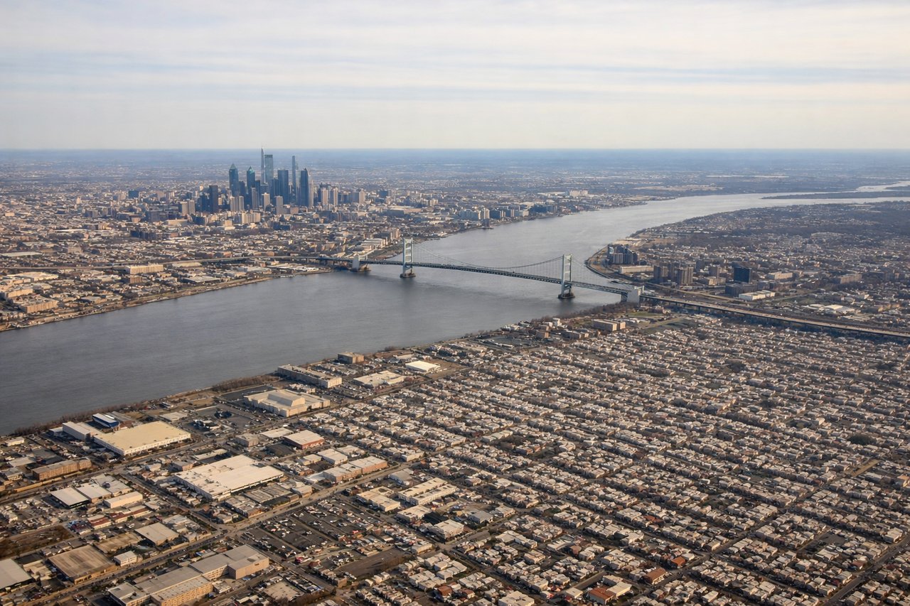
Takeoff from PHL
RIGHTDeparting PHL on runway 27, the jet climbs west over the Delaware River and then banks right onto its northwesterly routing toward the Great Lakes, swinging Center City Philadelphia's skyline and the Delaware/Schuylkill rivers into view on the right side. The left side only shows flat South Jersey suburbs and farmland.
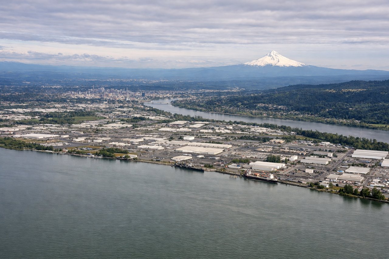
Landing at PDX
LEFTArriving into PDX from the east, the descent path follows the Columbia River Gorge, putting the snow-capped cone of Mount Hood directly and prominently off the left side, much closer than the Washington volcanoes visible to the north. It's the single most dramatic landmark of the whole flight.
Will your flight be in sunlight?
Pick a date and time in the Sun Map to watch the sun move across your whole flight.
About This Route
Which side of the plane should I sit on flying from Philadelphia International (PHL) to Portland International (PDX)?
Sit on the Right side of the plane for the best views on flights from Philadelphia to Portland. The right side wins two of three phases: a good look at Philadelphia's skyline on departure and, more importantly, the longest and most scenic stretch of cruise, passing north over the Great Lakes region and the Rocky Mountain Front near Glacier National Park in Montana. The left side is mostly flat Midwestern plains until Mount Hood appears at the very end.
What can I see during takeoff from Philadelphia International in Philadelphia?
During takeoff from Philadelphia International (PHL), sit on the Right side for the best views. Departing PHL on runway 27, the jet climbs west over the Delaware River and then banks right onto its northwesterly routing toward the Great Lakes, swinging Center City Philadelphia's skyline and the Delaware/Schuylkill rivers into view on the right side. The left side only shows flat South Jersey suburbs and farmland. Notable sights include: Center City Philadelphia skyline, Delaware River, Schuylkill River, Benjamin Franklin Bridge.
What can I see when landing at Portland International in Portland?
When landing at Portland International (PDX), sit on the Left side for the best views. Arriving into PDX from the east, the descent path follows the Columbia River Gorge, putting the snow-capped cone of Mount Hood directly and prominently off the left side, much closer than the Washington volcanoes visible to the north. It's the single most dramatic landmark of the whole flight. Notable sights include: Mount Hood, Columbia River Gorge, Sandy River valley, Willamette River near Portland.
How long is the flight from Philadelphia to Portland?
The flight from Philadelphia International (PHL) to Portland International (PDX) takes about 5 hours 50 minutes. The shortest flight path between them is 2,400 miles (3,863 km); winds and air traffic control usually add a few percent.
What does the Philadelphia to Portland flight path pass over?
The Great Lakes region near Lake Erie, the lake-studded farmland of Minnesota, the plains of North Dakota, and the Rocky Mountain Front near Glacier National Park in Montana before the descent into the Columbia River Gorge