While takeoff favors the right with Phoenix's urban desert scenery, the left side offers more sustained visual interest during cruise and landing, including glimpses of Nevada and Idaho's basin-and-range terrain and the textured Palouse hills near Spokane, giving it the edge over the flight as a whole.
Flown PHX to GEG? Did we get it right?
Flight Path
Phoenix to Spokane is 1,021 miles (1,644 km), a flight of about 2 hours 5 minutes.
Basin-and-range desert terrain of central Nevada, the Snake River Plain in southern Idaho, and the high desert plateau leading into eastern Washington
Great circle distance and headings ›


Phase by phase
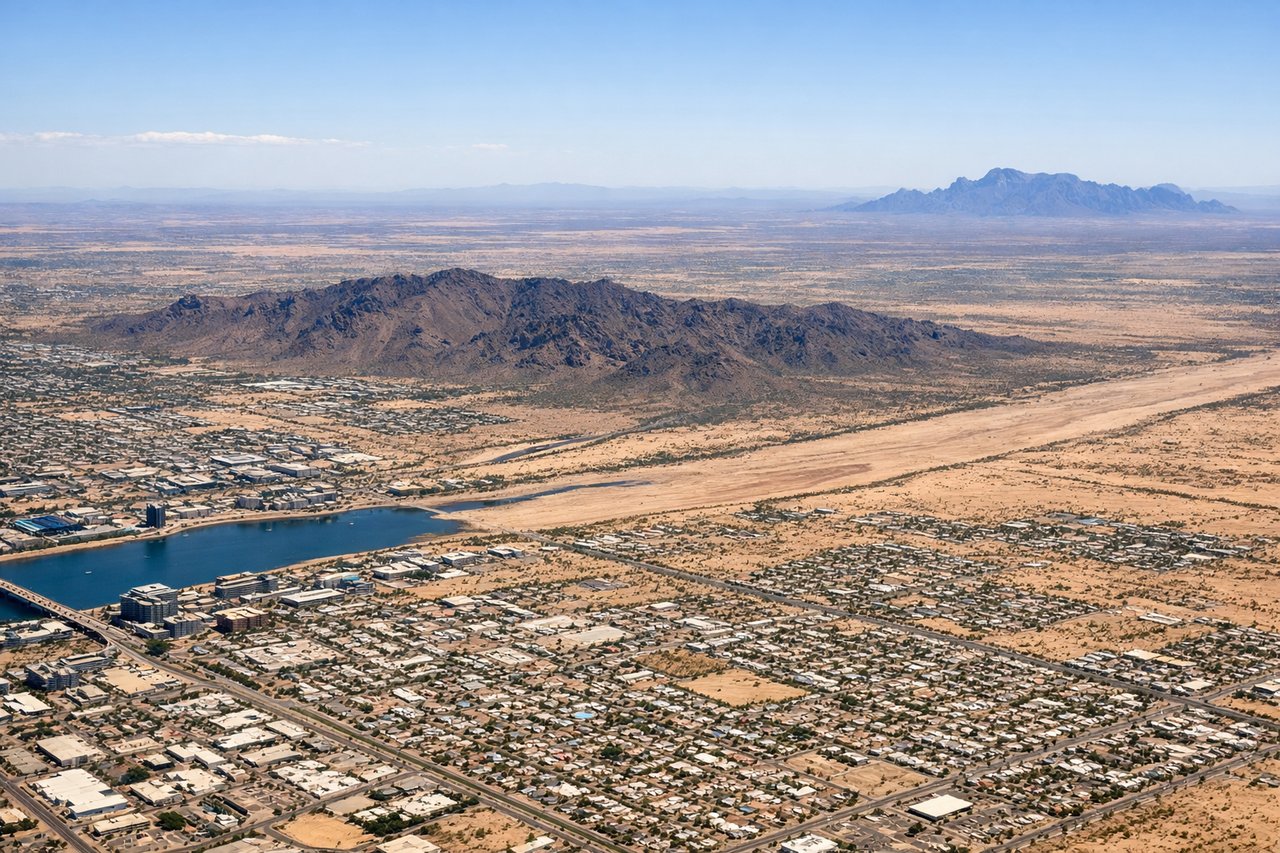
Takeoff from PHX
RIGHTDeparting PHX in typical west-flow conditions, the initial climb and right turn toward the north put Phoenix's skyline, Papago Park's red buttes, and South Mountain on the right side of the aircraft before the turn north. It's a brief but distinctive urban-desert view compared to the flatter valley floor on the left.
Landing at GEG
LEFTOn approach into GEG from the south with a northeast-facing final on Runway 21, the left side reveals the rolling wheat-covered Palouse hills and the forested foothills leading toward the Selkirk and Cascade ranges to the west, giving a more textured, hilly landscape than the flatter plains typically seen on the right.
Will your flight be in sunlight?
Pick a date and time in the Sun Map to watch the sun move across your whole flight.
About This Route
Which side of the plane should I sit on flying from Phoenix Sky Harbor International (PHX) to Spokane International (GEG)?
Sit on the Left side of the plane for the best views on flights from Phoenix to Spokane. While takeoff favors the right with Phoenix's urban desert scenery, the left side offers more sustained visual interest during cruise and landing, including glimpses of Nevada and Idaho's basin-and-range terrain and the textured Palouse hills near Spokane, giving it the edge over the flight as a whole.
What can I see during takeoff from Phoenix Sky Harbor International in Phoenix?
During takeoff from Phoenix Sky Harbor International (PHX), sit on the Right side for the best views. Departing PHX in typical west-flow conditions, the initial climb and right turn toward the north put Phoenix's skyline, Papago Park's red buttes, and South Mountain on the right side of the aircraft before the turn north. It's a brief but distinctive urban-desert view compared to the flatter valley floor on the left. Notable sights include: Downtown Phoenix skyline, Papago Park buttes, South Mountain Park, Salt River bed.
What can I see when landing at Spokane International in Spokane?
When landing at Spokane International (GEG), sit on the Left side for the best views. On approach into GEG from the south with a northeast-facing final on Runway 21, the left side reveals the rolling wheat-covered Palouse hills and the forested foothills leading toward the Selkirk and Cascade ranges to the west, giving a more textured, hilly landscape than the flatter plains typically seen on the right. Notable sights include: Palouse rolling wheat hills, Spokane River valley, forested foothills toward the Selkirks, Spokane's downtown skyline.
How long is the flight from Phoenix to Spokane?
The flight from Phoenix Sky Harbor International (PHX) to Spokane International (GEG) takes about 2 hours 5 minutes. The shortest flight path between them is 1,021 miles (1,644 km); winds and air traffic control usually add a few percent.
What does the Phoenix to Spokane flight path pass over?
Basin-and-range desert terrain of central Nevada, the Snake River Plain in southern Idaho, and the high desert plateau leading into eastern Washington