The right side wins on both ends of the flight — desert peaks and mountain terrain during the Phoenix departure, and a rare glimpse of Mount Fuji plus the Tokyo Bay skyline on arrival. The left side spends most of takeoff over flat suburban desert and the entire cruise over open Pacific water with no landmarks.
Flown PHX to HND? Did we get it right?
Flight Path
Phoenix to Tokyo is 5,789 miles (9,317 km), a flight of about 11 hours 40 minutes.
North Pacific Ocean, Aleutian Island chain (visible only in clear conditions far below), Kamchatka Peninsula approach corridor
Great circle distance and headings ›


Phase by phase
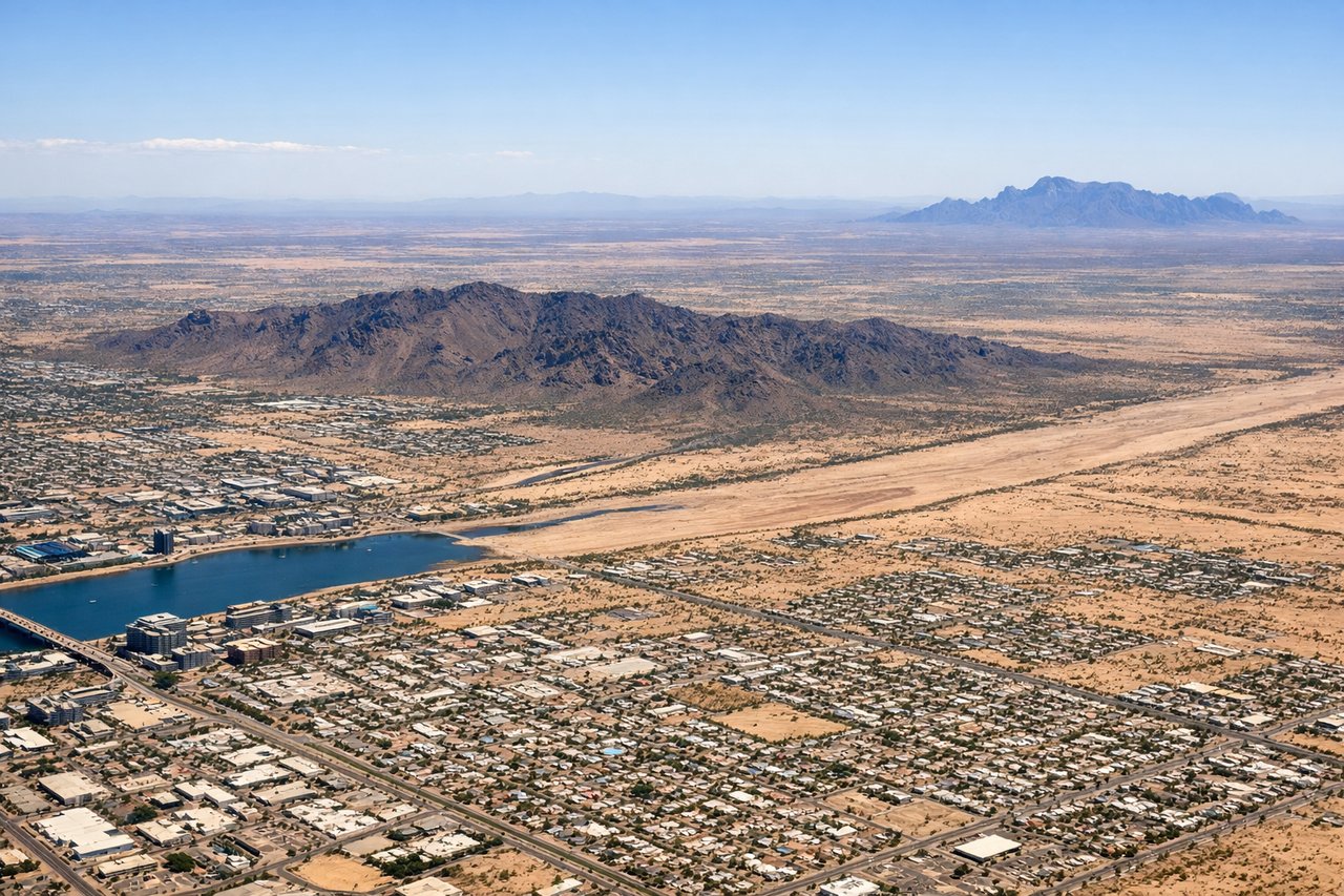
Takeoff from PHX
RIGHTDeparting PHX and turning onto the northwesterly track toward Japan, the right side offers views of Phoenix's iconic desert peaks (Camelback Mountain, Piestewa Peak) and the McDowell Mountains before the climb continues toward the Mogollon Rim and San Francisco Peaks near Flagstaff. The left side mainly shows flat South Phoenix suburbs and desert with less relief.
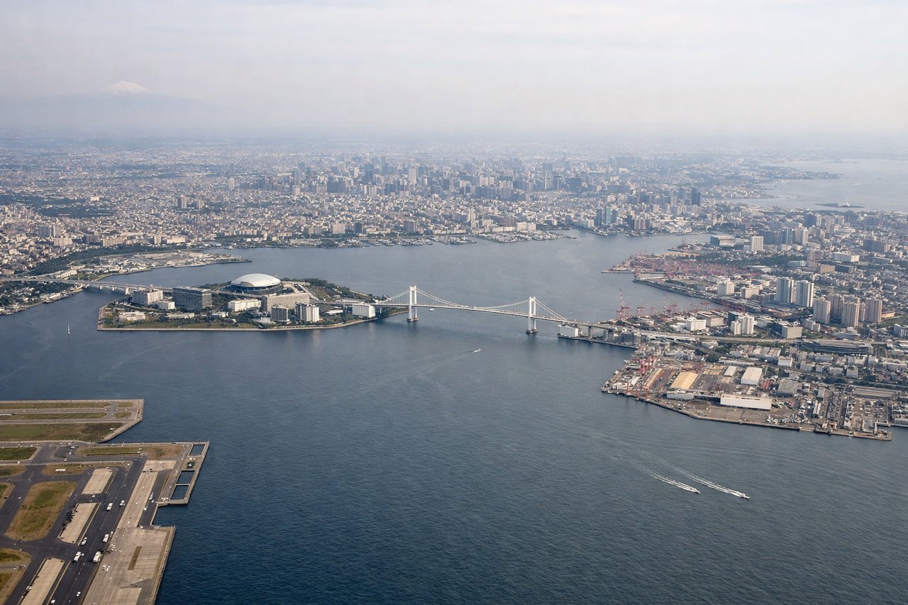
Landing at HND
RIGHTOn the descent into Haneda, arrivals crossing from the Pacific often pass south of Tokyo before turning north over the bay, giving right-side passengers a chance to see Mount Fuji's snow-capped cone in the distance along with the Izu Peninsula coastline. The final approach also reveals the skyscrapers of central Tokyo and the industrial waterfront of Tokyo Bay.
Will your flight be in sunlight?
Pick a date and time in the Sun Map to watch the sun move across your whole flight.
About This Route
Which side of the plane should I sit on flying from Phoenix Sky Harbor International (PHX) to Tokyo International (HND)?
Sit on the Right side of the plane for the best views on flights from Phoenix to Tokyo. The right side wins on both ends of the flight — desert peaks and mountain terrain during the Phoenix departure, and a rare glimpse of Mount Fuji plus the Tokyo Bay skyline on arrival. The left side spends most of takeoff over flat suburban desert and the entire cruise over open Pacific water with no landmarks.
What can I see during takeoff from Phoenix Sky Harbor International in Phoenix?
During takeoff from Phoenix Sky Harbor International (PHX), sit on the Right side for the best views. Departing PHX and turning onto the northwesterly track toward Japan, the right side offers views of Phoenix's iconic desert peaks (Camelback Mountain, Piestewa Peak) and the McDowell Mountains before the climb continues toward the Mogollon Rim and San Francisco Peaks near Flagstaff. The left side mainly shows flat South Phoenix suburbs and desert with less relief. Notable sights include: Camelback Mountain, Piestewa Peak, McDowell Mountains, San Francisco Peaks (distant).
What can I see when landing at Tokyo International in Tokyo?
When landing at Tokyo International (HND), sit on the Right side for the best views. On the descent into Haneda, arrivals crossing from the Pacific often pass south of Tokyo before turning north over the bay, giving right-side passengers a chance to see Mount Fuji's snow-capped cone in the distance along with the Izu Peninsula coastline. The final approach also reveals the skyscrapers of central Tokyo and the industrial waterfront of Tokyo Bay. Notable sights include: Mount Fuji, Izu Peninsula coastline, Tokyo Bay, Tokyo skyline (Odaiba, Rainbow Bridge).
How long is the flight from Phoenix to Tokyo?
The flight from Phoenix Sky Harbor International (PHX) to Tokyo International (HND) takes about 11 hours 40 minutes. The shortest flight path between them is 5,789 miles (9,317 km); winds and air traffic control usually add a few percent.
What does the Phoenix to Tokyo flight path pass over?
North Pacific Ocean, Aleutian Island chain (visible only in clear conditions far below), Kamchatka Peninsula approach corridor