Right side captures the dramatic Superstition Mountains and Salt River basin on departure, and during the cruise phase over eastern Arizona and western New Mexico, the right side looks south toward the White Mountains and the broad high desert basins. The left side wins at landing, but the takeoff and cruise views on the right are more sustained and visually varied across the full flight.
Flown PHX to SAF? Did we get it right?
Flight Path
Phoenix to Santa Fe is 369 miles (594 km), a flight of about 1 hour 5 minutes.
The flight crosses the Tonto Basin and the Mogollon Rim escarpment in central Arizona, a dramatic 2,000-foot cliff edge visible from altitude. It then passes over the White Mountains volcanic field near Show Low, crosses into New Mexico over the high plains around Quemado, and approaches Santa Fe across the Rio Puerco drainage and the Estancia Basin.
Great circle distance and headings ›

Phase by phase
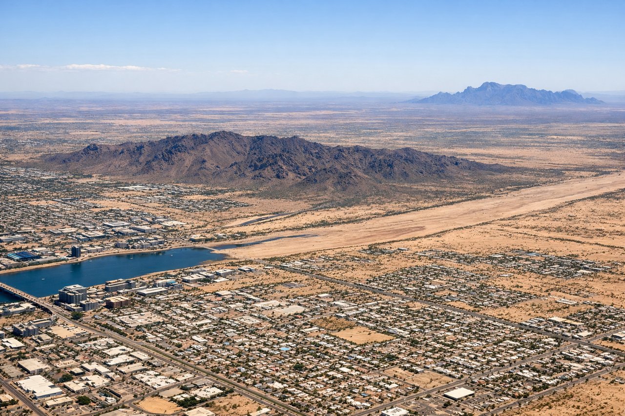
Takeoff from PHX
RIGHTPHX typically departs east on runway 26R/8 or uses the east complex. Departing eastbound, the right (south) side gives you a clear view of South Mountain Park and the broad Phoenix metro grid, while the left side faces north toward downtown. As the aircraft banks northeast toward Santa Fe, the right side opens up to the Superstition Mountains.
Landing at SAF
LEFTSanta Fe Municipal typically uses runway 20 for southerly approaches or runway 2 for northerly arrivals. Approaching from the southwest on a northeast heading, the left (west) side faces the Jemez Mountains and the Rio Grande valley. On a runway 2 arrival heading north, the left side looks west directly toward the Jemez Mountains and Valles Caldera, while the Sangre de Cristo Mountains dominate the right. Left wins for the dramatic Jemez volcanic terrain and the Rio Grande canyon.
Will your flight be in sunlight?
Pick a date and time in the Sun Map to watch the sun move across your whole flight.
About This Route
Which side of the plane should I sit on flying from Phoenix Sky Harbor International (PHX) to Santa Fe Muni (SAF)?
Sit on the Right side of the plane for the best views on flights from Phoenix to Santa Fe. Right side captures the dramatic Superstition Mountains and Salt River basin on departure, and during the cruise phase over eastern Arizona and western New Mexico, the right side looks south toward the White Mountains and the broad high desert basins. The left side wins at landing, but the takeoff and cruise views on the right are more sustained and visually varied across the full flight.
What can I see during takeoff from Phoenix Sky Harbor International in Phoenix?
During takeoff from Phoenix Sky Harbor International (PHX), sit on the Right side for the best views. PHX typically departs east on runway 26R/8 or uses the east complex. Departing eastbound, the right (south) side gives you a clear view of South Mountain Park and the broad Phoenix metro grid, while the left side faces north toward downtown. As the aircraft banks northeast toward Santa Fe, the right side opens up to the Superstition Mountains. Notable sights include: South Mountain Park, Superstition Mountains to the east, Salt River bed and its dry braided channels, Phoenix metro grid.
What can I see when landing at Santa Fe Muni in Santa Fe?
When landing at Santa Fe Muni (SAF), sit on the Left side for the best views. Santa Fe Municipal typically uses runway 20 for southerly approaches or runway 2 for northerly arrivals. Approaching from the southwest on a northeast heading, the left (west) side faces the Jemez Mountains and the Rio Grande valley. On a runway 2 arrival heading north, the left side looks west directly toward the Jemez Mountains and Valles Caldera, while the Sangre de Cristo Mountains dominate the right. Left wins for the dramatic Jemez volcanic terrain and the Rio Grande canyon. Notable sights include: Jemez Mountains and Valles Caldera, Rio Grande valley and canyon, Sangre de Cristo Mountains, Santa Fe city and its low adobe sprawl.
How long is the flight from Phoenix to Santa Fe?
The flight from Phoenix Sky Harbor International (PHX) to Santa Fe Muni (SAF) takes about 1 hour 5 minutes. The shortest flight path between them is 369 miles (594 km); winds and air traffic control usually add a few percent.
What does the Phoenix to Santa Fe flight path pass over?
The flight crosses the Tonto Basin and the Mogollon Rim escarpment in central Arizona, a dramatic 2,000-foot cliff edge visible from altitude. It then passes over the White Mountains volcanic field near Show Low, crosses into New Mexico over the high plains around Quemado, and approaches Santa Fe across the Rio Puerco drainage and the Estancia Basin.