While landing favors the left, the dramatic volcanic departure view from the right side of Mount Pico is the most distinctive visual moment on this route. The takeoff scenery is more geographically unique than the landing approach, which, while interesting, is less visually striking than a 7,700-foot volcano at close range.
Flown PIX to MSY? Did we get it right?
Flight Path
Pico to New Orleans is 3,513 miles (5,654 km), a flight of about 7 hours 10 minutes.
The flight crosses the central Atlantic with no significant landmarks visible for roughly 6-7 hours. Around the midpoint (near 35°N, 50°W), you're over open ocean. As you approach the North American continent, the Bahamas and Florida peninsula become visible on the right (south) side of the track around 4-5 hours before landing. The Gulf of Mexico opens up, and the Louisiana coast with its delta system becomes visible approximately 1 hour before descent into New Orleans.
Great circle distance and headings ›

Phase by phase
Takeoff from PIX
RIGHTPico typically departs runway 06 (eastbound) or 24 (westbound). Right-side seats on a westbound departure (runway 24) offer immediate views of Mount Pico's volcanic cone rising 7,713 feet directly off the right wing. Eastbound departures (runway 06) favor left seats, but westbound is more common for transatlantic traffic to New Orleans.
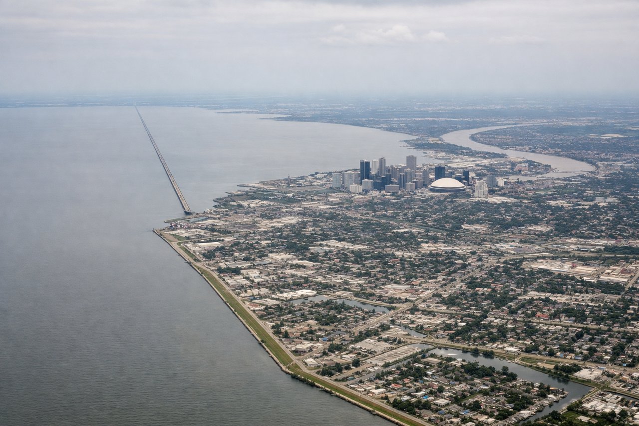
Landing at MSY
LEFTNew Orleans approaches typically use runways 10L/10R (eastbound) or 28L/28R (westbound). Transatlantic arrivals from Europe usually approach from the east on runways 10L/10R. Left-side seats provide views of Lake Pontchartrain's northern shore, the Mississippi River's crescent bend through downtown New Orleans, and the industrial canal system as you descend into the final approach corridor.
Will your flight be in sunlight?
Pick a date and time in the Sun Map to watch the sun move across your whole flight.
About This Route
Which side of the plane should I sit on flying from Pico (PIX) to Louis Armstrong New Orleans International (MSY)?
Sit on the Right side of the plane for the best views on flights from Pico to New Orleans. While landing favors the left, the dramatic volcanic departure view from the right side of Mount Pico is the most distinctive visual moment on this route. The takeoff scenery is more geographically unique than the landing approach, which, while interesting, is less visually striking than a 7,700-foot volcano at close range.
What can I see during takeoff from Pico in Pico?
During takeoff from Pico (PIX), sit on the Right side for the best views. Pico typically departs runway 06 (eastbound) or 24 (westbound). Right-side seats on a westbound departure (runway 24) offer immediate views of Mount Pico's volcanic cone rising 7,713 feet directly off the right wing. Eastbound departures (runway 06) favor left seats, but westbound is more common for transatlantic traffic to New Orleans. Notable sights include: Mount Pico (volcanic peak, 7,713 ft), Faial Island to the northwest across the channel, Atlantic Ocean extending westward, smaller islands of the Azores archipelago to the south.
What can I see when landing at Louis Armstrong New Orleans International in New Orleans?
When landing at Louis Armstrong New Orleans International (MSY), sit on the Left side for the best views. New Orleans approaches typically use runways 10L/10R (eastbound) or 28L/28R (westbound). Transatlantic arrivals from Europe usually approach from the east on runways 10L/10R. Left-side seats provide views of Lake Pontchartrain's northern shore, the Mississippi River's crescent bend through downtown New Orleans, and the industrial canal system as you descend into the final approach corridor. Notable sights include: Lake Pontchartrain (vast freshwater lake north of the city), Mississippi River with its distinctive crescent bend through downtown, Industrial Canal and port facilities, Levee system and wetlands to the east.
How long is the flight from Pico to New Orleans?
The flight from Pico (PIX) to Louis Armstrong New Orleans International (MSY) takes about 7 hours 10 minutes. The shortest flight path between them is 3,513 miles (5,654 km); winds and air traffic control usually add a few percent.
What does the Pico to New Orleans flight path pass over?
The flight crosses the central Atlantic with no significant landmarks visible for roughly 6-7 hours. Around the midpoint (near 35°N, 50°W), you're over open ocean. As you approach the North American continent, the Bahamas and Florida peninsula become visible on the right (south) side of the track around 4-5 hours before landing. The Gulf of Mexico opens up, and the Louisiana coast with its delta system becomes visible approximately 1 hour before descent into New Orleans.