Pico to Seattle is 4,487 miles (7,222 km), a flight of about 10 hours.
While takeoff from Pico offers dramatic volcanic scenery, the landing approach into Seattle provides more sustained and varied views: Puget Sound's geography, the Cascade Range, and urban Seattle. Left-side seats capture the most visually distinctive features during descent.
Flight Path
The flight path crosses the North Atlantic, passing south of Greenland and over the Canadian Arctic Archipelago. Notable features include the Labrador Sea, the Davis Strait, and the Canadian Shield's vast boreal forest and tundra landscape. Over the continental interior, the Rocky Mountains become visible as the aircraft approaches the Pacific Northwest. The flight typically maintains cruising altitude of 35,000-41,000 feet for most of the transatlantic and transcontinental segments, limiting ground detail visibility to major geographic features like mountain ranges, large lakes, and major river valleys.
Great circle distance and headings ›Phase by phase
Takeoff from PIX
RIGHTRight-side seats offer immediate views of Pico Island's volcanic cone and the surrounding Atlantic. The aircraft departs eastbound initially before turning northwest, so right seats capture the island's dramatic topography as it recedes.
Landing at SEA
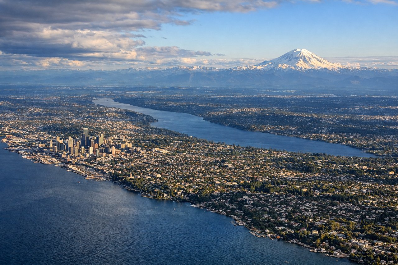
LEFTLeft-side seats provide excellent views during the approach into Seattle-Tacoma. The aircraft descends from the northeast over Puget Sound, and left seats face the Cascade Range and the sound's eastern shoreline, including views of downtown Seattle and the surrounding urban landscape.
Landmarks on this routeAll landmarks →
Will your flight be in sunlight?
Pick a date and time in the Sun Map to watch the sun move across your whole flight.
About This Route
Which side of the plane should I sit on flying from Pico (PIX) to Seattle Tacoma International (SEA)?
Sit on the Left side of the plane for the best views on flights from Pico to Seattle. While takeoff from Pico offers dramatic volcanic scenery, the landing approach into Seattle provides more sustained and varied views: Puget Sound's geography, the Cascade Range, and urban Seattle. Left-side seats capture the most visually distinctive features during descent.
What can I see during takeoff from Pico in Pico?
During takeoff from Pico (PIX), sit on the Right side for the best views. Right-side seats offer immediate views of Pico Island's volcanic cone and the surrounding Atlantic. The aircraft departs eastbound initially before turning northwest, so right seats capture the island's dramatic topography as it recedes. Notable sights include: Mount Pico (2,351 m volcanic peak), Faial Island to the west, Atlantic Ocean, Pico's lava fields and coastal cliffs.
What can I see when landing at Seattle Tacoma International in Seattle?
When landing at Seattle Tacoma International (SEA), sit on the Left side for the best views. Left-side seats provide excellent views during the approach into Seattle-Tacoma. The aircraft descends from the northeast over Puget Sound, and left seats face the Cascade Range and the sound's eastern shoreline, including views of downtown Seattle and the surrounding urban landscape. Notable sights include: Cascade Range (Mount Rainier visible on clear days), Puget Sound, Seattle skyline and Elliott Bay, Lake Washington.
How long is the flight from Pico to Seattle?
The flight from Pico (PIX) to Seattle Tacoma International (SEA) takes about 10 hours. The shortest flight path between them is 4,487 miles (7,222 km); winds and air traffic control usually add a few percent.
What does the Pico to Seattle flight path pass over?
The flight path crosses the North Atlantic, passing south of Greenland and over the Canadian Arctic Archipelago. Notable features include the Labrador Sea, the Davis Strait, and the Canadian Shield's vast boreal forest and tundra landscape. Over the continental interior, the Rocky Mountains become visible as the aircraft approaches the Pacific Northwest. The flight typically maintains cruising altitude of 35,000-41,000 feet for most of the transatlantic and transcontinental segments, limiting ground detail visibility to major geographic features like mountain ranges, large lakes, and major river valleys.