Seattle to Pico is 4,487 miles (7,222 km), a flight of about 10 hours.
The left seat wins overall due to the spectacular Cascade departure view including Mount Rainier, which is one of the most visually dramatic airport departures in North America. The landing view from the right is excellent but the takeoff experience tips the balance.
Flight Path
The great circle route from SEA to PIX tracks northeast over southern British Columbia, then across Newfoundland and Labrador, before crossing the North Atlantic. Midpoint features include the vast emptiness of the North Atlantic Ocean, occasional icebergs near the Labrador Sea in colder months, and the Azores archipelago itself becoming visible on descent. The Canadian Maritimes coastline and the Gulf of St. Lawrence may be visible in early cruise if routing is southerly enough.
Great circle distance and headings ›Phase by phase
Takeoff from SEA
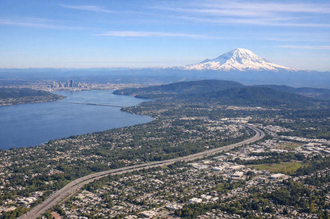
LEFTSEA's primary departure runways (16L/16R heading south, or 34L/34R heading north) mean a left-seat passenger gets the eastern view toward the Cascades. Climbing out northbound on 34s, the left side faces east toward Mount Rainier and the Cascade Range. Even on southbound departures, the aircraft banks right and left seats pick up the Cascades as the plane turns northwest toward the Pacific.
Landing at PIX
RIGHTPico Airport (PIX) has a single runway oriented roughly 09/27 (east-west). Aircraft typically approach from the east over the Atlantic on runway 27, meaning the final approach track runs westward. On this approach, the right side faces north toward the island of Faial and the channel between the islands, while the left side faces south toward open ocean. The right seat gives the better inter-island view.
Landmarks on this routeAll landmarks →
Will your flight be in sunlight?
Pick a date and time in the Sun Map to watch the sun move across your whole flight.
About This Route
Which side of the plane should I sit on flying from Seattle Tacoma International (SEA) to Pico (PIX)?
Sit on the Left side of the plane for the best views on flights from Seattle to Pico. The left seat wins overall due to the spectacular Cascade departure view including Mount Rainier, which is one of the most visually dramatic airport departures in North America. The landing view from the right is excellent but the takeoff experience tips the balance.
What can I see during takeoff from Seattle Tacoma International in Seattle?
During takeoff from Seattle Tacoma International (SEA), sit on the Left side for the best views. SEA's primary departure runways (16L/16R heading south, or 34L/34R heading north) mean a left-seat passenger gets the eastern view toward the Cascades. Climbing out northbound on 34s, the left side faces east toward Mount Rainier and the Cascade Range. Even on southbound departures, the aircraft banks right and left seats pick up the Cascades as the plane turns northwest toward the Pacific. Notable sights include: Mount Rainier (14,411 ft, dominant to the southeast), Lake Washington (large urban lake east of Seattle), the Seattle city skyline and Elliott Bay, Puget Sound islands including Vashon Island.
What can I see when landing at Pico in Pico?
When landing at Pico (PIX), sit on the Right side for the best views. Pico Airport (PIX) has a single runway oriented roughly 09/27 (east-west). Aircraft typically approach from the east over the Atlantic on runway 27, meaning the final approach track runs westward. On this approach, the right side faces north toward the island of Faial and the channel between the islands, while the left side faces south toward open ocean. The right seat gives the better inter-island view. Notable sights include: Pico Mountain (Ponta do Pico, 7,713 ft, the highest point in Portugal), the island of Faial visible across the Faial-Pico Channel to the north, the dark lava coastline of Pico's northern shore, the town of Madalena on Pico's northwest tip.
How long is the flight from Seattle to Pico?
The flight from Seattle Tacoma International (SEA) to Pico (PIX) takes about 10 hours. The shortest flight path between them is 4,487 miles (7,222 km); winds and air traffic control usually add a few percent.
What does the Seattle to Pico flight path pass over?
The great circle route from SEA to PIX tracks northeast over southern British Columbia, then across Newfoundland and Labrador, before crossing the North Atlantic. Midpoint features include the vast emptiness of the North Atlantic Ocean, occasional icebergs near the Labrador Sea in colder months, and the Azores archipelago itself becoming visible on descent. The Canadian Maritimes coastline and the Gulf of St. Lawrence may be visible in early cruise if routing is southerly enough.