While Palma's takeoff offers good harbor and coastal scenery, the right side captures more dramatic and varied geography across the full flight. Belfast Lough's distinctive shape, the Antrim cliffs, Cave Hill, and the industrial waterfront during approach provide stronger visual landmarks and terrain variety than the left side's more modest Mediterranean views. The approach to Belfast is particularly scenic, offsetting the cruise phase's ocean dominance.
Flown PMI to BFS? Did we get it right?
Flight Path
Palma De Mallorca to Belfast is 1,123 miles (1,808 km), a flight of about 3 hours 15 minutes.
The flight crosses the Bay of Biscay and the Celtic Sea. Notable features along the route include the Cornish coast (if visible during cruise at altitude), the Bristol Channel approaches, and the Welsh coastline. The Irish Sea crossing dominates the latter half of the flight, with the Pembrokeshire coast of Wales visible to the left (east) and the Irish coast to the right (west) during descent into Northern Ireland. No major mountain ranges are crossed; the route is primarily maritime with coastal approaches at both ends.
Great circle distance and headings ›Phase by phase
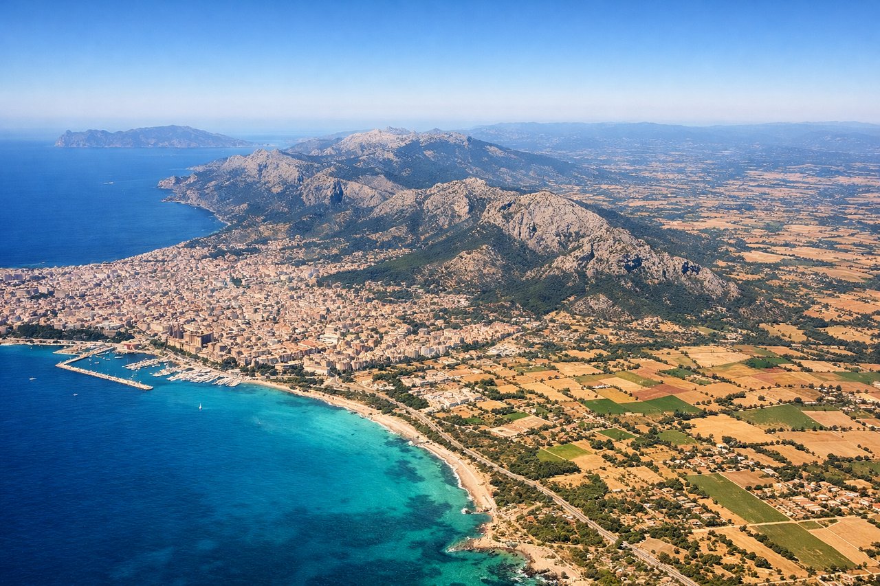
Takeoff from PMI
LEFTPalma's harbor and coastal infrastructure are visible on the left (north) side during typical southwest departures. The Mediterranean coastline, Palma Cathedral, and the harbor basin provide urban and maritime scenery during climb-out.
Landing at BFS
RIGHTThe right (east) side offers views of the Irish Sea, the Antrim coast, and Belfast Lough during the approach to runway 25 (southwest heading). The lough's distinctive shape, coastal cliffs, and the city's industrial waterfront provide strong visual interest during descent and final approach.
Will your flight be in sunlight?
Pick a date and time in the Sun Map to watch the sun move across your whole flight.
About This Route
Which side of the plane should I sit on flying from Palma De Mallorca (PMI) to Aldergrove (BFS)?
Sit on the Right side of the plane for the best views on flights from Palma De Mallorca to Belfast. While Palma's takeoff offers good harbor and coastal scenery, the right side captures more dramatic and varied geography across the full flight. Belfast Lough's distinctive shape, the Antrim cliffs, Cave Hill, and the industrial waterfront during approach provide stronger visual landmarks and terrain variety than the left side's more modest Mediterranean views. The approach to Belfast is particularly scenic, offsetting the cruise phase's ocean dominance.
What can I see during takeoff from Palma De Mallorca in Palma De Mallorca?
During takeoff from Palma De Mallorca (PMI), sit on the Left side for the best views. Palma's harbor and coastal infrastructure are visible on the left (north) side during typical southwest departures. The Mediterranean coastline, Palma Cathedral, and the harbor basin provide urban and maritime scenery during climb-out. Notable sights include: Palma Cathedral and old town waterfront, Palma Harbor and marina complex, Serra de Tramuntana foothills to the northwest, Mediterranean Sea extending northward.
What can I see when landing at Aldergrove in Belfast?
When landing at Aldergrove (BFS), sit on the Right side for the best views. The right (east) side offers views of the Irish Sea, the Antrim coast, and Belfast Lough during the approach to runway 25 (southwest heading). The lough's distinctive shape, coastal cliffs, and the city's industrial waterfront provide strong visual interest during descent and final approach. Notable sights include: Belfast Lough's sheltered basin and shoreline, Antrim coastal cliffs and headlands to the east, Cave Hill mountain overlooking Belfast from the north, Belfast city center and shipyard cranes along the Lagan River.
How long is the flight from Palma De Mallorca to Belfast?
The flight from Palma De Mallorca (PMI) to Aldergrove (BFS) takes about 3 hours 15 minutes. The shortest flight path between them is 1,123 miles (1,808 km); winds and air traffic control usually add a few percent.
What does the Palma De Mallorca to Belfast flight path pass over?
The flight crosses the Bay of Biscay and the Celtic Sea. Notable features along the route include the Cornish coast (if visible during cruise at altitude), the Bristol Channel approaches, and the Welsh coastline. The Irish Sea crossing dominates the latter half of the flight, with the Pembrokeshire coast of Wales visible to the left (east) and the Irish coast to the right (west) during descent into Northern Ireland. No major mountain ranges are crossed; the route is primarily maritime with coastal approaches at both ends.