Phnom Penh to Hong Kong is 955 miles (1,536 km), a flight of about 2 hours 15 minutes.
While takeoff offers lake and river views from the right, the landing approach into Hong Kong provides more dramatic and visually distinctive scenery with Victoria Harbour and the iconic skyline. The contrast between water and dense urban development is more compelling than the delta landscape at departure.
Flight Path
Hainan Island (large island with mountainous terrain visible as you pass east of it), the Gulf of Tonkin coastline (Vietnam's northeastern coast with limestone karst formations), and the South China Sea's open water with occasional fishing vessel activity. The flight path typically tracks northeast across the Gulf of Tonkin, offering glimpses of Vietnam's coastal provinces including Quang Ninh Province's distinctive karst landscape around Ha Long Bay area (though typically at the edge of visibility depending on atmospheric conditions).
Great circle distance and headings ›Phase by phase
Takeoff from PNH
RIGHTRight-side seats offer views of the Tonlé Sap Lake system and the Mekong River delta as the aircraft climbs northeastward. The lake's extensive water surface and river channels are distinctive from altitude and visible during the initial climb-out phase.
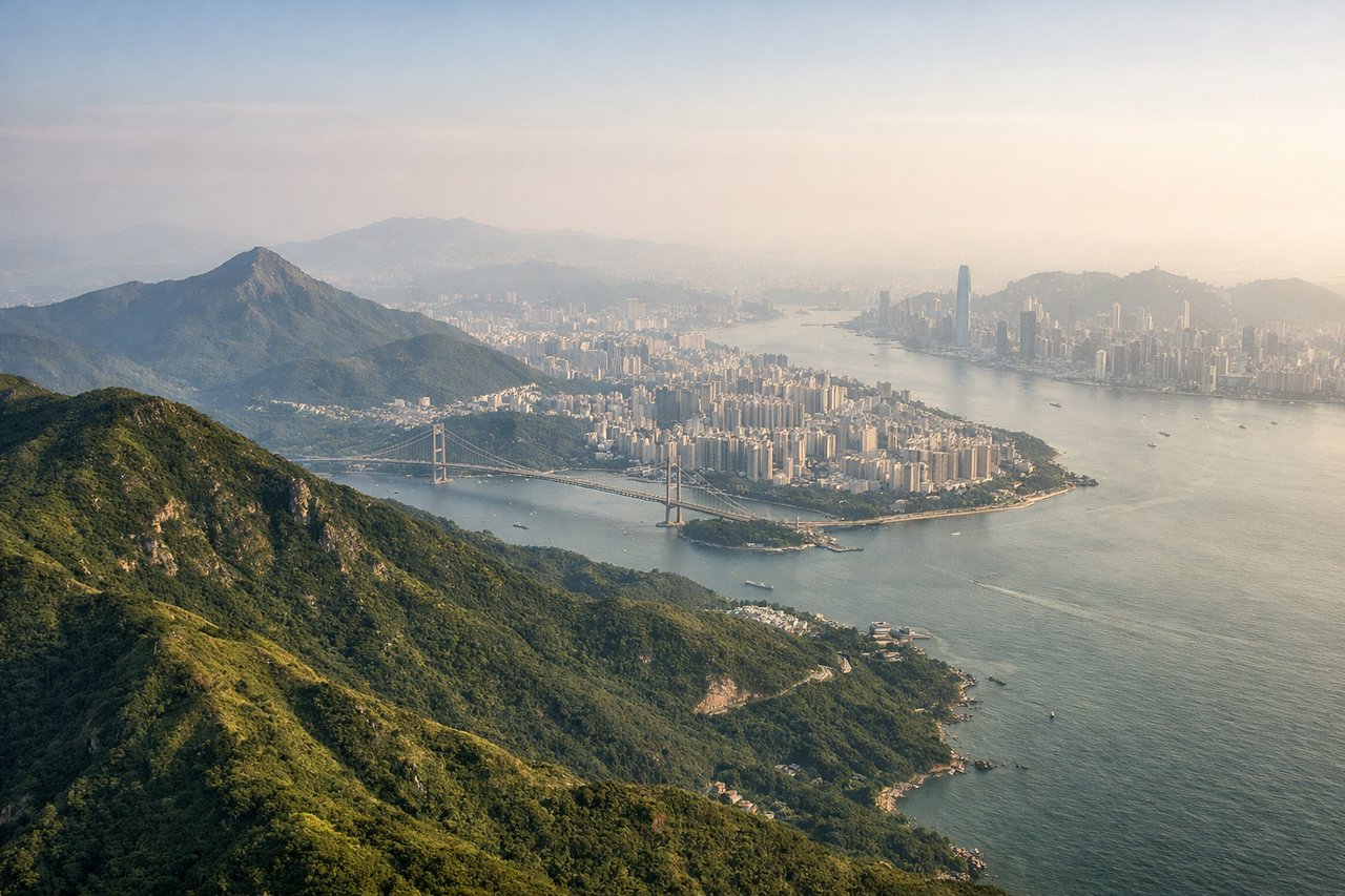
Landing at HKG
LEFTLeft-side seats provide excellent views of Victoria Harbour, Hong Kong Island's urban landscape, and Kowloon Peninsula during the approach from the northwest. The harbor's distinctive shape and the contrast between water and dense urban development are striking from altitude.
Landmarks on this routeAll landmarks →
Will your flight be in sunlight?
Pick a date and time in the Sun Map to watch the sun move across your whole flight.
About This Route
Which side of the plane should I sit on flying from Pochentong International (PNH) to Hong Kong International (HKG)?
Sit on the Left side of the plane for the best views on flights from Phnom Penh to Hong Kong. While takeoff offers lake and river views from the right, the landing approach into Hong Kong provides more dramatic and visually distinctive scenery with Victoria Harbour and the iconic skyline. The contrast between water and dense urban development is more compelling than the delta landscape at departure.
What can I see during takeoff from Pochentong International in Phnom Penh?
During takeoff from Pochentong International (PNH), sit on the Right side for the best views. Right-side seats offer views of the Tonlé Sap Lake system and the Mekong River delta as the aircraft climbs northeastward. The lake's extensive water surface and river channels are distinctive from altitude and visible during the initial climb-out phase. Notable sights include: Tonlé Sap Lake (large freshwater lake to the west), Mekong River delta channels (braided waterways), Phnom Penh city grid (urban sprawl below), Cardamom Mountains (distant southwestern horizon).
What can I see when landing at Hong Kong International in Hong Kong?
When landing at Hong Kong International (HKG), sit on the Left side for the best views. Left-side seats provide excellent views of Victoria Harbour, Hong Kong Island's urban landscape, and Kowloon Peninsula during the approach from the northwest. The harbor's distinctive shape and the contrast between water and dense urban development are striking from altitude. Notable sights include: Victoria Harbour (deep blue water body between Hong Kong Island and Kowloon), Hong Kong Island skyline (Central District high-rises), Kowloon Peninsula (dense urban grid), New Territories (green hills to the north).
How long is the flight from Phnom Penh to Hong Kong?
The flight from Pochentong International (PNH) to Hong Kong International (HKG) takes about 2 hours 15 minutes. The shortest flight path between them is 955 miles (1,536 km); winds and air traffic control usually add a few percent.
What does the Phnom Penh to Hong Kong flight path pass over?
Hainan Island (large island with mountainous terrain visible as you pass east of it), the Gulf of Tonkin coastline (Vietnam's northeastern coast with limestone karst formations), and the South China Sea's open water with occasional fishing vessel activity. The flight path typically tracks northeast across the Gulf of Tonkin, offering glimpses of Vietnam's coastal provinces including Quang Ninh Province's distinctive karst landscape around Ha Long Bay area (though typically at the edge of visibility depending on atmospheric conditions).