Pensacola to St. Louis is 600 miles (965 km), a flight of about 1 hour 40 minutes.
The left side wins narrowly thanks to the brief but genuinely scenic Gulf Coast and bay views during departure, which outweigh the flatter farmland scenery on the right during most of the flight; the route is otherwise dominated by flat Southeastern and Midwestern terrain with limited landmark variety.
Flight Path
Flat agricultural land and river valleys of Alabama, Mississippi, and southern Missouri, including tributaries of the Tombigbee and Mississippi River systems
Great circle distance and headings ›Phase by phase
Takeoff from PNS
LEFTDeparting PNS to the north before turning northwest toward St. Louis, the left side offers a good view back over Pensacola Bay and the Gulf of Mexico coastline as the aircraft banks. This is the most scenic moment of the flight, with white sand beaches and turquoise water briefly visible.
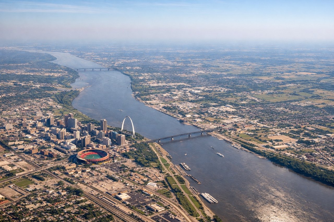
Landing at STL
RIGHTOn approach to STL from the southeast, the aircraft typically flies close to the Mississippi River corridor before turning onto final for the northwest-facing runways. Passengers on the right side get a chance to spot the river and possibly the St. Louis skyline with the Gateway Arch before landing.
Landmarks on this routeAll landmarks →
Will your flight be in sunlight?
Pick a date and time in the Sun Map to watch the sun move across your whole flight.
About This Route
Which side of the plane should I sit on flying from Pensacola Rgnl (PNS) to Lambert St Louis International (STL)?
Sit on the Left side of the plane for the best views on flights from Pensacola to St. Louis. The left side wins narrowly thanks to the brief but genuinely scenic Gulf Coast and bay views during departure, which outweigh the flatter farmland scenery on the right during most of the flight; the route is otherwise dominated by flat Southeastern and Midwestern terrain with limited landmark variety.
What can I see during takeoff from Pensacola Rgnl in Pensacola?
During takeoff from Pensacola Rgnl (PNS), sit on the Left side for the best views. Departing PNS to the north before turning northwest toward St. Louis, the left side offers a good view back over Pensacola Bay and the Gulf of Mexico coastline as the aircraft banks. This is the most scenic moment of the flight, with white sand beaches and turquoise water briefly visible. Notable sights include: Pensacola Bay, Santa Rosa Sound, Gulf of Mexico shoreline, Pensacola NAS peninsula.
What can I see when landing at Lambert St Louis International in St. Louis?
When landing at Lambert St Louis International (STL), sit on the Right side for the best views. On approach to STL from the southeast, the aircraft typically flies close to the Mississippi River corridor before turning onto final for the northwest-facing runways. Passengers on the right side get a chance to spot the river and possibly the St. Louis skyline with the Gateway Arch before landing. Notable sights include: Mississippi River, Gateway Arch (distant), downtown St. Louis skyline, river bottomland farmland.
How long is the flight from Pensacola to St. Louis?
The flight from Pensacola Rgnl (PNS) to Lambert St Louis International (STL) takes about 1 hour 40 minutes. The shortest flight path between them is 600 miles (965 km); winds and air traffic control usually add a few percent.
What does the Pensacola to St. Louis flight path pass over?
Flat agricultural land and river valleys of Alabama, Mississippi, and southern Missouri, including tributaries of the Tombigbee and Mississippi River systems