Left side wins at both ends of the flight. During the cruise over the Bahamas and eastern US seaboard, the left side also picks up occasional views of the Florida coast, the Carolinas, and the Great Lakes shoreline as the route tracks northwest. Right side has little to offer beyond open Atlantic and inland terrain without major visual anchors.
Flown POP to YYZ? Did we get it right?
Flight Path
Puerto Plata to Toronto is 1,734 miles (2,790 km), a flight of about 4 hours 30 minutes.
The route tracks northwest over the Turks and Caicos, across the Bahamas archipelago (visible as scattered low sandy cays in turquoise water), then over the Florida Straits and potentially the tip of Florida or the Florida Keys depending on routing. The flight then crosses Georgia, the Carolinas, and Virginia before passing over Pennsylvania and New York state. Lake Erie and the north shore of Lake Ontario are visible on descent into Toronto. The Appalachian ridgelines of the Blue Ridge and Allegheny Mountains appear as parallel corrugated ridges in the mid-flight section over the eastern US.
Great circle distance and headings ›

Phase by phase
Takeoff from POP
LEFTPOP's primary runway 08/26 means departures heading east put the Cordillera Septentrional mountain range on the left (north) side, with the Atlantic coast and Amber Cove visible below. Northbound departures climbing out over the coast give the left seat a clear view back over the green coastal mountains and the bay of Puerto Plata.
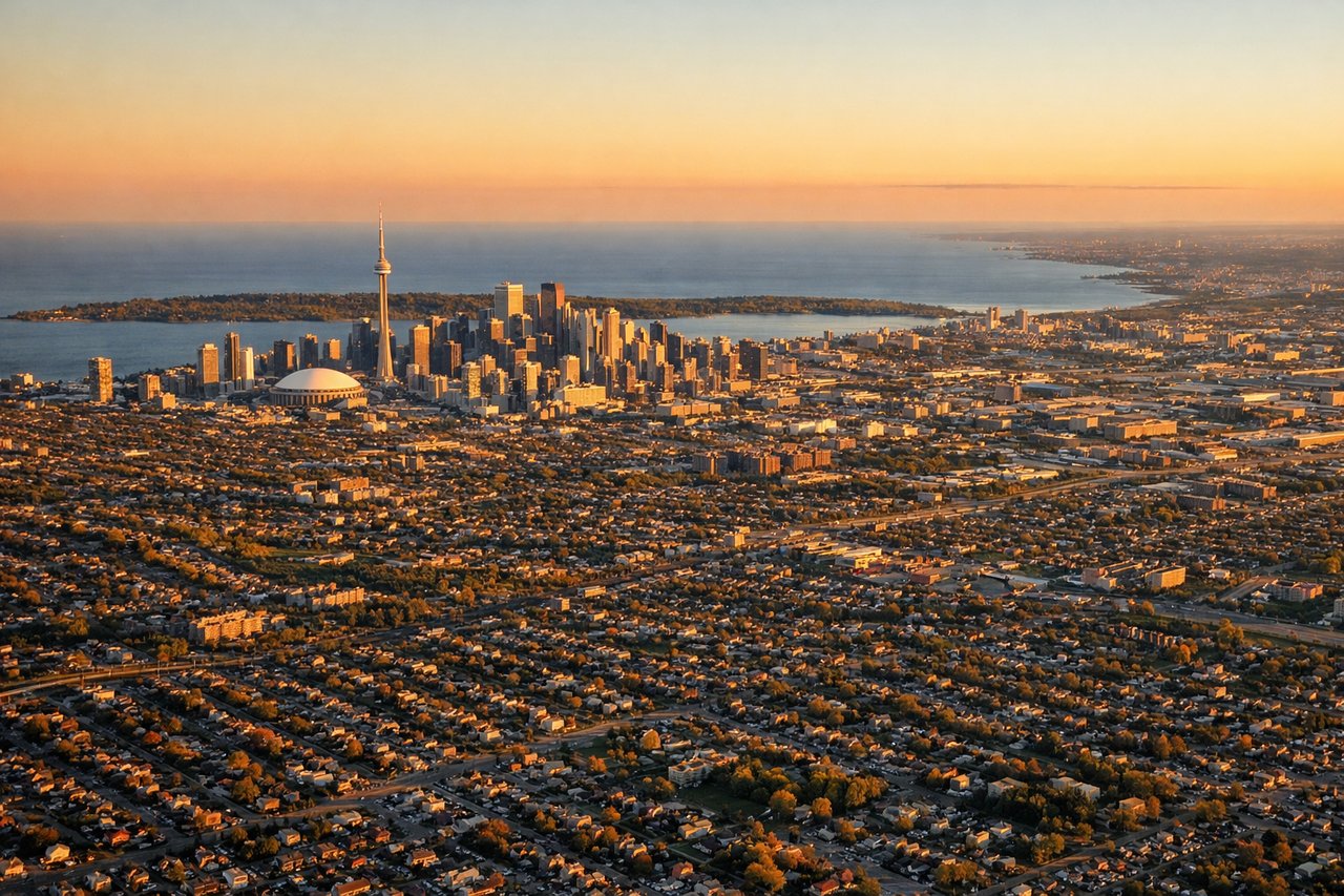
Landing at YYZ
LEFTPearson typically uses runways 05/23 or 06L/24R, with arrivals from the south often tracking over Lake Ontario before turning final. A left window seat on approach from the south gives a clear view of the Toronto skyline, CN Tower, and the lake shoreline as the aircraft descends over the city's east side.
Will your flight be in sunlight?
Pick a date and time in the Sun Map to watch the sun move across your whole flight.
About This Route
Which side of the plane should I sit on flying from Gregorio Luperon International (POP) to Lester B Pearson International (YYZ)?
Sit on the Left side of the plane for the best views on flights from Puerto Plata to Toronto. Left side wins at both ends of the flight. During the cruise over the Bahamas and eastern US seaboard, the left side also picks up occasional views of the Florida coast, the Carolinas, and the Great Lakes shoreline as the route tracks northwest. Right side has little to offer beyond open Atlantic and inland terrain without major visual anchors.
What can I see during takeoff from Gregorio Luperon International in Puerto Plata?
During takeoff from Gregorio Luperon International (POP), sit on the Left side for the best views. POP's primary runway 08/26 means departures heading east put the Cordillera Septentrional mountain range on the left (north) side, with the Atlantic coast and Amber Cove visible below. Northbound departures climbing out over the coast give the left seat a clear view back over the green coastal mountains and the bay of Puerto Plata. Notable sights include: Cordillera Septentrional ridgeline, Puerto Plata Bay and harbor, Atlantic coastline stretching east toward Sosua, Isabel de Torres peak (878m) visible inland.
What can I see when landing at Lester B Pearson International in Toronto?
When landing at Lester B Pearson International (YYZ), sit on the Left side for the best views. Pearson typically uses runways 05/23 or 06L/24R, with arrivals from the south often tracking over Lake Ontario before turning final. A left window seat on approach from the south gives a clear view of the Toronto skyline, CN Tower, and the lake shoreline as the aircraft descends over the city's east side. Notable sights include: Lake Ontario shoreline, Toronto downtown skyline and CN Tower, Humber Bay and waterfront, Highway 401 corridor visible as a broad east-west highway band.
How long is the flight from Puerto Plata to Toronto?
The flight from Gregorio Luperon International (POP) to Lester B Pearson International (YYZ) takes about 4 hours 30 minutes. The shortest flight path between them is 1,734 miles (2,790 km); winds and air traffic control usually add a few percent.
What does the Puerto Plata to Toronto flight path pass over?
The route tracks northwest over the Turks and Caicos, across the Bahamas archipelago (visible as scattered low sandy cays in turquoise water), then over the Florida Straits and potentially the tip of Florida or the Florida Keys depending on routing. The flight then crosses Georgia, the Carolinas, and Virginia before passing over Pennsylvania and New York state. Lake Erie and the north shore of Lake Ontario are visible on descent into Toronto. The Appalachian ridgelines of the Blue Ridge and Allegheny Mountains appear as parallel corrugated ridges in the mid-flight section over the eastern US.