While takeoff favors the right for canal views, the landing approach over Mexico City's dramatic mountain backdrop and the Sierra Madre Oriental is more visually rewarding. Left seats capture the descent's best geographic features and the approach into one of the world's highest-altitude major airports.
Flown PTY to MEX? Did we get it right?
Flight Path
Panama City to Mexico City is 1,498 miles (2,411 km), a flight of about 3 hours 30 minutes.
The flight path crosses the Yucatan Peninsula at cruise altitude (around 35,000 feet). Notable features include the Yucatan's flat limestone terrain with cenote lakes visible as small circular features, the Gulf of Mexico to the north, and the transition from tropical lowlands to the Mexican highlands. The Sierra Madre Occidental becomes visible as the aircraft approaches Mexican airspace from the east, appearing as a series of parallel ridges running north-south.
Great circle distance and headings ›


Phase by phase

Takeoff from PTY
RIGHTPTY typically departs eastbound (Runway 03R/03L). Right-side seats face toward the Caribbean coast and the Panama Canal approach, offering immediate views of the canal's northern reaches and Gatun Lake before climbing over the isthmus.
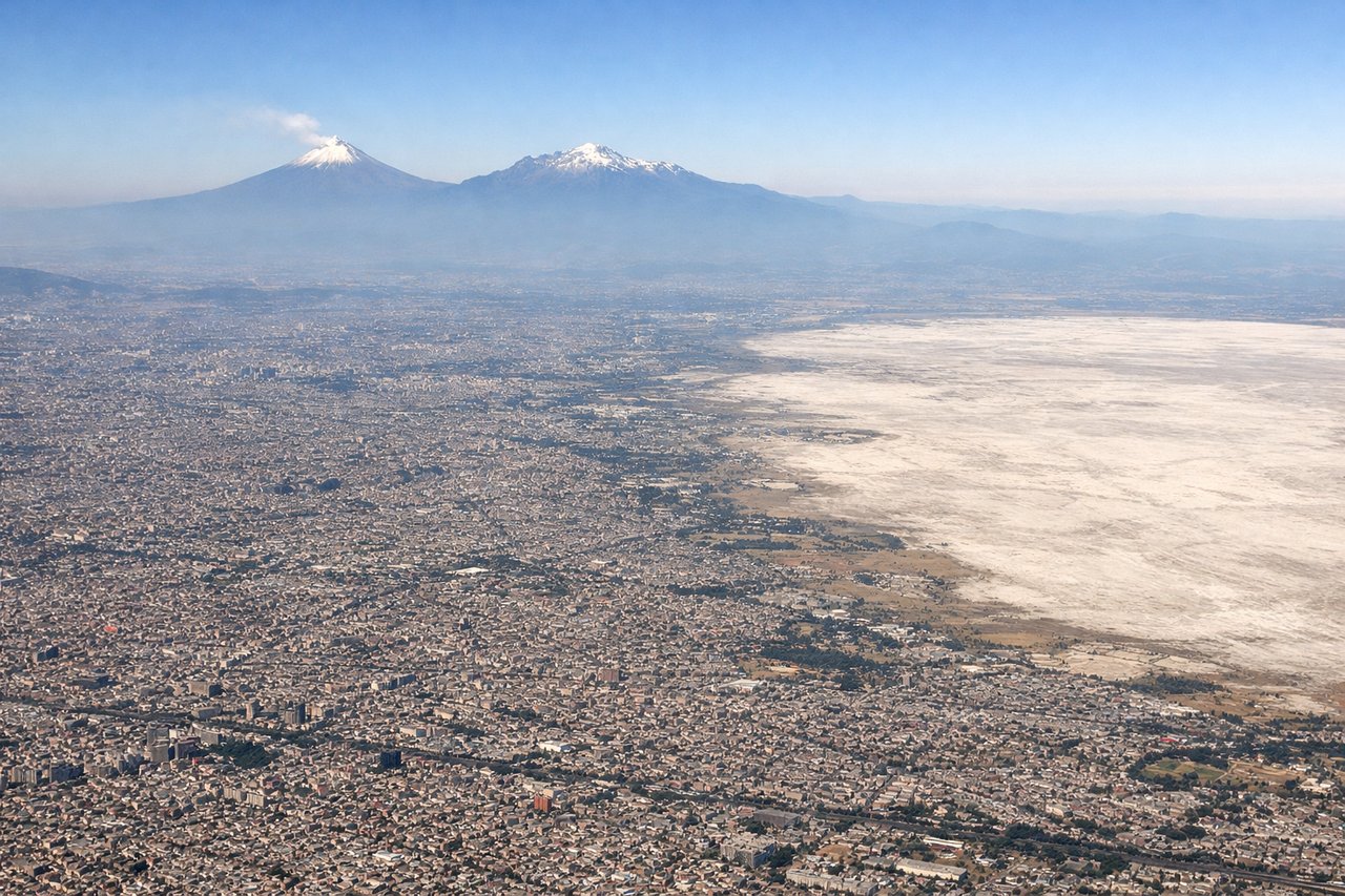
Landing at MEX
LEFTMEX typically lands westbound (Runway 05L/05R). Left-side seats during descent offer views of the Valley of Mexico, including the Sierra Madre Oriental mountains to the east and the city's eastern sprawl before final approach over the airport's western approach corridor.
Will your flight be in sunlight?
Pick a date and time in the Sun Map to watch the sun move across your whole flight.
About This Route
Which side of the plane should I sit on flying from Tocumen International (PTY) to Licenciado Benito Juarez International (MEX)?
Sit on the Left side of the plane for the best views on flights from Panama City to Mexico City. While takeoff favors the right for canal views, the landing approach over Mexico City's dramatic mountain backdrop and the Sierra Madre Oriental is more visually rewarding. Left seats capture the descent's best geographic features and the approach into one of the world's highest-altitude major airports.
What can I see during takeoff from Tocumen International in Panama City?
During takeoff from Tocumen International (PTY), sit on the Right side for the best views. PTY typically departs eastbound (Runway 03R/03L). Right-side seats face toward the Caribbean coast and the Panama Canal approach, offering immediate views of the canal's northern reaches and Gatun Lake before climbing over the isthmus. Notable sights include: Panama Canal (Gatun Lake and approach channels), Caribbean coastline with Colón Bay, Darién Gap rainforest to the southeast, Chagres River valley.
What can I see when landing at Licenciado Benito Juarez International in Mexico City?
When landing at Licenciado Benito Juarez International (MEX), sit on the Left side for the best views. MEX typically lands westbound (Runway 05L/05R). Left-side seats during descent offer views of the Valley of Mexico, including the Sierra Madre Oriental mountains to the east and the city's eastern sprawl before final approach over the airport's western approach corridor. Notable sights include: Sierra Madre Oriental (eastern mountain range), Lake Texcoco remnants and wetlands, Mexico City urban sprawl (Iztapalapa and eastern districts), Popocatépetl volcano (visible on clear days to the southeast).
How long is the flight from Panama City to Mexico City?
The flight from Tocumen International (PTY) to Licenciado Benito Juarez International (MEX) takes about 3 hours 30 minutes. The shortest flight path between them is 1,498 miles (2,411 km); winds and air traffic control usually add a few percent.
What does the Panama City to Mexico City flight path pass over?
The flight path crosses the Yucatan Peninsula at cruise altitude (around 35,000 feet). Notable features include the Yucatan's flat limestone terrain with cenote lakes visible as small circular features, the Gulf of Mexico to the north, and the transition from tropical lowlands to the Mexican highlands. The Sierra Madre Occidental becomes visible as the aircraft approaches Mexican airspace from the east, appearing as a series of parallel ridges running north-south.